Surface Wind
Surface wind is the wind measured about 10 m (33 ft) above the ground. Slowed and turned by friction, it is weaker, gustier and differently directed than the wind a few thousand feet higher, and it is the wind that governs runway choice, take-off and landing.
The surface wind is the wind that pilots take off and land in. By convention it is measured about 10 m (33 ft) above the ground, where friction with the surface has slowed it and turned it away from the wind blowing a few thousand feet higher. It is also the part of the wind that changes most from hour to hour: it follows the daily heating cycle, it gusts, and it responds to every hill, forest and hangar upwind of the sensor.
For the pilot it decides the runway in use, the crosswind and tailwind components to be checked against limits, the performance available, and the gust allowance added to the approach speed. For the meteorologist it is one of the elements most often observed, reported and warned of. This article covers how it behaves, how it is measured and reported, and the warnings issued when it becomes strong.
Surface wind and friction
Above the friction layer, roughly the lowest 2,000 to 3,000 ft, the wind blows almost along the isobars as the geostrophic or gradient wind (see wind forces and geostrophic wind). Below it, friction slows the air, the Coriolis force weakens with the speed, and the wind turns across the isobars towards low pressure.
In the northern hemisphere the surface wind is therefore backed relative to the wind above, and in the southern hemisphere veered. EASA training texts quote rules of thumb: over land the surface wind is backed (NH) or veered (SH) by about 30° and blows at about half the 2,000 ft speed; over the smoother sea the change is about 10° and the speed about 70 %. FAA material quotes crossing angles of about 30° to 45°. As an example in the northern hemisphere, a wind of 270° at 30 kt at 3,000 ft over land suggests a surface wind of about 240° at 15 kt.
Rough ground makes the surface wind weaker and gustier. Hills, woods, towns and aerodrome buildings shed eddies downwind, and in strong winds they produce mechanical turbulence and wind shear downwind of the obstruction, from ground level upwards. On short final, the wind can change abruptly as the aircraft descends into the lee of a hangar or a line of trees (see turbulence).
Diurnal variation of surface wind
The diurnal variation of surface wind is its regular daily cycle over land, driven by heating and cooling of the ground.
- By day. As the sun heats the ground, thermal turbulence mixes the lowest few thousand feet. Stronger, veered air from above is brought down to the surface, so in the northern hemisphere the surface wind veers and increases, usually reaching its maximum around 1500 local time. The wind at about 1,500 ft does the opposite: mixed with the slower surface air, it backs and decreases.
- By night. The ground cools by radiation, a surface inversion forms and mixing stops. The surface wind backs and decreases, often falling light or calm, and is usually lightest around dawn. Freed from the drag of the surface, the wind at about 1,500 ft veers and increases towards the geostrophic value.
The variation is greatest on clear days and nights over land, when heating and cooling are strongest, and small over the sea, whose surface temperature hardly changes through the day. In the southern hemisphere the directions reverse: the surface wind backs and strengthens by day.
Exam tip: Northern hemisphere, by day: surface wind veers and increases, 1,500 ft wind backs and decreases. At night the reverse, with marked wind shear possible between the calm surface and the stronger wind above the inversion.
The night-time contrast has operational consequences. An aircraft descending on a clear night can pass from a strong wind above the inversion, sometimes a low-level jet, to near calm at the surface, losing headwind and airspeed as it does (see windshear and microbursts and jet streams).

Gusts, squalls and gales
A wind gust is a sudden, brief increase in wind speed, often with a change of direction, lasting less than a minute. Gusts come from mechanical turbulence over rough ground, from thermal turbulence on sunny afternoons and from the downdraughts and gust fronts of showers and thunderstorms. The brief drop between gusts is a lull. Under ICAO reporting and forecasting rules, a gust is mentioned only when it exceeds the mean wind by 10 kt or more.
A squall is a sudden increase in wind speed that lasts longer than a gust, for minutes rather than seconds. Squalls come with active cold fronts, squall lines and cumulonimbus (see thunderstorms).
Gale thresholds taught in EASA ATPL texts are a mean wind above 33 kt or gusts above 42 kt. A hurricane-force wind is a mean wind above 63 kt, the same threshold that separates a tropical storm from a tropical cyclone (see tropical revolving storms).
For handling, the difference between the mean wind and the gusts matters as much as the mean itself. FAA guidance is to add the gust factor to the steady wind when comparing the crosswind with the aeroplane's demonstrated crosswind, and a strongly gusting wind makes speed control in the flare harder.
Reporting wind: VRB, gusts, peak wind, wind shift
Wind direction is always the direction from which the wind blows. In a METAR, SPECI or TAF it is given in degrees true, rounded to the nearest 10°, followed by the speed and its unit, for example 24015KT. The wind passed by ATIS or the tower for take-off and landing is in degrees magnetic, to match the runway designators.
The averaging period also differs. Under ICAO rules a METAR gives the mean over the previous 10 minutes, for planning and briefing. The wind passed by the tower for take-off and landing is normally averaged over 2 minutes, so it responds faster to changes.
| Group | Example | Meaning |
|---|---|---|
| Mean wind | 24015KT | 240° true, 15 kt |
| Gust | 24015G28KT | Gusts to 28 kt, reported only when 10 kt or more above the mean |
| Variation | 24015KT 210V280 | Direction has varied by 60° or more; extremes 210° and 280° |
| Variable wind (VRB) | VRB03KT | No mean direction can be given, usually in light winds |
| Calm | 00000KT | No wind |
US reports follow the same format, with a threshold of their own: when the direction varies and the speed is 6 kt or less, VRB is used, and the V group appears only above 6 kt. They also carry wind remarks:
- Peak wind (PK WND). PK WND 28035/1745 gives the peak wind, 280° at 35 kt, and the time it occurred, 1745 UTC.
- Wind shift (WSHFT). WSHFT 1730 gives the time of a wind shift, defined in FMH-1 as a change of direction of 45° or more in less than 15 minutes with a speed of 10 kt or more throughout. FROPA added after it means the shift was caused by a frontal passage.
A significant change also triggers a SPECI between routine reports. Under ICAO criteria this includes a change in the mean direction of 60° or more with a mean speed of 10 kt or more before or after the change (see METAR and SPECI).
Measuring wind: anemometers, vanes and windsocks
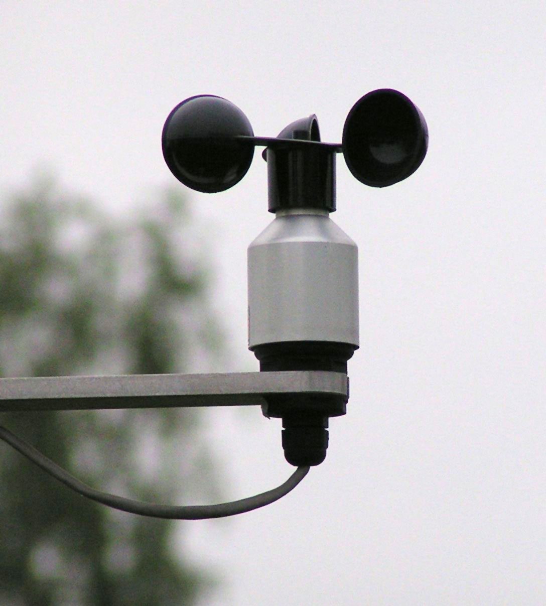
An anemometer measures wind speed, classically with cups spinning on a vertical shaft, and a wind vane measures direction. ICAO calls for aerodrome wind sensors to be mounted about 10 m (33 ft) above the ground and clear of buildings and obstructions that would disturb the flow. An anemograph records the observations continuously. In the United States, the low-level windshear alert system (LLWAS) compares the winds from anemometers placed around the airport to detect shear.
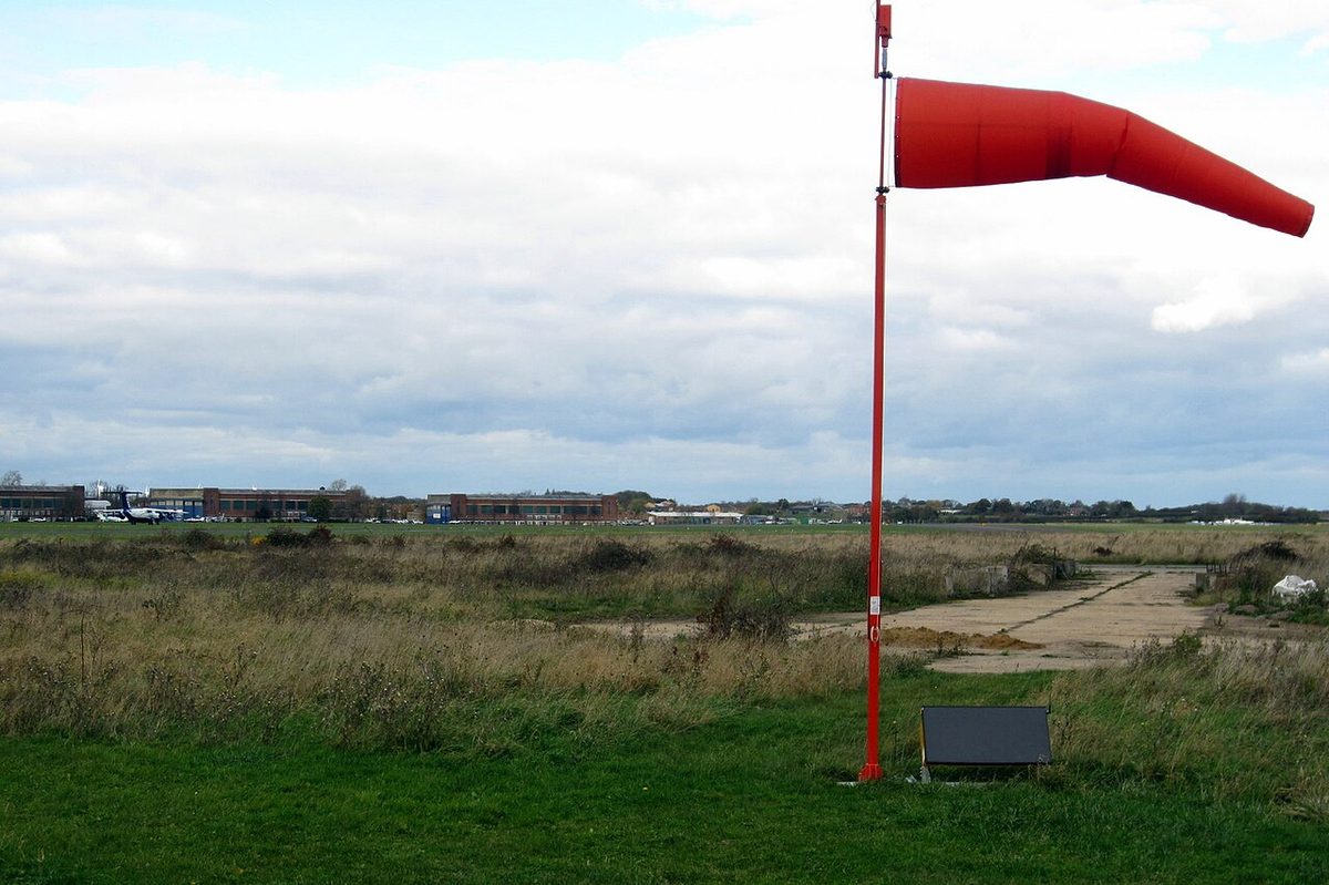
The windsock, formally a wind direction indicator, is a fabric cone on a mast that every pilot can see. It streams downwind, so its wide open end points into the wind, and the angle at which it hangs gives a rough idea of the speed. Wind direction indicators can be lighted for use at night, and a lighted indicator has its own symbol on aerodrome charts. Some US airports also have a landing direction indicator such as a tetrahedron, whose small end points in the direction of landing. Because it may be set by hand or tied down, it should always be cross-checked with the windsock.
Wind also shapes the aerodrome itself. ICAO recommends that the number and orientation of runways give a usability factor of at least 95 %: the proportion of time for which the crosswind component on an available runway stays below the value set for the aeroplanes the aerodrome serves.
Gale and strong wind warnings
At the aerodrome, the meteorological office issues aerodrome warnings of hazardous conditions at the aerodrome itself. They cover gales and strong winds as well as thunderstorms, hail, squalls, snow, frost and freezing precipitation. Thresholds are tailored to each aerodrome's runways and operational requirements. EASA ATPL texts give, as typical values, a strong wind warning for a mean wind above 20 kt with gusts above 28 kt, or above 25 kt with gusts above 37 kt, depending on the aerodrome, and a gale warning for a mean wind above 33 kt or gusts above 42 kt. Warnings of wind shear on the approach and take-off paths are a separate product.
En route, strong surface wind is a low-level hazard. It is included in Section I of the GAMET area forecast issued for low-level flights. In the United States, sustained surface winds of 30 kt or more are forecast by G-AIRMET Tango; surface wind is not a SIGMET criterion (see SIGMET, AIRMET and weather warnings).
Warning: Strong and gusty wind is a hazard on the ground as well as in the air. Parked light aircraft need to be tied down, control locks fitted and taxiing speed kept low, and jet blast adds to the natural wind behind large aircraft.
Surface wind in operations
The reported wind is resolved into headwind and crosswind components for the runway in use and checked against the aeroplane's limits and the operator's (see wind components and crosswind limits). Several rules build in margins:
- Performance. Take-off and landing calculations may credit no more than 50 % of a reported headwind component and must use at least 150 % of a reported tailwind component. The performance class B charts used in EASA exams (CAP 698) already include these factors.
- Approach speed. Most types add a wind or gust increment to the reference speed. The Airbus A320 FMGS, for example, adds one third of the tower headwind component, with a minimum of 5 kt and a maximum of 15 kt, to VLS; the Embraer E190-E2 adds half the steady headwind plus the full gust increment, between 5 and 20 kt.
- Noise-preferential runways. They should not be selected for noise abatement when the crosswind component, including gusts, exceeds 15 kt or the tailwind component, including gusts, exceeds 5 kt.
- Flight planning. Under EASA guidance for destination and alternate planning minima (AMC3 CAT.OP.MPA.182, formerly guidance to CAT.OP.MPA.185), the forecast mean wind should be within the required limits, and gusts may be disregarded.
In the air, the difference between the surface wind and the wind at circuit height is predictable: in the northern hemisphere expect the wind to back and ease during the final descent, especially on a clear evening, and to veer and strengthen after take-off. Local effects such as sea breezes and katabatic flows can override the pattern entirely (see local winds).
Frequently asked questions
When is a gust reported in a METAR?
Under ICAO rules a gust is included only when the maximum wind speed observed exceeds the mean speed by 10 kt or more. The mean is taken over the previous 10 minutes and the gust follows the letter G, so 24015G28KT means a mean of 15 kt from 240 degrees true with gusts to 28 kt. Forecasts in a TAF use the same rule, and many operators add part of the gust to the approach speed.
What does VRB mean in a METAR or TAF?
VRB means the wind direction is variable, with no mean direction that can be given, which usually happens in light winds, as in VRB03KT. It differs from a group such as 220V300, which gives the two extreme directions when the direction has varied by 60 degrees or more but a mean can still be defined. In US reports VRB is used when the direction varies and the speed is 6 kt or less.
Why does the surface wind veer and increase during the day?
As the ground heats up, thermal turbulence mixes air from a few thousand feet, where the wind is stronger and, in the northern hemisphere, veered, down to the surface. The surface wind therefore veers and strengthens, usually reaching its maximum in mid-afternoon. At night the ground cools, an inversion stops the mixing, and the surface wind backs, decreases and may fall calm. The sense of the change is reversed in the southern hemisphere.
What wind speed is a gale?
EASA ATPL texts define a gale as a mean wind above 33 kt or gusts above 42 kt, and a hurricane-force wind as a mean wind above 63 kt. Aerodrome meteorological offices issue gale warnings and strong wind warnings as aerodrome warnings, to thresholds tailored to each aerodrome's runways and operational requirements.
Why is the tower wind different from the METAR wind?
The wind in a METAR is in degrees true, because the report is distributed widely, and under ICAO rules it is averaged over 10 minutes. The wind passed by the tower or ATIS for take-off and landing is in degrees magnetic, to match the runway designators, and is averaged over a shorter period, usually 2 minutes. In gusty or shifting conditions the two can differ noticeably even when issued at the same time.
Test yourself on Surface Wind
The v1prep banks cover this topic in Meteorology (050), with a worked explanation for every answer. EASA ATPL, PPL, IR and CPL, the FAA written tests and A320/B737 type ratings.
Start practising →Sources and further reading
- ICAO Annex 3, Meteorological Service for International Air Navigation
- WMO-No. 782, Aerodrome Reports and Forecasts, A Users' Handbook to the Codes
- Federal Meteorological Handbook No. 1 (FMH-1), Surface Weather Observations and Reports (2019)
- FAA-H-8083-28B, Aviation Weather Handbook
- FAA Pilot's Handbook of Aeronautical Knowledge (FAA-H-8083-25), Chapter 12, Weather Theory
- UK CAA Regulatory Library, AMC3 CAT.OP.MPA.182, Fuel/energy scheme, aerodrome selection policy, aeroplanes
- EASA Easy Access Rules for Air Operations (Regulation (EU) No 965/2012)
Library articles are written for study and exam preparation. They do not replace your aircraft's approved documentation, your operator's procedures or the regulations themselves.