SIGMET, AIRMET and Weather Warnings
A SIGMET is a warning, issued by a meteorological watch office, of observed or forecast en-route weather hazardous to all aircraft, such as thunderstorms, severe turbulence, severe icing or volcanic ash. AIRMETs warn low-level flights of less severe hazards, and aerodrome warnings cover conditions at a single aerodrome.
Forecasts such as the TAF and the significant weather chart are written hours in advance and describe the weather the forecaster expects. Weather warnings exist for the moment when a real hazard appears or is about to: a line of storms developing across an airway, severe icing reported by an aircraft, an ash cloud drifting from an erupting volcano. They are unscheduled, short-lived and specific, and they are the most urgent weather messages a crew receives.
The ICAO system, defined in Annex 3 and applied in Europe through EASA's Part-MET, has three layers: the SIGMET for severe hazards to all aircraft, the AIRMET for lesser hazards to low-level flights, and aerodrome warnings for conditions at one aerodrome. The United States keeps the SIGMET but adds its own products, above all the convective SIGMET, the G-AIRMET and the Center Weather Advisory, so the vocabulary differs on each side of the Atlantic.
Meteorological watch offices
Every flight information region (FIR) is covered by a meteorological watch office (MWO). It keeps a continuous watch on the weather affecting flights in its area and prepares the SIGMET and AIRMET messages for it. It sends them to the area control centre or flight information centre, whose controllers pass the warnings relevant to each aircraft's route; in ATPL flight planning texts the route ahead is taken as up to 500 NM or 2 hours' flying time. SIGMETs are also read on VOLMET broadcasts and appear in every pre-flight briefing package.
Watch offices do not work alone. A special air-report of severe turbulence or icing from a crew is often the first evidence of a hazard (see meteorological services and briefings). For hazards larger than any single FIR, specialised centres advise the watch offices: nine Volcanic Ash Advisory Centres track ash clouds and tropical cyclone advisory centres track tropical storms. Their advisories are guidance for the watch office, not warnings to aircraft. The message that applies inside an FIR is always the SIGMET issued by its own watch office.

SIGMET content and codes
A SIGMET (significant meteorological information) warns of the occurrence or expected occurrence of en-route weather that may affect the safety of all aircraft, whatever their size and whether they fly IFR or VFR. It covers the whole FIR or a part of it, never a single aerodrome. ICAO restricts it to a short list of phenomena:
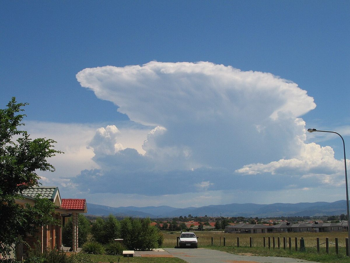
- thunderstorms that are obscured (OBSC), embedded (EMBD), frequent (FRQ) or in a squall line (SQL), with TSGR when hail is expected;
- tropical cyclones (TC);
- severe turbulence (SEV TURB) and severe icing (SEV ICE), including severe icing in freezing rain (SEV ICE (FZRA)), in both cases not associated with convective cloud;
- severe mountain wave (SEV MTW);
- heavy duststorm (HVY DS) and heavy sandstorm (HVY SS);
- volcanic ash (VA).
Turbulence and icing inside a cumulonimbus are not warned separately, because a thunderstorm SIGMET already implies them, as it implies hail. Isolated and occasional thunderstorms are not SIGMET material; for low-level flights they go in an AIRMET.
There are three families, identified in the message headings: WS for the general SIGMET, WV for volcanic ash and WC for tropical cyclones. A SIGMET is valid for no more than 4 hours. Volcanic ash and tropical cyclone SIGMETs may be valid for up to 6 hours, because those hazards change more slowly. Each carries a sequence number and its validity period, and a SIGMET is cancelled (CNL) as soon as the phenomenon ceases.
The body follows a fixed order: the FIR, the phenomenon, whether it is observed (OBS) or forecast, the area and levels affected, the movement and the expected change in intensity. The SIGMET movement and intensity codes are examined often:
| Code | Meaning |
|---|---|
| MOV E 25KT | Moving east at 25 kt |
| STNR | Stationary |
| INTSF | Intensifying |
| WKN | Weakening |
| NC | No change in intensity |
| EMBD TS | Thunderstorms embedded in layer cloud, not visible to the pilot |
| FRQ TS | Frequent storms, little or no separation, more than 75 % of the area |
| SQL TS | A line of thunderstorms with little or no space between cells |
Exam tip: EMBD describes whether the storms can be seen, not how many there are. ISOL (under 50 %), OCNL (50 to 75 %) and FRQ (over 75 %) describe coverage, and only FRQ reaches a SIGMET on coverage alone.
AIRMET and GAMET
Light aircraft fly low, slowly and often without ice protection or weather radar, so hazards well below SIGMET severity can end their flight. The AIRMET serves them. It is issued by the same watch office for phenomena below FL100, or FL150 over mountainous areas, that do not warrant a SIGMET:
- moderate icing and moderate turbulence;
- moderate mountain wave;
- isolated or occasional thunderstorms;
- widespread surface visibility below 5,000 m;
- broken or overcast cloud with a base below 1,000 ft above ground;
- mountain obscuration.
Like a SIGMET, an AIRMET is valid for no more than 4 hours. It is issued in addition to the low-level area forecast, so the two are read together.

The GAMET is that area forecast in text form: an abbreviated plain-language forecast for flights below FL100, or FL150 in mountainous regions, valid for 6 hours. Section I lists the phenomena hazardous to low-level flight: surface wind, visibility, significant weather, cloud, icing, turbulence and mountain wave. Section II gives the background: pressure systems, fronts, upper winds and the freezing level. Many states issue the low-level forecast as a chart instead of, or as well as, a GAMET, such as the UK Form 215. France goes further: its AIRMET information is communicated in the form of TEMSI low-level significant weather charts, and in metropolitan France the low-level area forecasts are issued as charts every 3 hours from 0600 to midnight UTC, a difference from Annex 3 listed in the French AIP (see significant weather and graphical forecasts).
For an aeroplane whose flight manual prohibits flight in icing, moderate icing forecast in an AIRMET or GAMET is not advice: the route, level or timing has to change.
FAA products: SIGMETs and convective SIGMETs
The FAA splits the SIGMET in two. A plain SIGMET (WS) covers non-convective hazards to all aircraft: severe icing, severe or extreme turbulence and clear air turbulence not caused by thunderstorms, and duststorms, sandstorms or volcanic ash lowering visibility below 3 SM. It is valid for up to 4 hours, or 6 hours for volcanic ash and tropical cyclones, the same limits as ICAO. SIGMETs are named with the phonetic letters November to Yankee, skipping Sierra, Tango and Zulu, which belong to AIRMETs; SIGMET NOVEMBER 2 is the second issue of the November series.
Thunderstorms have their own product, the convective SIGMET (WST). It is issued for three regions, the eastern, central and western United States, every hour at 55 minutes past, with specials between, and each is valid for 2 hours. They are numbered from 0000 UTC in each region, so 44C is the 44th of the day for the central region. The criteria are:
- severe thunderstorms;
- embedded thunderstorms;
- a line of thunderstorms at least 60 miles long with storms along 40 % of it;
- thunderstorms with heavy precipitation covering 40 % of an area of at least 3,000 square miles.
Every convective SIGMET implies severe or greater turbulence, severe icing and low-level windshear, so none of these is issued separately for the storms.
AIRMET Sierra, Tango and Zulu
US AIRMETs are produced mainly as graphical AIRMETs (G-AIRMETs), in three series named Sierra, Tango and Zulu. G-AIRMETs are issued every 6 hours, at 0300, 0900, 1500 and 2100 UTC, and each issue shows forecast snapshots at 3-hour intervals out to 12 hours, so the pilot can see a hazard move and spread.
| Product | Hazards covered |
|---|---|
| AIRMET Sierra | IFR conditions (ceiling below 1,000 ft and/or visibility below 3 SM over more than half the area) and extensive mountain obscuration |
| AIRMET Tango | Moderate turbulence, sustained surface winds of 30 kt or more, non-convective low-level windshear within 2,000 ft of the surface |
| AIRMET Zulu | Moderate icing and freezing levels |
Severe icing and severe turbulence are SIGMET material instead, and thunderstorms are left to the convective SIGMET.
Center weather advisories and watch bulletins
Each US air route traffic control center (ARTCC) has a Center Weather Service Unit (CWSU), a team of meteorologists working inside the centre. When conditions meet or approach SIGMET or AIRMET criteria and no advisory has yet been issued, or when an existing one needs local detail, the CWSU issues a Center Weather Advisory (CWA). It is an unscheduled nowcast, valid for up to 2 hours, typically for developing thunderstorms, icing, turbulence, windshear or low ceilings that affect the flow of IFR traffic. CWAs are numbered, often refer to the advisory they modify, are broadcast on centre frequencies and are available from Flight Service. They are not a flight planning product.
For severe weather the Storm Prediction Center issues the Severe Weather Watch Bulletin (WW), preceded by an Alert Severe Weather Watch (AWW). It defines the watch area and the period of the watch, and it is a strong reason to delay or reroute a flight.
Aerodrome and windshear warnings
Aerodrome warnings are issued by the meteorological office serving an aerodrome, for weather that threatens aircraft on the ground, parked aircraft and aerodrome operations. They cover gales and strong winds, thunderstorms, hail and squalls, snow, frost including hoar frost, glaze and rime, fog, and freezing precipitation. The thresholds are tailored to each aerodrome. EASA ATPL texts give, as typical values, a strong wind warning for a mean speed above 20 kt with gusts above 28 kt, or above 25 kt with gusts above 37 kt, depending on the aerodrome, and a fog warning when visibility is expected to fall below 600 m. At selected aerodromes a marked temperature inversion warning is given when the temperature rises by 10 °C or more between the surface and 1,000 ft, because climb performance suffers in the warm layer (see temperature inversions).
Windshear warnings cover the approach and departure paths from the runway up to 1,600 ft above aerodrome level, or higher where that is judged prudent. They are issued when the observations or forecast make windshear probable, or when pilots report it, and are worded in terms that matter to the crew, such as a loss or gain of airspeed.
Unlike a SIGMET, which covers an FIR, these warnings concern one aerodrome, and they reach crews through the ATIS or the controller (see windshear and microbursts).
Using warnings in planning and in flight
Before flight, every SIGMET and AIRMET along the route and for the times of the flight is read with its issue time and validity. A warning that ends before the aircraft arrives, or starts after it has passed, still says a great deal about the trend. In a light aeroplane without weather radar, an EMBD TS SIGMET across the planned route means a new route, visual conditions or a delay, not a plan to find a way through in cloud.
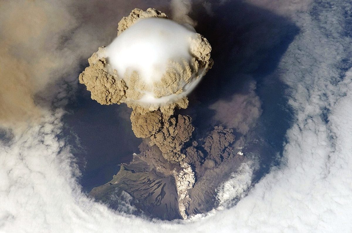
In flight, the crew listens for SIGMETs on VOLMET and ATC frequencies, and in the United States for convective SIGMET and CWA broadcasts. For volcanic ash the warning is the only real defence, because weather radar gives no useful echo (see volcanic ash).
The system depends on pilots. Under SERA, a pilot who meets moderate or severe turbulence, moderate or severe icing, severe mountain wave, obscured, embedded, widespread or squall-line thunderstorms, heavy dust or sand storms or volcanic ash must make a special air-report to the ATS unit as soon as practicable, so that the watch office can issue or amend a SIGMET or AIRMET. The FAA equivalent is the urgent pilot report (UUA).
Frequently asked questions
What is the difference between a SIGMET and an AIRMET?
Both are issued by the meteorological watch office for its flight information region. A SIGMET warns of severe phenomena hazardous to all aircraft at any level, such as embedded thunderstorms, severe turbulence, severe icing and volcanic ash. An AIRMET warns of less severe phenomena that matter to low-level flights below FL100, or FL150 in mountainous areas, such as moderate icing, moderate turbulence, low cloud and poor visibility.
How long is a SIGMET valid?
Under ICAO rules a SIGMET is valid for no more than 4 hours and is cancelled as soon as the phenomenon ends. Volcanic ash and tropical cyclone SIGMETs may be valid for up to 6 hours, because those hazards evolve more slowly. The FAA uses the same 4 and 6 hours for its SIGMETs, but a US convective SIGMET is valid for only 2 hours and is reissued every hour.
What does EMBD TS mean in a SIGMET?
EMBD TS means embedded thunderstorms, cumulonimbus hidden inside layers of other cloud. A pilot in cloud cannot see them to go around them, so without weather radar or lightning detection the only safe choices are to avoid the area, stay in visual conditions or wait. Other SIGMET thunderstorm terms are OBSC for obscured storms, FRQ for frequent cells covering more than 75 per cent of the area, and SQL for a squall line.
What is a convective SIGMET?
It is the US warning for thunderstorms, issued for the eastern, central and western United States every hour at 55 minutes past and valid for 2 hours. It covers severe or embedded thunderstorms, a line at least 60 miles long and areas of storms covering 40 per cent of at least 3,000 square miles. Every convective SIGMET implies severe turbulence, severe icing and low-level windshear.
What are AIRMET Sierra, Tango and Zulu?
They are the three US AIRMETs, issued mainly in graphical form as G-AIRMETs. Sierra covers IFR conditions, with ceilings below 1,000 ft or visibility below 3 SM over more than half the area, and mountain obscuration. Tango covers moderate turbulence, sustained surface winds of 30 kt or more and non-convective low-level windshear. Zulu covers moderate icing and freezing levels.
What is a Center Weather Advisory?
A Center Weather Advisory (CWA) is an unscheduled US nowcast written by the meteorologists of the Center Weather Service Unit at an air route traffic control center. It is valid for up to 2 hours and is issued when conditions meet or approach SIGMET or AIRMET criteria before an advisory exists, or to add local detail. ATC broadcasts it on centre frequencies; it is not a planning product.
Test yourself on SIGMET, AIRMET and Weather Warnings
The v1prep banks cover this topic in Meteorology (050), with a worked explanation for every answer. EASA ATPL, PPL, IR and CPL, the FAA written tests and A320/B737 type ratings.
Start practising →Sources and further reading
- ICAO Annex 3, Meteorological Service for International Air Navigation
- ICAO EUR Doc 014, EUR SIGMET and AIRMET Guide
- FAA Aeronautical Information Manual, Chapter 7, Section 1 (Meteorology, SIGMETs, AIRMETs and CWAs)
- FAA-H-8083-28B, Aviation Weather Handbook (advisories and warnings)
- EASA Easy Access Rules for Standardised European Rules of the Air (SERA), special air-reports
- AIP France, GEN 1.7, Differences from ICAO Standards (Annex 3, AIRMET area forecasts)
- SKYbrary, Volcanic Ash
Library articles are written for study and exam preparation. They do not replace your aircraft's approved documentation, your operator's procedures or the regulations themselves.