Meteorological Services and Briefings
Aviation meteorological services are the organisations and products that observe, forecast and deliver weather information to pilots, from the World Area Forecast Centres and national weather services to pre-flight briefings, in-flight broadcasts, datalink weather and the reports pilots themselves send back.
Every weather product a pilot reads, from a METAR to a significant weather chart, is the end of a long chain: observing stations and satellites, global computer models, forecasters, distribution networks and finally a briefing, a broadcast or a screen in the cockpit. Aviation meteorological services are the organisations that run that chain, and the rules that make their products look the same in every country.
The framework is international, set by ICAO and the World Meteorological Organization (WMO) and applied in Europe through EASA's Part-MET. The way the pilot actually receives the weather still differs: European pilots mostly brief themselves from their national met service and operator, while in the United States the FAA's Flight Service gives spoken briefings of defined types. Pilots are also producers: their reports from the air are the only direct observations of icing, turbulence and cloud tops.
The ICAO Annex 3 framework
ICAO Annex 3, Meteorological Service for International Air Navigation, sets the standards and recommended practices for aviation weather: what must be observed and forecast, the formats of METAR, TAF, SIGMET and the charts, and who is responsible for each. The detailed code forms are published by the WMO in its Manual on Codes. France, for example, lists the 20th edition of Annex 3, amended to Amendment 81 applicable since 28 November 2024, as the reference against which it files its differences.
Each state designates a meteorological authority and the offices that do the work:
- aerodrome meteorological offices prepare TAFs, trend forecasts and aerodrome warnings and brief crews;
- aeronautical meteorological stations make the METAR and SPECI observations;
- meteorological watch offices keep watch over each flight information region and issue SIGMETs and AIRMETs (see SIGMET, AIRMET and weather warnings).
What a state provides, and where it departs from Annex 3, is published in its AIP: the services in GEN 3.5 and the differences in GEN 1.7. France, for instance, reports RVR up to 5,000 m instead of 2,000 m and issues its low-level AIRMET information as charts.

World Area Forecast System
Route forecasts for long flights need a global view, so ICAO set up the World Area Forecast System (WAFS). It has two World Area Forecast Centres (WAFCs): WAFC London, run by the UK Met Office at Exeter, and WAFC Washington, run by NOAA in Kansas City. They work in duplicate, each able to meet the global requirement alone if the other fails.

The WAFCs produce two kinds of product:
- gridded forecasts of upper wind, temperature and humidity at many flight levels, and of icing, turbulence and cumulonimbus, at a resolution of 1.25° or finer. Flight planning systems use them to choose routes, levels and fuel, and the crew sees the result as the wind and temperature columns of the flight plan;
- significant weather (SIGWX) forecasts, fixed-time forecasts of jet streams, clear air turbulence, cumulonimbus and the tropopause, issued every 6 hours (see significant weather and graphical forecasts).
The gridded data travel in GRIB (gridded binary), a WMO code form built for large arrays of numbers. Nobody reads GRIB directly: flight planning software and briefing websites turn it into flight plans and charts such as the upper wind and temperature charts (see surface and upper air charts).
Distribution: SADIS and WIFS
WAFS forecasts reach states, operators and briefing offices through two services: SADIS, run by the UK Met Office, and the WAFS Internet File Service (WIFS), run by the US National Weather Service. Both began as satellite broadcasts (SADIS, the Satellite Distribution System, and ISCS, the International Satellite Communication System, on the US side); the broadcasts have been withdrawn and the data now go out over the internet. Older exam material still uses those names: pair SADIS with London and the Met Office, and ISCS, now WIFS, with Washington.
Regional and national weather agencies
National weather services do most of the day-to-day work: aerodrome observations, TAFs, SIGMETs, low-level charts and briefings. Some centres have regional roles. The WMO designates Regional Specialised Meteorological Centres (RSMCs) for particular tasks; six of them, with the tropical cyclone warning centres around Australia, track and forecast tropical cyclones, and their advisories are turned into tropical cyclone SIGMETs by the watch offices. ICAO's nine Volcanic Ash Advisory Centres do the same for ash (see volcanic ash).
In the United States the national weather service is the National Weather Service, part of the National Oceanic and Atmospheric Administration (NOAA). Two of its national centres matter most to pilots:
- the Aviation Weather Center (AWC) runs aviationweather.gov, home of the Graphical Forecasts for Aviation and of icing guidance such as the Current and Forecast Icing Products (CIP and FIP);
- the Storm Prediction Center (SPC) issues the convective outlooks for the next days and the severe weather watches.
Meteorologists in the Center Weather Service Units at each air route traffic control center write Center Weather Advisories, and the FAA's Flight Service gives the briefings.
Numerical weather prediction and nowcasting
Forecasts start with observations. Surface stations report every hour or half hour, many of them automated. Radiosondes, instrument packages carried to about 30 km by balloon, measure temperature, dew point, pressure and wind; about 900 stations launch them at 0000 and 1200 UTC. Satellites fill the gaps over oceans and deserts, and airliners report wind and temperature along their routes.
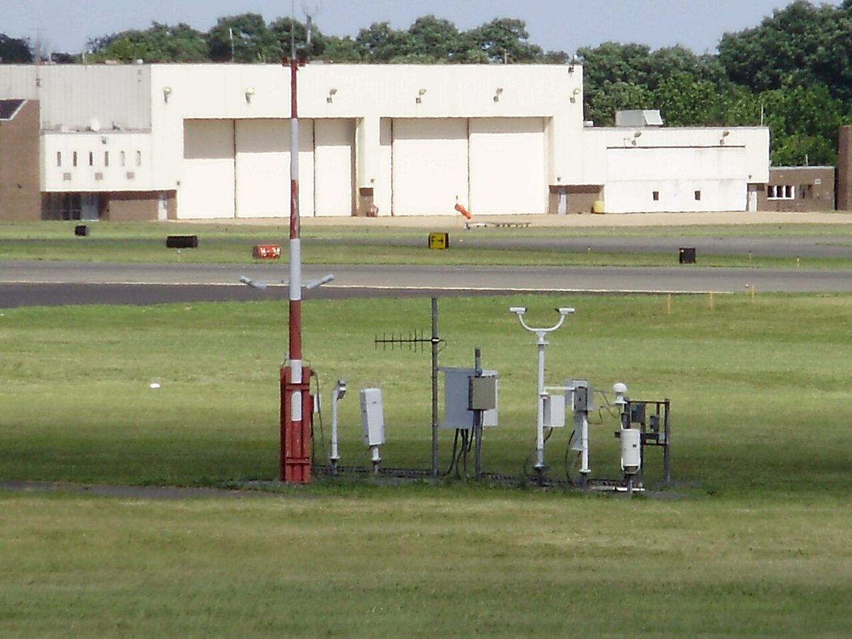
Numerical weather prediction (NWP) feeds these observations into computer models that solve the equations of motion, heat and moisture of the atmosphere on a three-dimensional grid and step them forward in time. Model output is the basis of the WAFS grids, the upper wind forecasts and much of every TAF and chart, but the grid cannot resolve individual showers or the effect of every valley, so forecasters still interpret and correct it.
A nowcast is a very short-range forecast, for roughly the next hour or two, built mainly from current observations such as radar, satellite and surface reports. The US Center Weather Advisory is a nowcast; so are the Ceiling and Visibility Analysis, which estimates conditions between airports in near real time, and the nowcast version of the Graphical Turbulence Guidance, updated every 15 minutes. Weather radar and satellite images are the other main nowcasting tools (see ground weather radar and satellite imagery).
Pre-flight briefings
Under ICAO Annex 2 and SERA, before any flight away from the vicinity of an aerodrome and before every IFR flight, the pilot in command must study the available current weather reports and forecasts, work out the fuel needed and prepare an alternative course of action. In Europe this is usually a self-briefing from the national met service's aviation website and the AIS. Airline crews receive a briefing package with the operational flight plan: METARs and TAFs for the departure, destination and alternates, SIGMETs, SIGWX and wind charts, and NOTAMs. Those TAFs also decide whether an aerodrome may be planned as destination or alternate (see TAF and trend forecasts).
In the United States, 14 CFR 91.103 requires the pilot in command to become familiar with all available information, including weather reports and forecasts for an IFR flight or any flight not in the vicinity of an airport. Pilots can call Flight Service on 1-800-WX-BRIEF, or use its website, and ask for one of three briefings:
| Briefing | When | Content |
|---|---|---|
| Standard | No previous briefing | Adverse conditions; VFR flight not recommended when warranted; synopsis; current conditions; en route forecast; destination forecast; winds and temperatures aloft; NOTAMs; ATC delays; other items on request |
| Abbreviated | Updating an earlier briefing, or one or two items needed | What the pilot asks for, plus any new adverse conditions; state the time and source of the earlier briefing |
| Outlook | Departure 6 hours or more away | Forecast conditions, for planning only; a standard briefing is obtained nearer departure |
Adverse conditions come first so that the pilot can decide early whether the flight is feasible at all. A VFR flight not recommended (VNR) statement follows them when the weather warrants it. It is a recommendation: the decision stays with the pilot in command.
In-flight briefings and datalink weather
In flight, European crews get the weather from three sources: VOLMET, ATIS and the ATS unit on request. VOLMET broadcasts the METARs, SPECIs, TAFs and SIGMETs for a list of aerodromes, on VHF as a continuous loop and on HF, for long-range and oceanic flights, in time slots at fixed times past each hour; Shannon VOLMET serves the North Atlantic. The content is updated every half hour. A controller should be asked only when the broadcasts cannot supply what is needed, to keep the frequency free.

In the United States, an inflight briefing or update comes from Flight Service on 122.2 MHz or on the discrete frequencies of the remote communications outlets printed on the charts. The dedicated Flight Watch frequency, 122.0 MHz, was withdrawn in 2015.
Datalink weather now carries much of this. Airline crews request weather by ACARS and can receive the ATIS by datalink (D-ATIS). In the United States, Flight Information Service–Broadcast (FIS-B) uplinks free weather and aeronautical information, including radar mosaics, reports, forecasts, temporary flight restrictions and NOTAMs, on the 978 MHz UAT link to aircraft with ADS-B In (see ADS-B). A datalink radar picture is a strategic tool: the mosaic can be 15 to 20 minutes old by the time it is displayed, so a gap between cells that looks open may already have closed.
Pilot reports: PIREP, UA, UUA and AIREP
Pilots are the only source of direct information about icing, turbulence and cloud tops at altitude, and they feed the warnings. Under ICAO rules, applied in Europe by SERA, the air-report (AIREP) takes two forms: routine air-reports and special air-reports. A special air-report is mandatory when a pilot meets moderate or severe turbulence, moderate or severe icing, severe mountain wave, thunderstorms that are obscured, embedded, widespread or in a squall line, heavy dust or sand storms, or volcanic ash. It goes to the ATS unit by voice as soon as practicable, and the watch office can use it to issue a SIGMET or AIRMET. Suitably equipped airliners also send automated turbulence reports, expressed as eddy dissipation rate (see turbulence).
In the United States the pilot report (PIREP) has a coded format. A routine report (UA) covers anything of value, such as tops, light turbulence or moderate icing. An urgent pilot report (UUA) is given priority for tornadoes, funnel clouds or waterspouts, severe or extreme turbulence including clear air turbulence, severe icing, hail, low-level windshear within 2,000 ft of the surface, volcanic ash or any other condition the pilot considers hazardous.
| Field | Meaning | Example |
|---|---|---|
| /OV | Location from a navaid: identifier, radial, distance | OKC090020 |
| /TM | Time, UTC | 1930 |
| /FL | Altitude, hundreds of feet MSL | 080 |
| /TP | Aircraft type | C172 |
| /SK | Sky cover, bases and tops, MSL | BKN035-TOP045 |
| /WX | Flight visibility and weather | FV05SM HZ |
| /TA | Outside air temperature, °C | 18 |
| /WV | Wind | 24020KT |
| /TB | Turbulence | LGT |
| /IC | Icing | NEG |
All heights in a PIREP are MSL, because the pilot reads them from the altimeter, unlike the heights above ground in a METAR. The aircraft type matters: moderate turbulence for a Boeing 737 may be severe for a Cessna 172. PIREPs go to Flight Service or to the controller being worked, and under 14 CFR 91.183 an IFR pilot must report unforecast weather conditions encountered.
Exam tip: UA is routine, UUA urgent. Severe icing, severe turbulence, low-level windshear, hail and volcanic ash always make a report urgent; moderate icing and cloud tops do not.
Frequently asked questions
What is the World Area Forecast System?
The World Area Forecast System (WAFS) is the ICAO arrangement that provides global en-route forecasts for aviation. Two World Area Forecast Centres, London at the UK Met Office and Washington at NOAA in Kansas City, produce gridded forecasts of upper wind, temperature, humidity, icing, turbulence and cumulonimbus, and significant weather charts. Each centre can take over the whole world if the other fails.
What are the three types of FAA weather briefing?
Flight Service gives a standard briefing for a flight that has not been briefed, following a fixed order that starts with adverse conditions. An abbreviated briefing updates an earlier briefing or supplies one or two items; the pilot states when and where the first briefing was obtained. An outlook briefing is given when departure is six or more hours away and is for planning only. Once airborne, the pilot can obtain an inflight briefing.
What does VFR flight not recommended mean?
VFR flight not recommended (VNR) is a statement a US Flight Service briefer adds to a standard briefing, straight after the adverse conditions, when the reported or forecast weather warrants it. As the words say, it is a recommendation rather than a prohibition. The pilot in command still makes the decision, but a VNR is a strong reason to delay, replan or fly IFR.
What is the difference between a UA and a UUA PIREP?
UA marks a routine pilot report, such as cloud tops, light turbulence or moderate icing. UUA marks an urgent report, given priority handling, for tornadoes, funnel clouds or waterspouts, severe or extreme turbulence including clear air turbulence, severe icing, hail, low-level windshear within 2,000 ft of the surface, volcanic ash or any other condition the pilot considers hazardous.
When must a pilot make a special air-report?
Under ICAO rules and SERA, any pilot who meets moderate or severe turbulence, moderate or severe icing, severe mountain wave, thunderstorms that are obscured, embedded, widespread or in a squall line, a heavy dust or sand storm, or volcanic ash must report it to the ATS unit as soon as practicable. The report warns other aircraft and lets the meteorological watch office issue or amend a SIGMET or AIRMET.
Test yourself on Meteorological Services and Briefings
The v1prep banks cover this topic in Meteorology (050), with a worked explanation for every answer. EASA ATPL, PPL, IR and CPL, the FAA written tests and A320/B737 type ratings.
Start practising →Sources and further reading
- ICAO Annex 3, Meteorological Service for International Air Navigation
- FAA Aeronautical Information Manual, Chapter 7, Section 1 (Meteorology, briefings and PIREPs)
- FAA Pilot's Handbook of Aeronautical Knowledge (FAA-H-8083-25), Chapter 13, Aviation Weather Services
- FAA-H-8083-28B, Aviation Weather Handbook
- 14 CFR 91.103, Preflight action
- EASA Easy Access Rules for Standardised European Rules of the Air (SERA)
- AIP France, GEN 1.7, Differences from ICAO Standards (Annex 3)
Library articles are written for study and exam preparation. They do not replace your aircraft's approved documentation, your operator's procedures or the regulations themselves.