Temperature Inversions
A temperature inversion is a layer of the atmosphere in which temperature increases with height instead of decreasing. It is the most stable state the air can take, so it suppresses vertical motion, caps cloud, traps haze and can produce marked wind shear at its boundaries.
A temperature inversion is a layer of air in which temperature increases with height. Normally the troposphere cools upwards, by about 2 °C per 1,000 ft in the standard atmosphere, because it is heated from the ground. In an inversion that pattern is reversed: colder, denser air lies beneath warmer, lighter air, and the layer strongly resists any vertical motion.
Inversions are common, from the shallow layer that forms over a field on any clear night to the lid that settles over a whole region beneath an anticyclone. They bring smooth air, but also some of the most insidious hazards in low-level flying: fog and haze that will not clear, wind shear at the top of the layer, freezing rain where warm air overlies cold, and a loss of climb performance when the air aloft is much warmer than at the surface.
What an inversion is
The rate at which temperature changes with height in the real atmosphere is the environmental lapse rate. In an inversion it is negative. Stability depends on comparing that profile with the rate at which a lifted parcel of air cools, about 3 °C per 1,000 ft for unsaturated air. A parcel pushed up into an inversion cools while its surroundings get warmer, so it is at once colder and denser than the air around it and sinks back. An inversion is therefore the most stable condition the atmosphere can take (see atmospheric stability).
Pilots notice inversions in several ways:
- the outside air temperature rises during a climb, often with smooth air and a haze top below;
- cloud tops are flat, and cumulus stop growing at a common level;
- a temperature sounding, plotted on a tephigram or skew-T diagram, shows the temperature line leaning towards warmer values with height;
- the freezing level is duplicated: temperature can pass through 0 °C, rise above it in the inversion and fall through it again, giving two freezing levels.

Radiation (nocturnal) inversions
A radiation inversion, also called a nocturnal inversion, forms at the surface over land at night. After sunset the ground loses heat by terrestrial radiation. Air is a poor conductor, so only the air in contact with the ground is cooled, while the air a little higher stays warm. The result is a layer, cold at the bottom and warmer above, that deepens through the night and is strongest around dawn, since the minimum temperature comes about 30 minutes after sunrise.
It forms best with:
- a clear sky, which allows rapid radiative cooling; cloud returns radiation to the ground and prevents it;
- light wind; a stronger wind stirs the cooled air up through a deeper layer, so no sharp surface inversion forms and any cloud is low stratus rather than fog;
- long nights, so autumn and winter favour it.
If the air is moist, radiation fog forms within the inverted layer (see fog). Cold, dense air drains downhill as a katabatic wind and pools in valleys, so valley aerodromes are the first to get fog and the last to clear. On a winter morning under an anticyclone the weak sun may never break the inversion, and fog can last all day. Radiation inversions do not form over the open sea, where the diurnal variation of temperature is too small. Normally insolation after sunrise warms the ground, convection mixes the layer, and the inversion lifts and disappears during the morning.
Subsidence inversions
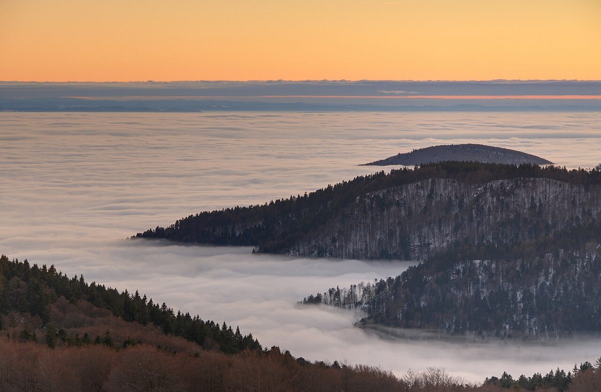
A subsidence inversion forms aloft when a large mass of air sinks, as it does in an anticyclone or a ridge. Descending air is compressed and warms adiabatically, at about 3 °C per 1,000 ft while it is unsaturated. After a long descent it becomes warmer than the air at lower levels, and an inversion forms at the base of the subsiding air.
Subsidence also lowers the relative humidity of the sinking air, which evaporates cloud and gives a stationary anticyclone its often cloud-free skies. Below the inversion, however, moisture and pollution are trapped. The same process caps weak kata-fronts, whose warm air is subsiding, so that their cloud is limited to stratus and stratocumulus with light rain or drizzle (see fronts).
Turbulence inversions and turbulence cloud
A turbulence inversion forms at the top of the friction layer, the lowest 2,000 to 3,000 ft or so, where wind blowing over rough ground stirs the air. Mixing carries air up and down through the layer: air carried up cools adiabatically and air brought down warms. After mixing, the top of the layer is cooler than before, while the undisturbed air just above it keeps its original temperature. The boundary between them is an inversion.
If the air is moist enough, the mixing lifts it to its condensation level and a sheet of turbulence cloud, stratus or stratocumulus, forms beneath the inversion. The cloud cannot grow up through the stable layer, so it spreads out with a flat top. Turbulence cloud gives very poor visibility inside it and drizzle, and below freezing it brings a risk of airframe icing.
Isothermal layers and inversions aloft
An isothermal layer is one in which temperature stays constant with height. It is not an inversion, but it is also very stable: a lifted parcel cools while its surroundings do not, so it is immediately colder than the air around it. The lower stratosphere is the largest example; the ISA treats the air from 11 to 20 km as isothermal at −56.5 °C, and a Mach number held constant in a climb through such a layer gives a constant true airspeed.
Isothermal layers and inversions aloft have several operational effects:
- Capping convection. A stable layer stops thermals and cumulus at its base. Where unstable, moist air lies beneath an inversion, the sky stays quiet until surface heating breaks through it, which is how some of the most violent thunderstorms begin.
- Mountain waves. A stable layer, isothermal or inverted, near summit level is one of the conditions for standing lee waves (see mountain waves).
- Freezing rain. At a warm front, warm air rides over retreating cold air. Rain falling from the warm layer into sub-zero air below becomes supercooled and freezes on impact, and ice pellets at a lower level show that freezing rain exists above (see airframe icing).
- Hoar frost. An aircraft climbing through an inversion from air below 0 °C into warmer, moist air can collect frost on its cold skin.
Trapped haze and anticyclonic gloom
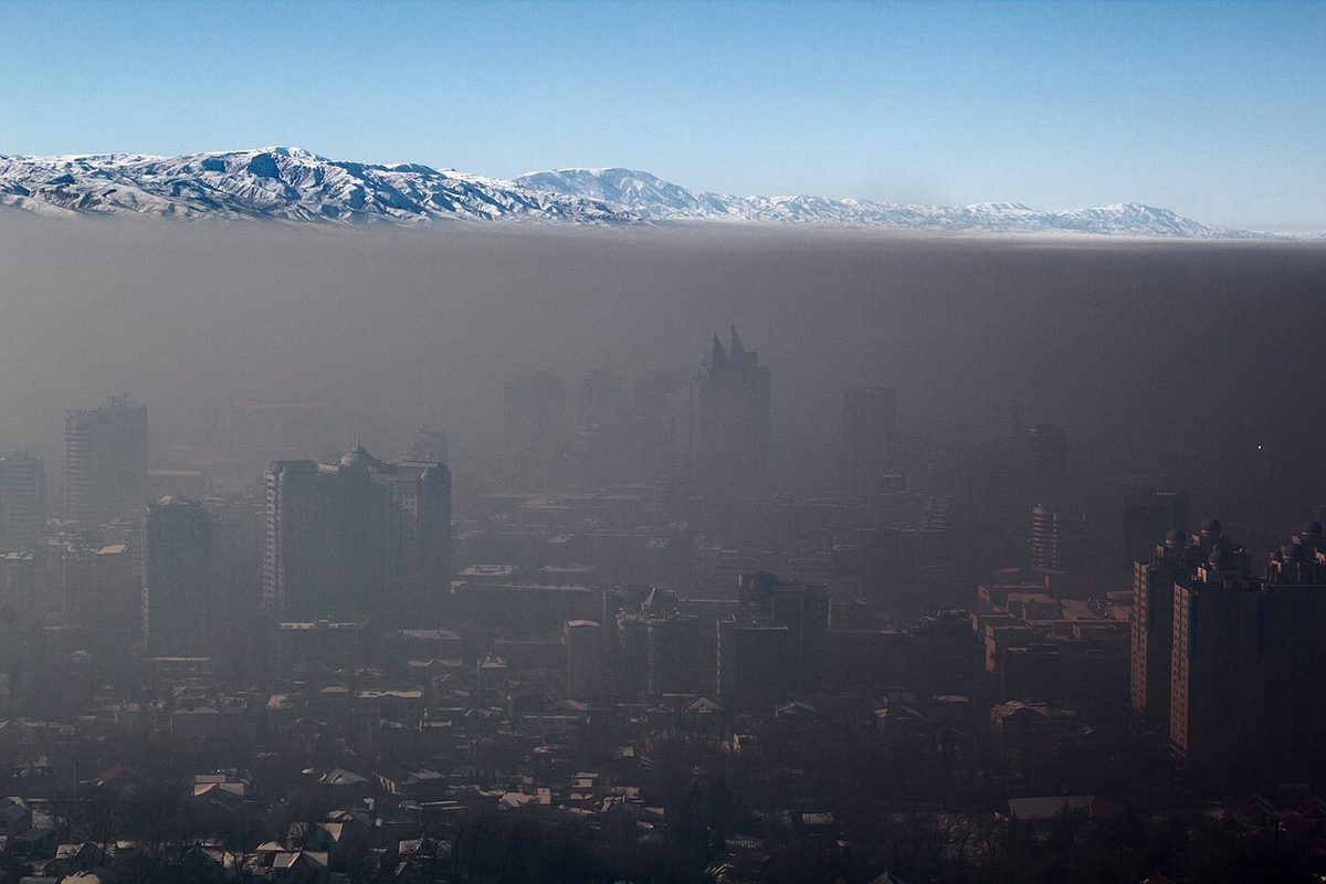
Because an inversion suppresses vertical mixing, everything released beneath it stays there. Smoke, dust, pollution and moisture accumulate, and visibility below the inversion is poor while the air is smooth. Slant visibility can be particularly poor, especially when looking into the sun, and it usually improves markedly once the aircraft climbs above the inversion top.
Under a slow-moving anticyclone in winter, the subsidence inversion traps haze and moisture day after day. The result is anticyclonic gloom: dull, murky conditions that worsen the longer the high remains, the opposite of the fine weather a high is often expected to bring (see mist, haze and obscurations).
Inversions also bend radio waves. A sharp inversion with a rapid decrease of humidity with height can form a duct that traps VHF and higher frequencies and carries them far beyond their normal range, a common effect over land at night under high pressure.
Inversions and wind shear near the ground
A strong surface inversion decouples the air above it from the ground. Freed from friction, the wind above the inversion can accelerate into a low-level jet, often around the top of the inversion, while the wind at the surface falls light or calm. A wind of 30 to 40 kt can blow a few hundred feet above a calm runway.
The hazard is low-level wind shear:
- On approach, an aircraft descending out of a strong headwind above the inversion into the calm layer below loses airspeed suddenly; a loss of 20 kt is possible, with a sink that needs an immediate increase of power and, if the approach becomes unstable, a go-around.
- On departure, an aircraft climbing into a strong tailwind above the inversion loses airspeed in the same way.
- FAA guidance is to expect a shear zone in the inversion when the wind at 2,000 to 4,000 ft is 25 kt or more.
A large difference between groundspeed and airspeed on approach shows how much wind will be lost on the way down. In US TAFs, non-convective wind shear of this kind is forecast with a WS group such as WS020/24045KT, a wind of 240° at 45 kt at 2,000 ft above the surface (see windshear and microbursts and jet streams).
An inversion also affects climb performance. An aircraft climbing out of cold surface air into a much warmer layer aloft meets less dense air than the take-off temperature suggests, so thrust and climb gradient fall. Valley and high aerodromes in winter can have inversions of 10 °C or more within the first 2,000 ft, and some operators include an inversion allowance in their engine-out performance analysis.
Marked inversion warnings
Because of these effects, a warning of a marked temperature inversion is issued at selected aerodromes when the temperature increases by 10 °C or more between the surface and 1,000 ft above it. It is one of the aerodrome warnings, alongside those for gales, thunderstorms, snow, frost, fog and freezing precipitation.
Exam tip: the three inversions to know are radiation (clear, calm night, at the surface), subsidence (sinking air in a high, aloft) and turbulence (top of the friction layer, with stratus or stratocumulus beneath). The marked inversion criterion is 10 °C or more in the first 1,000 ft.
For the crew, a marked inversion means checking take-off and climb performance against the temperature aloft as well as the surface temperature, briefing the possibility of shear at the top of the layer, and allowing for poor slant visibility and fog beneath it.
Frequently asked questions
What is a temperature inversion?
A temperature inversion is a layer in which temperature increases with height, the reverse of the normal fall of about 2 °C per 1,000 ft. Because the air at the bottom is colder and denser than the air above it, the layer is very stable. It acts as a lid on vertical motion, so cloud, smoke, haze and moisture are held beneath it, and the wind above it can differ sharply from the wind below.
What are the main types of temperature inversion?
The three types examined are the radiation inversion, formed near the ground by cooling of the surface on a clear, calm night; the subsidence inversion, formed aloft by air sinking and warming adiabatically in an anticyclone; and the turbulence inversion, formed at the top of the layer mixed by surface friction. Warm air riding over cold air at a warm front produces a frontal inversion as well.
Why does a temperature inversion cause wind shear?
A strong surface inversion cuts the air above it off from the friction of the ground. The wind just above the inversion can then strengthen into a low-level jet, sometimes 30 to 40 kt, while the surface wind is calm. An aircraft descending through the top of the inversion on approach can lose that headwind abruptly, with a sudden loss of airspeed and a sink; a departing aircraft can meet a strong tailwind as it climbs out.
What is anticyclonic gloom?
Anticyclonic gloom is the dull, murky weather that can persist under a slow-moving anticyclone in winter. Air sinking in the high warms adiabatically and forms a subsidence inversion, which stops vertical mixing. Smoke, dust, haze and moisture released at the surface accumulate beneath it, and visibility deteriorates the longer the high stays in place, despite the settled pressure pattern.
What is a marked temperature inversion warning?
At selected aerodromes a warning of a marked temperature inversion is issued when the temperature increases by 10 °C or more between the surface and 1,000 ft above it. Such an inversion matters because an aircraft climbing through it moves into warmer, less dense air and loses climb performance, and because it brings a risk of wind shear at its top and of poor visibility beneath it.
Test yourself on Temperature Inversions
The v1prep banks cover this topic in Meteorology (050), with a worked explanation for every answer. EASA ATPL, PPL, IR and CPL, the FAA written tests and A320/B737 type ratings.
Start practising →Sources and further reading
- FAA-H-8083-28B, Aviation Weather Handbook (temperature, stability, wind shear)
- FAA Pilot's Handbook of Aeronautical Knowledge (FAA-H-8083-25), Chapter 12, Weather Theory (temperature inversions)
- American Meteorological Society, Glossary of Meteorology, inversion
- ICAO Doc 9817, Manual on Low-level Wind Shear (SKYbrary bookshelf)
- NAV CANADA Aviation Meteorology Reference, Low-Level Jet
- Flight Safety Foundation, AeroSafety World, Unseen Jets (low-level jets)
Library articles are written for study and exam preparation. They do not replace your aircraft's approved documentation, your operator's procedures or the regulations themselves.