Fog
Fog is a suspension of very small water droplets, or of ice crystals in extreme cold, in the air next to the ground, reducing horizontal visibility to less than 1,000 m. It forms when air is cooled to its dew point or moisture is added until the air is saturated.
Fog is cloud whose base rests on the ground. It consists of very small water droplets, or ice crystals in extreme cold, held in suspension in the air close to the surface, and by international definition it reduces visibility to less than 1,000 m. It can bring the runway visual range down to a few hundred metres or less and close an aerodrome for hours or, under a winter anticyclone, for days.
Every fog forms by one of two routes: the air is cooled until it reaches its dew point, or moisture is added until the dew point rises to meet the air temperature. Which route is at work decides whether a clear sky helps or hinders, how much wind the fog will tolerate and what must change before it clears. For the pilot the practical questions are when fog will form, how long it will last and what it will do to the approach, and each type answers them differently.
What fog is
Fog and mist are the same phenomenon at different densities. Under ICAO rules fog (FG) is reported when water droplets reduce visibility below 1,000 m. Mist (BR) is the same suspension of fine droplets at visibilities of 1,000 m or more, with relative humidity above 95 %, reported up to 5,000 m. Haze, by contrast, is caused by solid particles such as dust and smoke (see mist, haze and obscurations). United States reports use statute miles: FG below 5/8 SM, BR from 5/8 SM to 6 SM.
Fog needs air that is at or very close to saturation, so the relative humidity is near 100 % and the temperature and dew point in the METAR are equal or within a degree or two. It also needs stable air, typically beneath an inversion, which stops the cooled, moist layer mixing with the drier air above (see temperature inversions). A temperature falling towards a steady dew point on a clear evening with a light wind is the classic warning: once the spread narrows to about 1 to 2 °C, mist and then fog can follow within hours (see humidity and water vapour).
The present weather codes add detail. FZFG is freezing fog, MIFG shallow fog, BCFG fog patches and PRFG fog covering part of the aerodrome; the last three can be reported with a visibility above 1,000 m. VCFG is fog in the vicinity. When fog hides the sky, the cloud group is replaced by a vertical visibility, such as VV002 for 200 ft.

Radiation fog
Radiation fog forms over land on clear nights. The ground loses heat by terrestrial radiation and cools the air in contact with it; if the air is moist enough, it is cooled to its dew point. It needs three ingredients together:
- a clear sky, so that the ground cools rapidly;
- high relative humidity, so that a small fall in temperature brings saturation;
- a light wind of about 2 to 8 kt, which stirs the chilled layer, spreads the cooling upwards, keeps the droplets in suspension and brings more air down to the cold ground to thicken the fog.
In a flat calm only the air touching the ground is cooled, giving dew, hoar frost or at most a very shallow ground fog. A stronger wind mixes the cooling through too deep a layer and produces low stratus instead of fog. Light winds mean a slack pressure gradient, so radiation fog belongs to anticyclones, ridges and cols. It is commonest in autumn and winter, when nights are long, and it does not form over the sea, whose temperature changes too little between day and night.
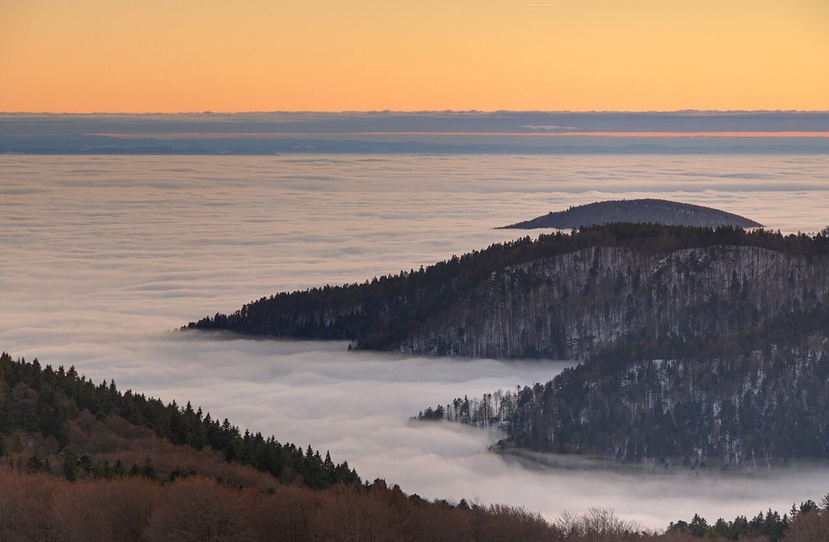
Timing and terrain follow from the mechanism. The ground is coldest around dawn, and the first heating supplies the light turbulence the fog needs, so radiation fog can still form up to about 30 minutes after sunrise. Cold, dense air drains downhill as a katabatic flow, so aerodromes in valleys and at the foot of slopes fog first, while hilltops sit above the cold pool and coastal aerodromes are protected by the sea.
Advection fog and haar
Advection fog forms when warm, moist air moves over a surface colder than its dew point and is cooled from below. The cooling comes from the surface, not from radiation, so the fog forms by day or by night and survives winds that would destroy radiation fog. A wind of up to about 15 kt keeps a fresh supply of moist air arriving over the cold surface; above that, mechanical turbulence lifts the fog into low stratus instead of clearing it.
Over the sea, advection fog is often called sea fog. Around the British Isles it comes with a south-westerly flow of tropical maritime air from the region of the Azores anticyclone, over the sea mainly in late spring and early summer, and over cold land in winter and early spring. The most notorious sea fog regions are the Grand Banks of Newfoundland and the waters around the Kamchatka Peninsula, where warm air from the south crosses the cold Labrador and Oyashio currents. The cold Canaries current does the same off the Atlantic coast of north-west Africa, and the FAA cites the Pacific coast of the United States in summer and the Gulf coast in winter.
Haar is the local name for the advection fog and very low stratus that come in from the North Sea onto the east coasts of Scotland and northern England. It is an early to mid-summer phenomenon: high pressure over Scandinavia drives a north-easterly flow across the sea, and the air, cooled and moistened on the crossing, arrives as fog, low stratus and drizzle.
The sea barely warms during the day, so heating cannot clear advection fog. It lasts until the wind direction or the air mass changes and can persist for days, drifting inland on an onshore wind.
Exam tip: radiation fog: land only, clear sky, 2 to 8 kt, clears with the sun. Advection fog: warm moist air over a colder surface, winds up to 15 kt, day or night, and heating does not clear it over the sea.

Hill and upslope fog
Hill fog is low cloud whose base lies below the tops of the hills. Seen from a distance it is stratus; on the hill it is fog. It is typical of moist, stable air such as the tropical maritime air of a warm sector, and it is a classic trap for VFR pilots, who can find a route over high ground closed while the valleys remain clear (see mist, haze and obscurations).
Upslope fog forms when a steady wind forces moist, stable air up rising ground. The air expands and cools adiabatically until it reaches its dew point, so the cooling comes from ascent, not from the surface. Because the wind produces the fog, it can form in winds that would disperse radiation fog, and it persists until the wind drops, changes direction or brings drier air.
Frontal fog
Frontal fog forms at a warm front or an occlusion, ahead of the surface front. The main cause is precipitation: rain falling from the warm air aloft evaporates into the colder air beneath, raising its dew point until it is saturated, while the cloud base lowers to meet the ground. Evaporation from wet ground and the mixing of saturated and unsaturated air contribute. Frontal fog needs neither a clear sky nor a light wind. It forms in a belt up to 200 NM wide that travels with the front, so it passes rather than lifts (see fronts).
Steam fog
Steam fog, also called steaming fog or Arctic sea smoke, is the reverse of sea fog: very cold air moves over much warmer water. Evaporation from the water adds vapour to the cold air, whose dew point quickly rises to its temperature, and the vapour condenses at once, rising from the surface like steam. EASA exam material requires the air to be very stable. The fog is shallow, up to about 500 ft thick, and may drift inland. It is common in polar regions, for example over the fjords of Greenland and Iceland, where cold air flows off the land over open water.
Freezing fog and ice fog
Freezing fog (FZFG) consists of supercooled water droplets at temperatures below 0 °C. The droplets freeze on contact with any surface, so freezing fog deposits rime on the airframe and windscreen during the approach and on an aircraft waiting on the ground. It is an icing hazard as well as a visibility one: a METAR such as 0400 FZFG VV002 M03/M03 warns of both. De-icing holdover time tables list freezing fog as a condition in its own right, with short protection times. Aircraft procedures take account of fog in general: on the Airbus A320, for example, fog with a visibility of 1,600 m or less counts as visible moisture, so with a low enough temperature it defines icing conditions and calls for engine and wing anti-ice.
Ice fog is made of ice crystals, not droplets. It forms only in extreme cold, usually below −40 °C according to EASA exam material, while FAA guidance cites about −25 °F (−32 °C) or colder. It appears when warm, moist air, typically from combustion such as vehicle and aircraft exhausts, is released into air that is already saturated. Condensation and freezing then happen almost together. It is rare, found in winter in northern North America and northern Eurasia. Because its particles are already ice, ice fog is not freezing fog.
Shallow fog and forecasting fog clearance
Shallow fog (MIFG) lies in a thin layer on the ground. The reported visibility, observed above it, may be good, yet a pilot can see the runway clearly from above and lose it in the flare, when looking horizontally through the layer. For this reason UK practice, which EASA exam material follows, reports RVR whenever shallow fog is observed or forecast, even if the visibility is well above the ICAO threshold of 1,500 m (see visibility and runway visual range).
How fog clears depends on how it formed:
| Type | Forms by | Usually clears when |
|---|---|---|
| Radiation fog | Cooling of the ground on a clear night | The sun warms the ground or the wind freshens; often lifts first into low stratus |
| Advection fog | Moist air cooled over a colder surface | The wind direction or air mass changes |
| Hill and upslope fog | Moist air on or lifted up high ground | The wind drops or changes, or drier air arrives |
| Frontal fog | Rain evaporating into cold air ahead of a warm front | The front passes |
| Steam fog | Cold air over warmer water | The flow of cold air stops |
In the UK radiation fog usually clears by 1000 to 1100 local time, but it can persist all day in valleys and in winter. Under a winter anticyclone the weak sun may fail to break the inversion at all, and subsidence caps any mixing, so fog can last for days. A layer of cloud above the fog slows clearance by keeping the sun off the ground.
Fog and flight operations
Fog creates the conditions for which low visibility procedures, CAT II and CAT III approaches and low visibility take-offs exist, and in fog it is the RVR, not the meteorological visibility, that is compared with the minima (see low visibility operations). Planning must allow for it. Aerodrome warnings are issued when fog is expected to reduce visibility below 600 m. Under EASA planning guidance, fog forecast in a TAF TEMPO or PROB group is persistent weather that must be applied when planning an alternate. Fog forecast at the destination calls for a suitable alternate and extra fuel, and fog below landing minima at the departure aerodrome can require a take-off alternate (see TAF and trend forecasts).
On the approach, the view down through fog is poorer than the view along the ground: a vertical visibility of 200 ft does not mean the runway will be seen at 200 ft, because the pilot looks forward and down through the whole depth of the fog. Entering fog can also create an illusion of pitching up, and a pilot who does not recognise it may steepen the approach abruptly (see visual illusions).
Frequently asked questions
What conditions are needed for radiation fog?
Radiation fog needs a clear sky, so that the ground loses heat rapidly at night, air with a high relative humidity, and a light wind of about 2 to 8 kt, which spreads the cooling through a shallow layer. It forms over land only, typically on long autumn and winter nights under an anticyclone, ridge or col. In calm air only dew or frost forms; a stronger wind mixes the air too deeply and gives low stratus instead.
What is the difference between radiation fog and advection fog?
Radiation fog forms over land when the ground cools by radiation on a clear night with a light wind, and usually clears in the morning as the sun heats the surface. Advection fog forms when warm, moist air moves over a surface colder than its dew point, such as a cold sea. It can form by day or night, tolerates winds up to about 15 kt and can persist for days until the airflow changes.
What is haar?
Haar is the name used on the east coasts of Scotland and northern England for advection fog and very low stratus coming in from the North Sea. It is most common in early to mid summer, when high pressure over Scandinavia drives a north-easterly flow across the sea. The air is cooled and moistened on the crossing and arrives as fog, low stratus and drizzle along the coast.
What is the difference between freezing fog and ice fog?
Freezing fog, coded FZFG, is made of supercooled water droplets at temperatures below 0 °C. They freeze on contact, depositing rime on aircraft, so it is an icing hazard as well as a visibility one. Ice fog is made of ice crystals. It forms only in extreme cold, which EASA exam material puts at usually below −40 °C, when moist air, typically from combustion and engine exhausts, is released into very cold, saturated air.
When does fog clear?
It depends on the type. Radiation fog clears when the sun warms the ground or the wind increases, often lifting first into low stratus; in the UK it usually goes by 1000 to 1100 local time, but it can last all day in valleys or in winter. Advection fog persists until the wind direction or air mass changes. Frontal fog passes with the front, and hill fog clears when the wind, or its moisture, changes.
Test yourself on Fog
The v1prep banks cover this topic in Meteorology (050), with a worked explanation for every answer. EASA ATPL, PPL, IR and CPL, the FAA written tests and A320/B737 type ratings.
Start practising →Sources and further reading
- FAA-H-8083-28B, Aviation Weather Handbook
- FAA Pilot's Handbook of Aeronautical Knowledge (FAA-H-8083-25), Chapter 12, Weather Theory
- WMO-No. 782, Aerodrome Reports and Forecasts, A Users' Handbook to the Codes
- Met Office, Fog
- SKYbrary, Fog
- FAA Aeronautical Information Manual, Chapter 8, Section 1 (8-1-5, Illusions in Flight)
Library articles are written for study and exam preparation. They do not replace your aircraft's approved documentation, your operator's procedures or the regulations themselves.