Mountain Waves
Mountain waves, also called standing or lee waves, are oscillations set up in a stable airstream that crosses a ridge in a strong wind. They stay almost fixed over the ground downwind of the high ground and bring strong vertical currents, rotor turbulence and characteristic lens-shaped clouds.
When a strong wind blows across a mountain ridge in stable air, the air that has been lifted over the crest does not simply settle back to its original level. It sinks on the lee side, overshoots, rises again, and sets up a train of waves that can stretch far downwind and extend well above the ridge. These mountain waves, also called standing waves or lee waves, stay almost fixed over the ground while the wind flows through them.
They matter to every class of aircraft. A light aeroplane on the lee side of a ridge can meet a downdraught stronger than its best rate of climb, or violent rotor turbulence close to the ground. Airliners crossing high ranges meet wave turbulence and altitude excursions at cruising levels. For examinations, the conditions for wave formation, the clouds that mark the waves and the position of the rotor are asked again and again.
How mountain waves form
Air forced up the windward slope of a ridge is displaced from its equilibrium level. If the air is stable, it is colder and denser than its surroundings once lifted, so it sinks back on the lee side. Its momentum carries it below its original level, where it is now warmer and less dense than its surroundings, and it rises again. The stability of the airstream acts as a restoring force, and the air oscillates as it travels downwind. Without stability there is no restoring force: the lifted air convects or mixes away instead of waving.
Because the ridge is fixed and the wind steady, the crests and troughs of the waves stay in the same place over the ground, although the air itself moves rapidly through them. FAA guidance notes that a wave system can extend 100 miles or more downwind and reach the tropopause, and waves can at times penetrate into the stratosphere.
The terms for the two sides of the ridge are used throughout. The windward side faces the wind, where the air is lifted. The leeward side, or lee side, is the downwind side, where the air sinks and the waves form.
Conditions for wave formation
Three conditions must come together:
- Wind direction. The wind blows within about 30° of perpendicular to the ridge, with little change of direction with height.
- Wind speed. The wind at ridge level is strong and increases with height. The minimum quoted differs between EASA and FAA material: EASA ATPL texts give at least 15 kt at summit level, FAA guidance about 25 kt at ridge level.
- Stability. A marked stable layer, an inversion or isothermal layer, lies at or near summit height.
When the air is moist, clouds reveal the waves; when it is dry, the same waves can be present with no cloud to mark them.
Exam tip: Mountain waves need a wind within 30° of perpendicular to the ridge, strong at summit level and increasing with height, and a stable layer near the summits. For EASA, remember 15 kt at summit level; for the FAA, about 25 kt.
Windward and leeward effects
On the windward side the air is lifted: there are updraughts, and if the air is moist, orographic cloud and precipitation. The rain and snow left on the windward slopes are why the air that descends on the lee side arrives warmer and drier, the föhn effect described in local winds.
On the leeward side the air descends. Close to the lee slope there are downdraughts and mechanical turbulence, and in a light aircraft the sink can exceed the maximum rate of climb. Over the crest itself the wind accelerates, and the Venturi effect lowers the pressure, so the altimeter over-reads just where terrain clearance is least. If the air is also colder than ISA, the altimeter over-reads further.
Lenticular, cap and banner clouds
When there is enough moisture, cloud marks the flow over and downwind of the high ground: the cap and lenticular clouds of a wave system, the banner cloud of a single peak, and the rotor cloud described with the rotor below.
- Cap cloud. Moist air lifted over the crest reaches its condensation level and forms a cloud that sits on the ridge. It forms on the windward side, spills a short way down the lee slope and evaporates as the air sinks and warms. Although the air is streaming through it, the cloud appears stationary.
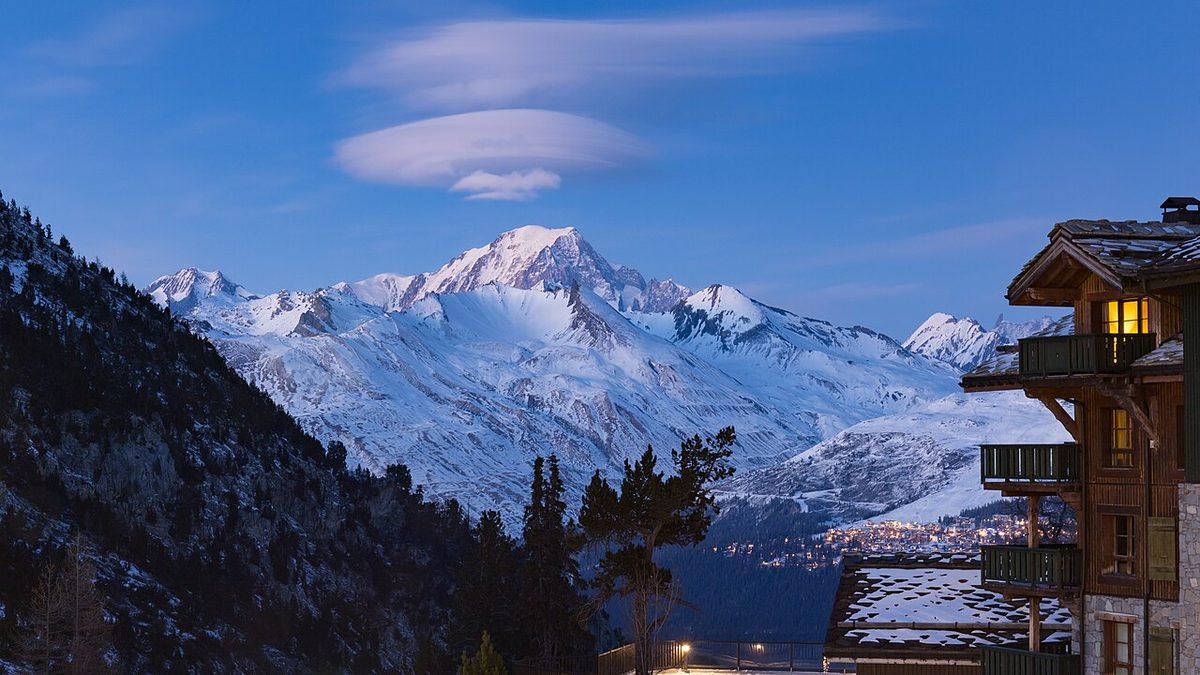
- Lenticular cloud. In each wave crest the air is lifted to its condensation level and a smooth, lens-shaped cloud forms, evaporating again in the descending part of the wave. These altocumulus lenticularis clouds, reported in US METAR remarks as ACSL (altocumulus standing lenticular), can lie in rows downwind of the ridge, be stacked one above another, and form far above the ridge, sometimes as high as the tropopause or above. The air inside a lenticular cloud is smooth; ragged edges show turbulence.
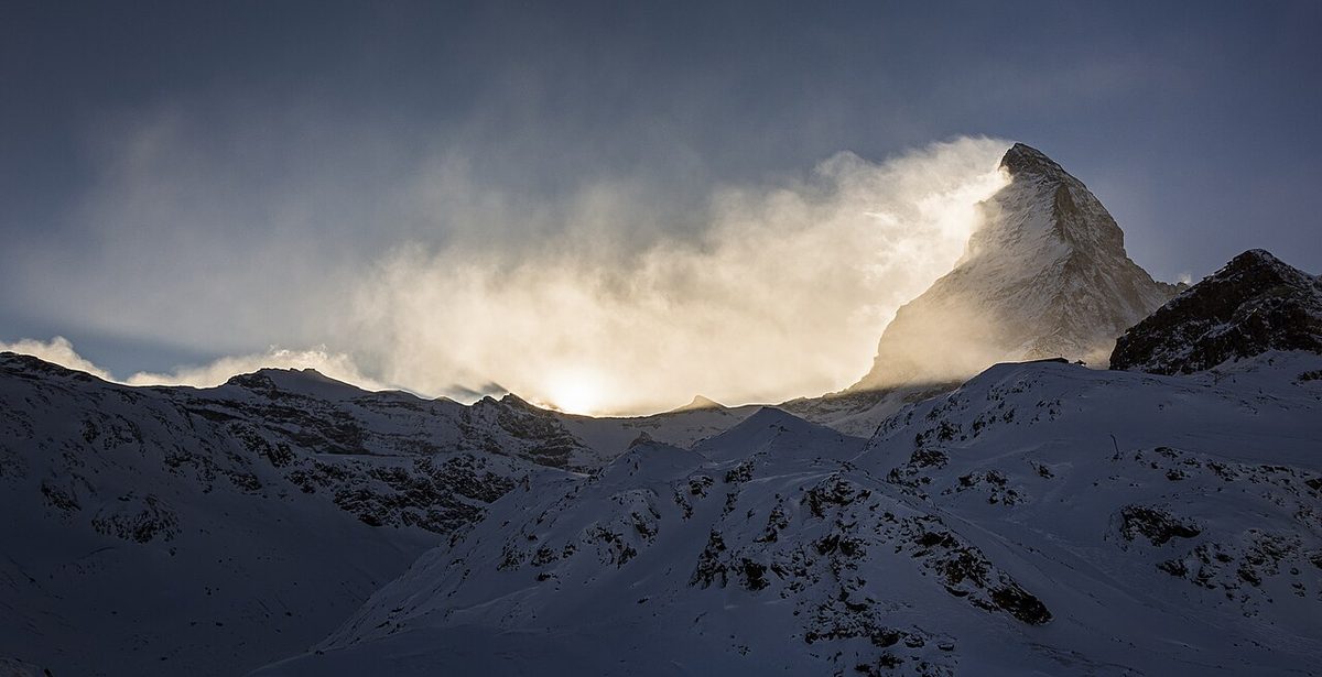
- Banner cloud. A cloud streaming downwind from the summit of an isolated peak or crest, like a flag. At Gibraltar the easterly Levanter produces a banner of stratus or stratocumulus streaming west from the top of the Rock, and ATPL texts warn of considerable turbulence up to 5,000 ft above the airfield when it blows.
Rotors and rotor streaming
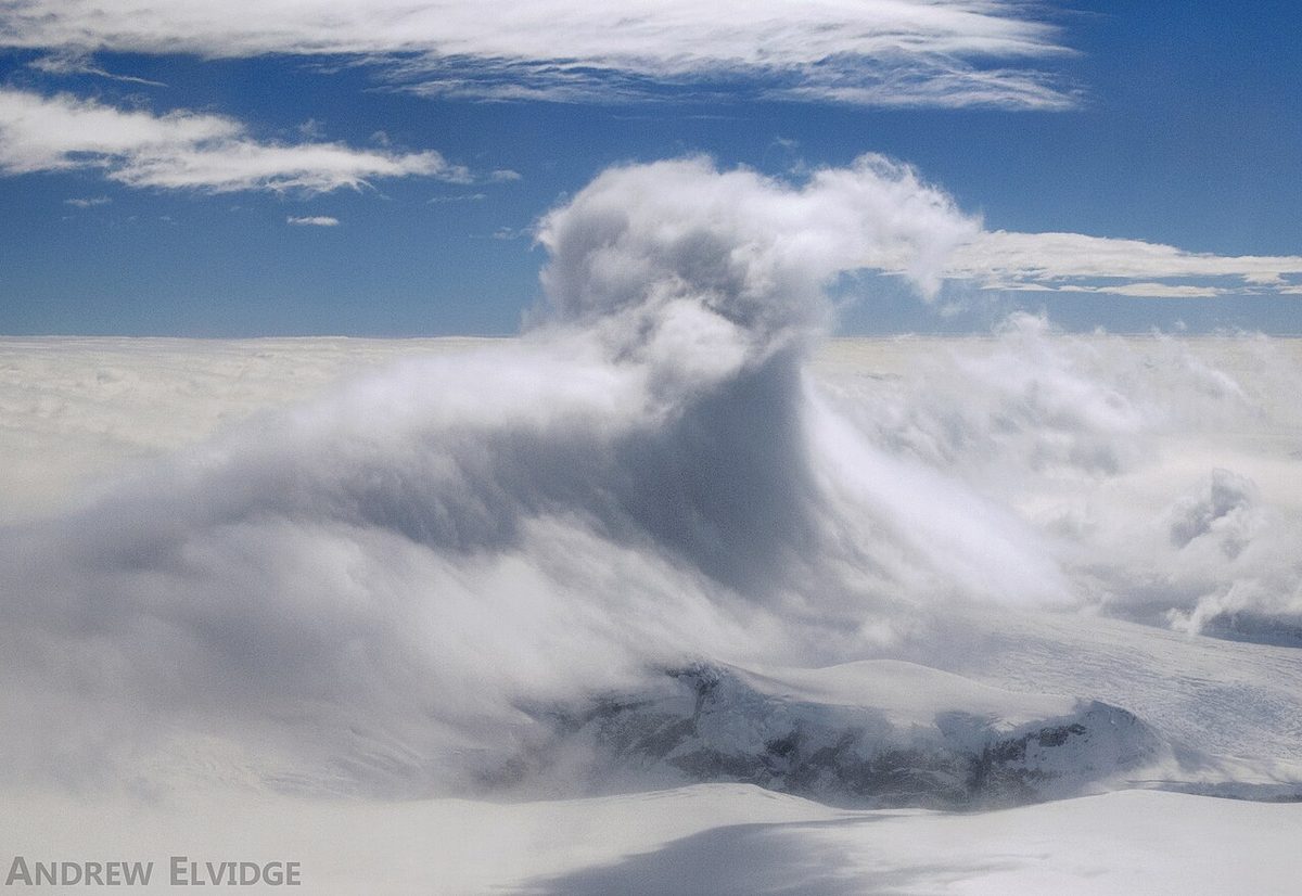
Beneath the wave crests, at or below ridge height on the lee side, the flow can separate from the ground and turn over into a horizontal eddy, the rotor. Near the surface the wind in a rotor can blow towards the ridge, against the general flow. The turbulence in a rotor is far more violent than anything in the smooth wave flow above it and can be severe or extreme. The most powerful rotor normally lies beneath the first wave crest, about one wavelength downwind of the ridge.
When the air is moist, a rotor cloud, or roll cloud, can form in the rotor: a ragged, rolling band of cloud lying parallel to the ridge, below the smooth lenticular clouds and usually at or below ridge height. It is the visible warning of the most dangerous part of the wave system.
Rotor streaming is a variation. When the wind is strong at low levels but falls off or reverses direction at higher levels above the ridge, a regular wave train does not form. Rotors form on the lee slopes and travel downwind instead of staying in place, spreading low-level turbulence over a wide area.
Hazards to aircraft
- Downdraughts. Downdraughts in the descending limb of a wave commonly reach 1,000 to 2,000 ft/min, can exceed 2,000 ft/min and are sustained over several miles. A light aeroplane cannot outclimb them; trying to means losing airspeed while still descending.
- Rotor turbulence. Severe or extreme turbulence close to the ground, at the heights used for circuits and approaches at lee-side aerodromes, with the risk of loss of control near terrain.
- Altimeter error. Low pressure in the accelerated flow over ridges, and cold air, make the altimeter over-read, reducing the real terrain clearance.
- Wind shear on approach. Aerodromes in the lee of high ground can see rapid changes of wind speed and direction on final approach when waves and rotors are active.
- Turbulence at cruising levels. Waves over high ranges can reach the tropopause. At cruising levels they cause altitude and airspeed excursions and clear air turbulence, which has injured passengers on flights across the Rocky Mountains and the Sierra Nevada (see turbulence).
Mountain wave is a reportable and forecast hazard. A SIGMET is issued for severe mountain wave (SEV MTW). An AIRMET covers moderate mountain wave (MOD MTW) for flights below FL100, or FL150 in mountainous areas, and the GAMET area forecast lists mountain wave among the low-level hazards. Under the Standardised European Rules of the Air (SERA), a pilot who meets severe mountain wave must make a special air-report to the ATS unit as soon as practicable; in the United States severe turbulence is reported as an urgent PIREP (UUA).

Crossing high ground safely
Before flight. Read the SIGMETs, AIRMETs, GAMET or low-level significant weather chart and the forecast wind at ridge level. A strong wind across the ridge in stable air is warning enough, even without cloud; lenticular, cap and rotor clouds confirm it.
Choose the height. Minimum IFR levels already include extra clearance over high ground. Under SERA.5015 the minimum is 2,000 ft (600 m) above the highest obstacle within 8 km of the estimated position over high terrain or in mountainous areas; under 14 CFR 91.177 it is 2,000 ft above the highest obstacle within 4 NM of the course in a designated mountainous area (see minimum safe altitudes). In strong winds, FAA guidance is to cross ridges 3,000 to 5,000 ft above them.
Approach the ridge obliquely. Crossing at about 45° to the ridge means that a turn away towards lower ground takes only a short time if a downdraught is met. Approaching from the lee side, flying into wind, expect downdraughts and turbulence before reaching the ridge. Avoid flying below ridge level on the lee side, where the rotors are.
If caught in a downdraught. Do not try to outclimb it. Turn towards lower terrain and out of the descending air, accepting the height loss, and do not descend into the rotor zone beneath the wave crests.
In turbulence. Slow to the turbulence penetration speed or the design manoeuvring speed, hold the attitude and accept altitude and airspeed deviations rather than chasing them. Tell ATC if the assigned level cannot be held, and report the encounter to warn those behind.
Warning: A lenticular cloud sitting quietly over a range on a fine day is not a sign of benign weather. It marks strong wind across the high ground, and the rotor beneath it can be violent close to the ground.
Frequently asked questions
What is a mountain wave?
A mountain wave is a standing wave in a stable airstream downwind of a ridge. The air, lifted over the ridge, sinks on the lee side, overshoots its original level and oscillates up and down as it flows downstream. The waves stay nearly fixed over the ground, can extend far downwind and well above the ridge, and bring strong up- and downdraughts, rotor turbulence near the ground and turbulence at cruising levels.
What do lenticular clouds indicate?
Lenticular clouds, altocumulus lenticularis, reported in US METAR remarks as ACSL, form in the crests of mountain waves where the air is lifted to its condensation level. They show that a wave system is active, with a strong wind across the high ground. The air inside the cloud is smooth, but turbulence, sometimes severe, can be found around them, and the rotor zone beneath the crests is the most dangerous part.
Where is the worst turbulence in a mountain wave?
The most violent turbulence is in the rotors, horizontal eddies that form beneath the wave crests at or below ridge height on the lee side. The most powerful rotor normally lies beneath the first wave crest, about one wavelength downwind of the ridge. Rotors can hold severe or extreme turbulence close to the ground, at the heights where light aircraft fly circuits and approaches into mountain aerodromes.
What conditions produce mountain waves?
Three things are needed together. The wind must blow within about 30 degrees of perpendicular to the ridge, without much change of direction with height. It must be strong at ridge level and increase with height; EASA ATPL texts quote at least 15 kt at summit level and FAA guidance about 25 kt. And there must be a marked stable layer, an inversion or isothermal layer, near summit height.
How should a pilot cross a mountain ridge in strong winds?
Plan a crossing height well above the ridge; FAA guidance suggests 3,000 to 5,000 ft in strong winds. Approach the ridge at about 45 degrees so that a turn away towards lower ground takes little time, and avoid flying below ridge level on the lee side. If a downdraught exceeds the aircraft's climb performance, turn towards lower terrain rather than trying to outclimb it, and fly at the turbulence penetration speed.
What is rotor streaming?
Rotor streaming occurs when the wind is strong at low levels but falls off or reverses direction at higher levels above the ridge. Instead of a regular train of standing waves with stationary rotors beneath them, rotors form on the lee slopes and are carried downwind, spreading turbulence at low level over a wide area downstream of the high ground.
Test yourself on Mountain Waves
The v1prep banks cover this topic in Meteorology (050), with a worked explanation for every answer. EASA ATPL, PPL, IR and CPL, the FAA written tests and A320/B737 type ratings.
Start practising →Sources and further reading
- FAA Aeronautical Information Manual, Chapter 7, Section 6 (Potential flight hazards, mountain flying)
- FAA-H-8083-28B, Aviation Weather Handbook (chapter on turbulence)
- WMO, Aviation hazards, turbulence and wind shear
- SKYbrary, Mountain Waves
- ICAO EUR Doc 014, EUR SIGMET and AIRMET Guide
- Commission Implementing Regulation (EU) No 923/2012, Standardised European Rules of the Air (SERA)
- 14 CFR 91.177, Minimum altitudes for IFR operations
Library articles are written for study and exam preparation. They do not replace your aircraft's approved documentation, your operator's procedures or the regulations themselves.