Distance Measuring Equipment (DME)
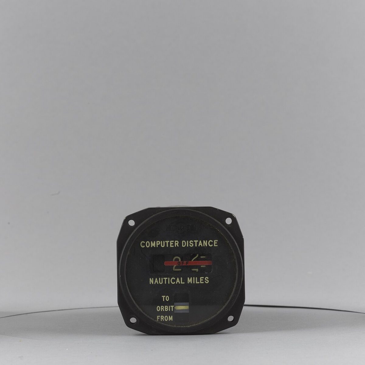
Distance measuring equipment (DME) is a UHF radio navigation aid in which an airborne interrogator and a ground transponder exchange pulse pairs, the aircraft timing the round trip to display its slant range from the station in nautical miles.
DME (distance measuring equipment) tells the pilot how far the aircraft is from a ground station. The airborne unit transmits pulses, a beacon on the ground answers, and the round-trip time gives the distance, displayed in nautical miles. Co-located with a VOR, a DME turns a bearing into a complete fix: the rho-theta principle behind airways, arcs, holding patterns and stepdown fixes. Associated with an ILS, it can replace marker beacons.
Two properties explain nearly every DME exam question. The distance is slant range, measured along the line of sight rather than over the ground, so it never reads zero overhead. And the groundspeed many sets display is simply the rate of change of that range, true only when flying directly towards or away from the station. DME also underpins area navigation, since flight management systems can fix their position from several DMEs when satellite signals are lost (see GNSS).
DME principle: interrogation and reply
DME applies the secondary radar principle, like SSR. The aircraft's interrogator transmits pairs of pulses; the ground transponder receives them and, after a fixed delay, replies with pulse pairs of the same spacing on a frequency 63 MHz above or below the interrogation. The airborne unit measures the time from interrogation to reply, subtracts the beacon's delay, halves the rest and converts it to distance.
DME works in the UHF band from 960 to 1,215 MHz. A radio signal takes about 12.36 µs to travel one nautical mile and back, and the beacon waits a fixed 50 µs before replying, so a reply arriving 173.6 µs after the interrogation means (173.6 − 50) ÷ 12.36 = 10 NM.
Being UHF, DME is limited to line of sight. The FAA's AIM quotes reliable signals up to 199 NM at line-of-sight altitude, with an accuracy better than ½ NM or 3% of the distance, whichever is greater. EASA theory material quotes a total error of ±0.25 NM plus 1.25% of the distance measured, which is 1.5 NM at 100 NM.
Pulse pairs, jitter, search and track modes
A beacon answers every aircraft interrogating it, and all its replies go out on the same frequency, so each set must pick out its own. Every interrogator transmits its pulse pairs at deliberately irregular intervals, a random PRF jitter unique to that set. Only the replies to its own interrogations follow the same irregular pattern at a constant delay, so they line up time after time; replies meant for other aircraft fall at random and are rejected. Sending pulses in pairs, at a set spacing, also helps the receiver reject stray pulses and noise.
On tuning, the set is in search mode: it interrogates at a high rate, up to about 150 pulse pairs per second, looking for a reply at a consistent delay. Once it finds one it locks on and changes to track mode, dropping to about 30 pulse pairs per second, which leaves the beacon's capacity for other users. A beacon can serve about 100 aircraft at once. If its monitor finds the beacon out of tolerance, the beacon goes to standby, sending its identifier but no range replies, and the cockpit indicator shows a warning flag rather than a false distance.
Channels, X/Y and frequency pairing
DME has 252 channels at 1 MHz spacing: 126 X channels and 126 Y channels. The channels are frequency paired with the VHF navigation frequencies of VORs and ILS localisers: selecting the VHF frequency tunes the paired DME automatically, and the pilot never selects the UHF channel. Military TACAN sets are tuned by channel number instead, which is why FAA charts print both: the Yakima VORTAC's box reads "116.0 Chan 107", and the Yakima localiser "110.1 Chan 38".
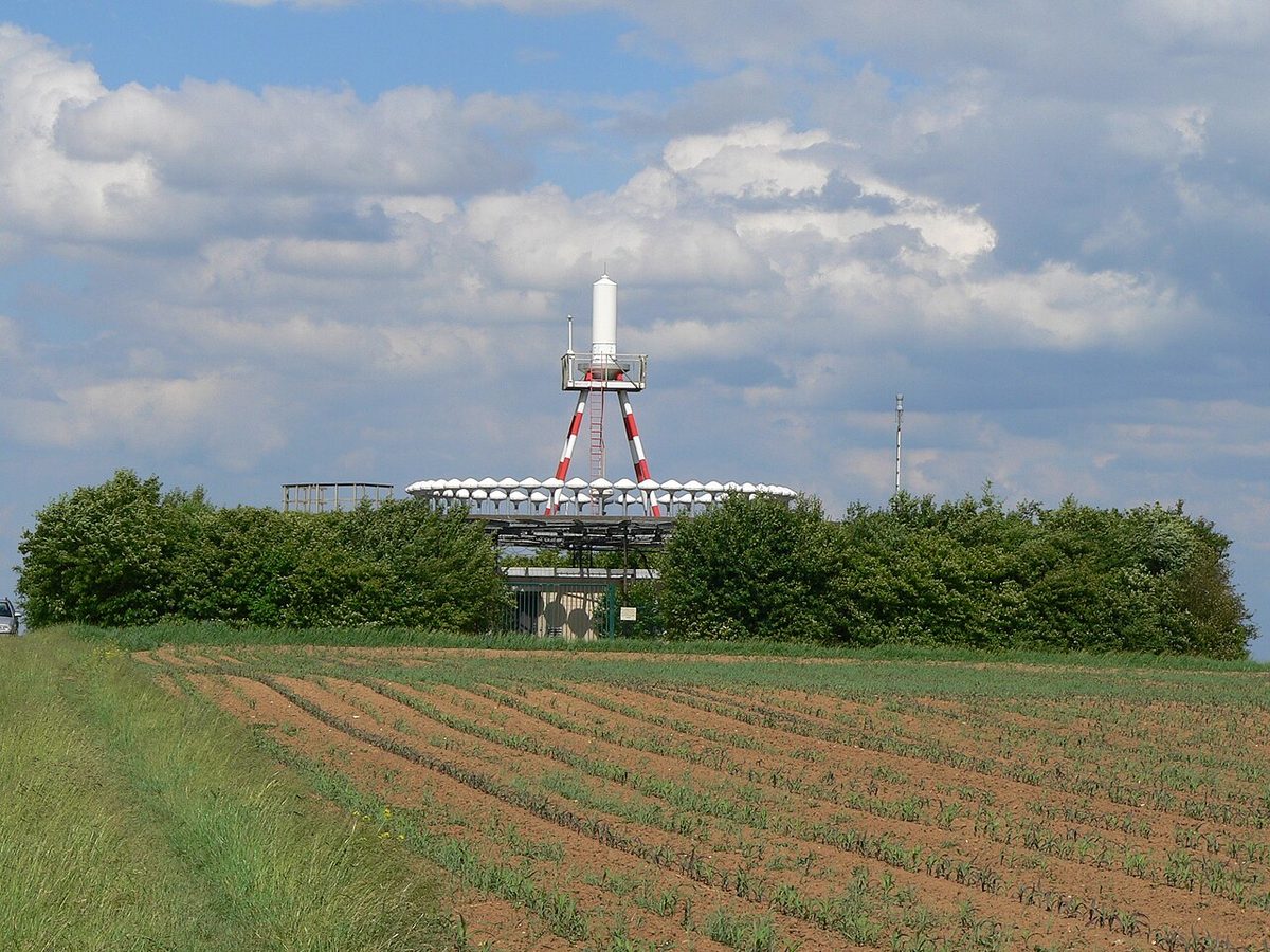
A DME may be co-located with a VOR (VOR/DME), with an ILS or localiser (ILS/DME, LOC/DME) or with an NDB (see NDB and ADF); form part of a VORTAC; or stand alone. Because paired frequencies are scarce, a few military VOR and TACAN facilities with paired channels serve the same area from sites up to a few miles apart.
Co-located facilities send synchronised identifiers. The VOR or localiser keys its Morse on a 1,020 Hz tone; the DME sends the same letters on a higher 1,350 Hz tone, once for every three or four VOR idents. A single high-pitched ident about every 30 seconds therefore means only the DME is working; if the high tone never comes, the DME is off. Automatic pairing has a trap: tuning a VOR or ILS that has no DME may still produce a distance on the display, and the AIM tells pilots to disregard it.
When installed with an ILS and specified in the procedure, a DME may replace the outer marker, provide the final approach fix of a back-course approach and define other fixes on the localiser. EASA exam questions assume that an ILS DME is referenced to the runway threshold. Installations differ, so the pilot uses the DME values printed on the approach chart.
Slant range and slant-range error
DME measures the straight line from aircraft to beacon, the hypotenuse of a triangle whose other sides are the ground distance and the aircraft's height above the station. The difference between that line and the ground distance is slant-range error. Overhead, the ground distance is zero and the DME reads the height. With 6,076 ft to the nautical mile, an aircraft 15,000 ft above the station reads about 2.5 NM, and one at FL360 about 5.9 NM, the smallest reading it will see.
Ground distance = √(DME² − height²), with the height in nautical miles. At FL350 above a station at sea level, a height of 5.8 NM:
| DME reading | Ground distance at FL350 |
|---|---|
| 6 NM | 1.7 NM |
| 10 NM | 8.2 NM |
| 20 NM | 19.2 NM |
| 40 NM | 39.6 NM |
The error matters only when the aircraft is high and close. The FAA's rule of thumb makes it negligible when the aircraft is at least 1 NM from the station for every 1,000 ft of height above it; EASA questions put the same idea as "greatest when high and close to the beacon".
Exam tip: overhead, the DME reads the height above the station: divide feet by 6,076, so FL360 reads about 6 NM. No reading can be smaller than that height.
Procedures are designed around slant range. DME fixes, arcs and holding leg lengths are published as DME readings, so crews fly the reading. An RNAV system computing ground distance instead holds slightly further from the navaid than designed; the AIM treats the difference as negligible when RNAV distance is substituted for DME.

DME groundspeed and time to station
Many sets display DME groundspeed and time to station. Both come from the rate at which the measured range changes, so they are correct only when the aircraft tracks directly towards or away from the station and is not close to it at height. Passing abeam, or flying an arc, the range hardly changes and the displayed speed falls towards zero. On any track that does not pass through the station the value under-reads, and near the station at altitude it under-reads again, because slant range changes more slowly than ground distance.
Flying a DME arc
A DME arc is a path at a constant DME distance around a station, used as an initial approach segment or a transition to the final course. The AIM lists arc initial segments among the uses of a DME, and FAA charts label them, for example "YKM 13 Arc" on the VOR/DME or TACAN RWY 27 approach at Yakima, with initial approach fixes on the arc and "NoPT" where no procedure turn is flown.
The arc is flown as a series of short straight legs:
- Approaching along a radial, lead the turn by a distance that grows with groundspeed, about 0.5 NM at light-aircraft speeds, and turn 90° onto the arc.
- Keep the station near the wingtip; with an RMI, hold the needle near the wingtip reference.
- Let the needle drift slightly behind the wingtip, then turn about 10° towards the station to bring it slightly ahead. If the range grows, turn towards the station; if it shrinks, turn away.
- In a crosswind, hold the needle slightly ahead of or behind the wingtip reference to allow for drift.
- With only a CDI, turn the OBS 10° ahead each time the needle centres to keep track of progress.
The 1-in-60 rule gives the distance flown: each degree of arc is one sixtieth of the radius, so moving from R-090 to R-095 on a 15 DME arc covers 1.25 NM.
The turn off the arc begins at a lead radial, printed on FAA charts as "LR" and the radial, for example LR-257. Turning there rolls the aircraft out on the inbound course instead of overshooting it. A suitable RNAV system may also fly a DME arc.
In DME holding, distances replace times (see holding patterns). With the inbound course towards the navaid, a fix at 10 DME and 5 NM legs, the outbound leg ends at 15 DME; with the inbound course away from it, a fix at 28 DME and 8 NM legs, the outbound leg ends at 20 DME. Where a stepdown fix can only be identified by DME, charts note "DME required" or publish separate minima for aircraft that can identify it.
TACAN and VORTAC
TACAN (tactical air navigation) is the military counterpart of VOR/DME, developed because the civil system did not suit military and naval needs, such as operating from the pitching deck of a ship. It is a UHF pulse system that gives bearing and distance from one facility, but its bearing needs TACAN equipment; a VOR receiver cannot use it. Its distance function is the same as DME, so civil aircraft read range from TACAN stations with ordinary DME.
A VORTAC combines a VOR and a TACAN at one site and provides three services: VOR azimuth, TACAN azimuth and TACAN distance. Civil aircraft use it as a VOR/DME, taking bearing from the VOR and distance from the TACAN. The two identifiers are interlocked, so a pilot combining VOR azimuth with TACAN distance knows both come from the same station, and the channels are paired under the national plan. Approach charts may serve both user groups, as the "VOR/DME or TACAN" title at Yakima shows.
DME in area navigation
Alongside GPS, DME is what flight management systems normally use to update their position. Measuring ranges to two or more stations gives a DME/DME fix; combined with inertial reference units (DME/DME/IRU), it meets RNAV 1 on US SIDs and STARs and the requirements of Q-routes. The AIM describes DME/DME as the back-up that lets equipped aircraft continue on performance-based routes through a GNSS disruption. Coverage and geometry decide whether it works: some US RNAV approach charts carry the note "DME/DME RNP-0.3 NA". To support PBN, the FAA added DME Low and DME High service volumes: below 12,900 ft above the transmitter they extend to radio line of sight, and above it to 130 NM, up to 18,000 ft (DME Low) or 45,000 ft (DME High).
Frequently asked questions
Why does DME not read zero when you fly over the station?
DME measures slant range, the straight-line distance from the aircraft to the ground beacon, not distance over the ground. Directly overhead the ground distance is zero but the slant range equals the aircraft's height above the station. One nautical mile is about 6,076 ft, so at 15,000 ft above the beacon the DME reads about 2.5 NM, and at FL360 about 6 NM.
When can DME slant-range error be ignored?
The error is large only when the aircraft is high and close to the station. The FAA's rule of thumb is that it becomes negligible when the aircraft is at least 1 NM from the station for every 1,000 ft of height above it. Published DME fixes, arcs and holding legs are defined by the DME reading itself, so crews fly the indicated value.
Why does DME groundspeed read wrong on a DME arc?
DME groundspeed is not measured directly; the equipment derives it from the rate of change of the slant range. It equals the true groundspeed only when the aircraft flies straight towards or away from the station and is not close to it at height. On an arc, or passing abeam, the range barely changes, so the displayed groundspeed falls towards zero.
How is DME paired with a VOR or ILS frequency?
Each VHF navigation frequency used by VORs and ILS localisers has a DME channel assigned to it under the ICAO frequency plan. Selecting the VOR or localiser frequency tunes the paired DME automatically. Military TACAN sets are tuned by channel number instead, so FAA charts print both, for example 116.0 and Channel 107. The pilot still checks both identifiers, because either element can be off the air.
What is the difference between VOR/DME, VORTAC and TACAN?
A VOR/DME is a civil VOR with a co-located DME giving bearing and distance. TACAN is the military system, a UHF pulse system giving both bearing and distance but needing TACAN equipment for the bearing. A VORTAC combines a VOR and a TACAN at one site, so civil aircraft use the VOR bearing with the TACAN distance, which any DME can receive.
How do you fly a DME arc?
Lead the turn onto the arc, about 0.5 NM at light-aircraft speeds, and turn 90 degrees from the radial. Keep the station near the wingtip, letting the RMI needle drift slightly behind it and then turning about 10 degrees towards the station. If the range grows, turn in; if it shrinks, turn out. Start the turn onto the final course at the published lead radial.
Test yourself on Distance Measuring Equipment (DME)
The v1prep banks cover this topic in General and Radio Navigation (061/062), with a worked explanation for every answer. EASA ATPL, PPL, IR and CPL, the FAA written tests and A320/B737 type ratings.
Start practising →Sources and further reading
- FAA Aeronautical Information Manual, Chapter 1 Section 1 (1-1-5 TACAN, 1-1-6 VORTAC, 1-1-7 DME, 1-1-8 NAVAID Service Volumes)
- FAA Aeronautical Information Manual, Chapter 1 Section 2 (DME/DME RNAV and RNAV substitution for conventional aids)
- FAA Aeronautical Information Manual, Chapter 5 Section 3 (5-3-8 Holding, DME holding)
- ICAO Annex 10, Aeronautical Telecommunications, Volume I, Radio Navigation Aids (copy published by IACM Mozambique)
- FAA Instrument Flying Handbook (FAA-H-8083-15B), Chapter 9, Navigation Systems
- FAA Instrument Procedures Handbook (FAA-H-8083-16B)
Library articles are written for study and exam preparation. They do not replace your aircraft's approved documentation, your operator's procedures or the regulations themselves.