Global Navigation Satellite Systems (GNSS)
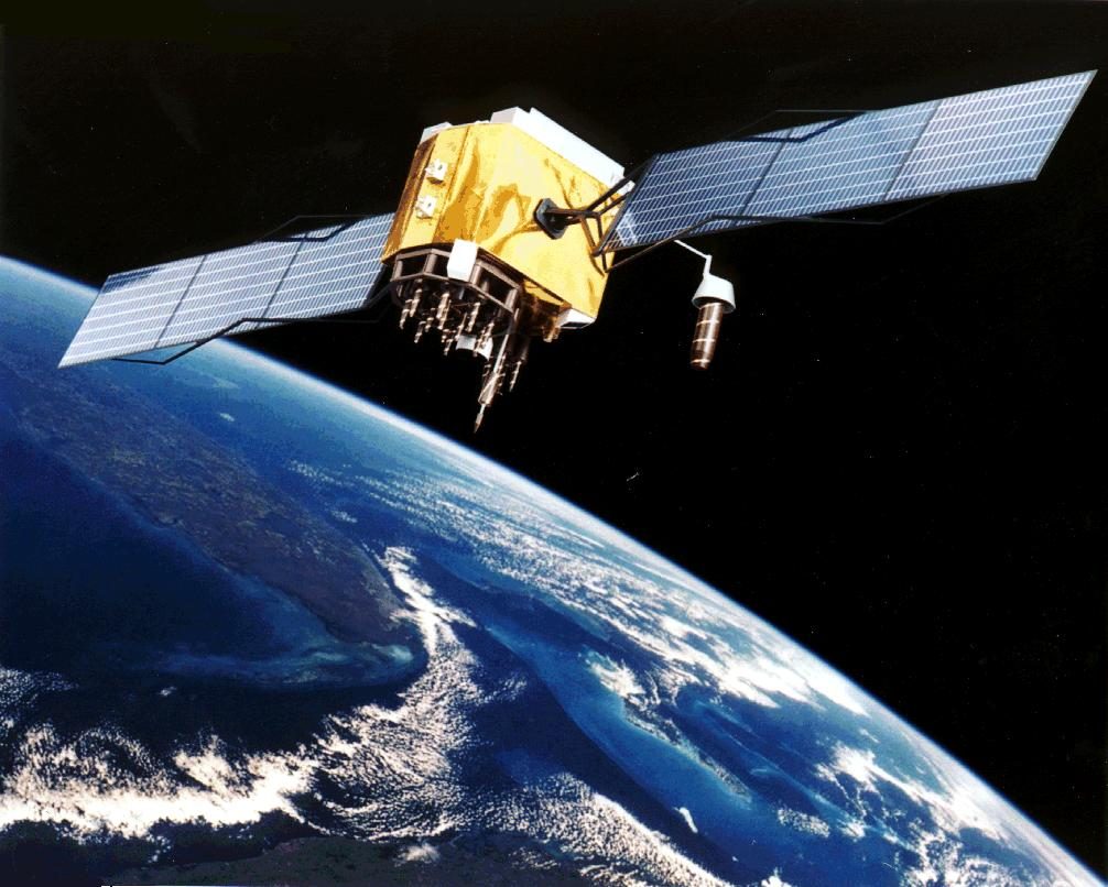
A global navigation satellite system (GNSS) is a constellation of satellites broadcasting precisely timed ranging signals, from which a receiver anywhere on Earth computes its three-dimensional position, velocity and time. GPS, GLONASS, Galileo and BeiDou are the global systems; augmentation systems add the integrity aviation needs.
A global navigation satellite system (GNSS) gives position, velocity and time anywhere on or above the Earth from signals broadcast by satellites. The receiver measures how long each signal took to arrive, converts that time into a range and solves for its position; the aircraft transmits nothing. Four global constellations exist: the United States' Global Positioning System (GPS), Russia's GLONASS, the European Union's Galileo and China's BeiDou (BDS).
In aviation, GNSS is the primary sensor for area navigation and RNP approaches, supplies the position broadcast by ADS-B, and feeds terrain awareness systems and aircraft clocks. Accuracy alone is not enough for those uses: the receiver must also know when its position cannot be trusted, the job of integrity monitoring and of augmentation systems. Certified aviation receivers have long used GPS alone, so most exam questions, and most of this article, concern GPS. EASA material generally speaks of GNSS and EGNOS, FAA material of GPS and WAAS.
- Constellations, orbits and segments
- Signals, carrier frequencies and codes
- The navigation message, ephemeris and GPS time
- Pseudo-ranges, trilateration and the fourth satellite
- Receivers and time to first fix
- Error sources, Selective Availability and anti-spoofing
- Integrity: RAIM and FDE
- Augmentation: SBAS and GBAS
- Interference, jamming and spoofing
- Frequently asked questions
Constellations, orbits and segments
Each satellite, or space vehicle (SV), flies in medium Earth orbit (MEO), well below the geostationary belt at about 35,800 km used by SBAS satellites.
| System | Operator | Orbital planes | Altitude | Inclination | Period |
|---|---|---|---|---|---|
| GPS | United States | 6 | About 20,200 km | 55° | 11 h 58 min |
| GLONASS | Russia | 3 | About 19,100 km | 64.8° | 11 h 15 min |
| Galileo | European Union | 3 | About 23,200 km | 56° | About 14 h |
The GPS baseline is 24 satellites, arranged so that at least five are in view from anywhere on Earth; about 31 are normally operational, the extras adding redundancy. The GPS period is half a sidereal day: each satellite completes two orbits while the Earth turns once, so its ground track repeats daily. GLONASS's steeper inclination improves coverage at high latitudes. Galileo, which began initial services in 2016, is planned as 24 operational satellites plus spares. BeiDou reached global service in 2020 and mixes MEO satellites with geostationary and inclined geosynchronous ones that strengthen coverage over Asia.
Every system has three segments. The space segment is the satellites. The control segment is the network of monitor stations, ground antennas and a master control station that tracks the satellites, computes their orbits and clock errors and uploads them for broadcast. The user segment is every receiver.
Signals, carrier frequencies and codes
GNSS signals lie in the L band, part of UHF. GPS satellites all share the same frequencies and are told apart by their codes. Every GPS frequency is a multiple of a 10.23 MHz fundamental:
| Carrier | Frequency | Content |
|---|---|---|
| L1 | 1575.42 MHz (154 × 10.23) | C/A code, P(Y) code, navigation message |
| L2 | 1227.60 MHz (120 × 10.23) | P(Y) code; civil L2C on newer satellites |
| L5 | 1176.45 MHz (115 × 10.23) | Second civil signal, for safety-of-life use |
Each code is a pseudo-random noise (PRN) code: a binary sequence that looks like noise but is fully known and unique to each satellite, which it identifies. The coarse/acquisition (C/A) code runs at 1.023 MHz and repeats every millisecond, so a receiver can lock on quickly; it underpins the civil Standard Positioning Service. The precision (P) code runs ten times faster, at 10.23 MHz, and repeats only once a week, giving finer ranging to authorised, mainly military, users. The receiver generates a replica of each code and slides it in time until it matches the incoming signal; the shift needed is the signal's travel time. The signals reach the aircraft at very low strength, which is why they are so vulnerable to interference and jamming.
The navigation message, ephemeris and GPS time
The GPS navigation message tells the receiver where each satellite is and what time it is. It is sent at 50 bits per second in 30-second frames, each divided into five 6-second subframes:
- Subframe 1: satellite clock corrections.
- Subframes 2 and 3: the ephemeris, the precise orbital parameters of the transmitting satellite.
- Subframes 4 and 5: an ionospheric model, the offset between GPS time and UTC, and the almanac, approximate orbits for the whole constellation.
A satellite's own clock and ephemeris data repeat every 30 seconds, but a complete almanac takes about 12.5 minutes to download. The almanac tells the receiver which satellites should be in view; the ephemeris, valid only for a limited period, gives the precise satellite position used in the fix.
Each satellite carries several atomic clocks, rubidium or caesium standards. The control segment measures their drift and broadcasts it as a correction rather than adjusting the clocks. The common timescale is GPS time, a continuous atomic time that started at 0000 UTC on 6 January 1980 and has no leap seconds; it has run 18 seconds ahead of UTC since the start of 2017, and the message carries the offset so receivers can display UTC.
GPS time is counted in weeks and seconds of the week, and the legacy message holds the week in 10 bits. The count therefore returns to zero every 1,024 weeks, about 19.6 years. This GPS week number rollover occurred at the turn of 21 to 22 August 1999 and of 6 to 7 April 2019, and the next falls at the turn of 20 to 21 November 2038.
Pseudo-ranges, trilateration and the fourth satellite
A radio signal covers about 300 m in a microsecond, so ranging by time demands precise clocks. The satellites have them; the receiver, with a quartz oscillator, does not. The range it computes is therefore a pseudo-range: the true range plus the receiver's clock error multiplied by the speed of light. The same receiver clock bias affects every satellite measured at the same instant.
Position is found by trilateration, the intersection of spheres centred on the satellites. Three true ranges would intersect at two points, one near the Earth and one far out in space, which the receiver discards. With a clock bias there are four unknowns, latitude, longitude, altitude and clock error, so four pseudo-ranges are needed: the fourth satellite solves the clock, and in doing so makes the receiver an accurate time source. A three-satellite fix is possible only when altitude comes from elsewhere, such as the barometric altimeter.
Geometry matters as much as numbers. Satellites spread widely across the sky give a low dilution of precision (DOP); satellites bunched together give a high DOP and a poor fix, although each range is as good as before. DOP is quoted as HDOP (horizontal), VDOP (vertical), PDOP (position, the two combined), TDOP (time) and GDOP (position and time). The ideal is one satellite overhead and others spread around near the horizon.
Because every satellite is above the horizon, vertical geometry is always weaker than horizontal. GNSS height is also referenced to the WGS-84 ellipsoid, which differs from mean sea level by up to about 100 m, so it never replaces the barometric altimeter for terrain clearance or separation.
Receivers and time to first fix
Aviation receivers are multi-channel all-in-view receivers: they track every satellite above the mask angle, typically 5°, below which the signal's long path through the atmosphere and multipath make it unreliable, and use them for the fix and for integrity monitoring.
Time to first fix (TTFF) depends on what the receiver already knows. With a valid almanac and an approximate position and time, it knows which satellites to search for and needs typically about 30 seconds to collect their ephemerides and fix. From a cold start without a usable almanac, it must search the whole sky and download a fresh almanac, which alone takes 12.5 minutes, so a first fix takes 15 minutes or more. The antenna sits on top of the fuselage for a clear view of the sky, and the AIM warns that pitch and bank changes can mask satellites and trigger integrity warnings.
Error sources, Selective Availability and anti-spoofing
ICAO standardises the GPS Standard Positioning Service at 13 m horizontal and 22 m vertical accuracy (95%), and typical performance is much better. Figures typically quoted in EASA training material for the individual errors are:
| Source | Typical contribution | Reduced by |
|---|---|---|
| Ionospheric delay | Up to 5 m | Dual-frequency reception; SBAS and GBAS corrections |
| Ephemeris error | About 2.5 m | Differential corrections |
| Satellite clock error | About 1.5 m | Broadcast clock corrections; differential corrections |
| Multipath | About 0.6 m | Antenna siting; receiver processing |
| Tropospheric delay | About 0.5 m | Receiver model; GBAS |
| Receiver noise | About 0.3 m | Receiver design |
The ionosphere is the largest single source for a single-frequency receiver. Its delay varies inversely with the square of the frequency, so comparing two frequencies reveals it; the troposphere is not frequency-dependent and dual-frequency reception does not remove it.
Selective Availability (SA) was the deliberate degradation of civil accuracy, mainly by dithering the satellite clocks, to about 100 m. It was discontinued on 1 May 2000. Anti-spoofing (AS) encrypts the P code into the Y code, so that only authorised users can use it and a hostile transmitter cannot imitate it. It protects military receivers only.
Integrity: RAIM and FDE
Integrity is the assurance that the crew will be warned in time when the position is wrong. A satellite can transmit bad data for some time before the control segment notices; the AIM cites delays of up to two hours. Aviation receivers therefore check themselves.
Receiver autonomous integrity monitoring (RAIM), the main form of aircraft-based augmentation (ABAS), compares redundant measurements for consistency. RAIM needs five satellites, or four plus barometric altitude (baro-aiding), to detect a fault. Fault detection and exclusion (FDE) needs six, or five with baro-aiding, to identify the faulty satellite, drop it and continue with an integrity-assured position. A RAIM alert means either too few satellites to monitor integrity or a detected inconsistency; either way the position is no longer assured for that phase of flight. VFR panel-mount and hand-held receivers have no RAIM alerting.
Crews using GPS without SBAS (TSO-C129 or TSO-C196 equipment in FAA terms) check a RAIM prediction for the destination around the ETA. If a RAIM alert appears before the final approach waypoint, the pilot does not begin the final descent but flies to the missed approach waypoint and goes around; after it, the pilot climbs and flies the missed approach. If their receivers have FDE and the prediction has been made, the FAA lets them plan on a GPS-based approach at the destination or at the alternate, but not both.
Augmentation: SBAS and GBAS
Differential GNSS uses reference receivers at surveyed positions to measure errors and broadcast corrections and integrity data.
A satellite-based augmentation system (SBAS) covers a continent. Reference stations send their measurements to master stations, which compute corrections for satellite clock and ephemeris errors and model the ionospheric delay; geostationary satellites broadcast the corrections and integrity data on L1 and add a ranging signal of their own. WAAS serves North America, with 38 reference stations, three master stations and three geostationary links; EGNOS serves Europe, GAGAN India and MSAS Japan. SBAS enables LP and LPV approaches, LPV with decision altitudes as low as 200 ft above touchdown. Ionospheric storms can still deny vertical guidance, hence the FAA's "WAAS MAY NOT BE AVBL" NOTAMs.
A ground-based augmentation system (GBAS), formerly called LAAS in the United States, serves one airport. At least four reference receivers feed a corrections processor, and a VHF data broadcast in the band used by ILS and VOR transmits corrections, integrity parameters and the final approach path definition. The aircraft flies a GBAS landing system (GLS) approach with ILS-like angular guidance, and one ground station can serve several runway ends.
Interference, jamming and spoofing
Weak signals make GNSS vulnerable to unintentional interference, from radars, solar activity and GPS repeaters, and to deliberate jamming, which denies reception, and spoofing, which makes the receiver compute a false position or time. AIM paragraph 1-2-4 lists the symptoms: loss of RNP capability, map shifts, unreliable TAWS alerts, erroneous ADS-B, wrong aircraft clocks and false wind and groundspeed. Crews check GPS NOTAMs, keep conventional aids such as VOR and DME available, cross-check the position, plan an approach that does not rely on GPS and report anomalies to ATC.

Frequently asked questions
How many satellites does GPS need for a position fix?
Four for a three-dimensional fix, because the receiver must solve four unknowns, latitude, longitude, altitude and its own clock error. Three are enough only if altitude comes from another source, such as the barometric altimeter. Integrity monitoring needs more. RAIM needs a fifth satellite, or four plus baro-aiding, to detect a faulty signal, and fault detection and exclusion needs six, or five plus baro-aiding, to identify and remove it.
Why is the range measured by a GPS receiver called a pseudo-range?
The receiver measures the travel time of each signal and multiplies it by the speed of light, but its quartz clock is not synchronised with the atomic clocks in the satellites. Every measured range therefore contains the same unknown error, the receiver clock bias multiplied by the speed of light. Solving for that bias as a fourth unknown, using a fourth satellite, turns the pseudo-ranges into a true position.
What is the largest source of error in GPS?
For a single-frequency receiver it is the ionospheric delay, typically quoted as up to about 5 m. Charged particles in the upper atmosphere slow the signal by an amount that varies with solar activity, time of day and satellite elevation. Because the delay depends on frequency, dual-frequency receivers using L1 and L5 can measure and remove most of it, and SBAS broadcasts an ionospheric correction model for single-frequency users.
What is the difference between RAIM and SBAS?
RAIM is done inside the receiver, which uses redundant satellites to check that its measurements agree and warns the crew when they do not or when too few satellites are available. It improves integrity but not accuracy. SBAS, such as WAAS or EGNOS, is an external network of reference stations whose corrections and integrity data are broadcast from geostationary satellites. It improves both, and enables LP and LPV approaches.
What is the GPS week number rollover?
The legacy GPS navigation message counts weeks since 6 January 1980 in 10 bits, so the counter returns to zero every 1,024 weeks, about 19.6 years. Rollovers occurred at the turn of 21 to 22 August 1999 and of 6 to 7 April 2019, and the next falls in November 2038. A receiver that does not handle the event correctly can revert to a date 1,024 weeks in the past.
Test yourself on Global Navigation Satellite Systems (GNSS)
The v1prep banks cover this topic in General and Radio Navigation (061/062), with a worked explanation for every answer. EASA ATPL, PPL, IR and CPL, the FAA written tests and A320/B737 type ratings.
Start practising →Sources and further reading
- FAA Aeronautical Information Manual, Chapter 1 Section 1 (1-1-17 GPS, 1-1-18 WAAS, 1-1-19 GBAS)
- FAA Aeronautical Information Manual, Chapter 1 Section 2 (1-2-4, GPS jamming and spoofing)
- ICAO Annex 10, Aeronautical Telecommunications, Volume I, Radio Navigation Aids (GNSS standards; copy published by IACM Mozambique)
- GPS.gov, GPS Space Segment
- US Department of Defense, GPS Standard Positioning Service Performance Standard, 5th edition (2020)
- FAA Instrument Flying Handbook (FAA-H-8083-15B), Chapter 9, Navigation Systems
- SKYbrary, Global Navigation Satellite System (GNSS)
Library articles are written for study and exam preparation. They do not replace your aircraft's approved documentation, your operator's procedures or the regulations themselves.