Special Use Airspace
Special use airspace is airspace of defined dimensions in which activities must be confined because of their nature, or in which limitations are placed on aircraft not taking part in them. It ranges from prohibited, restricted and danger areas to military training airspace, security zones and temporary flight restrictions.
Special use airspace is airspace of defined dimensions in which activities must be confined because of their nature, or in which limitations are imposed on aircraft that are not part of those activities, or both. It is laid over the ordinary airspace structure and classes: a restricted area can sit inside Class G or inside Class C, and entry is governed by the area's own conditions rather than by the class.
ICAO recognises three types: prohibited, restricted and danger areas, used across Europe together with reserved areas for military activity. The FAA uses a wider family of prohibited, restricted, warning and alert areas, military operations areas, controlled firing areas and national security areas, and adds security airspace such as air defense identification zones and the Washington special flight rules area, together with temporary flight restrictions.
Prohibited, restricted and danger areas
| Type | ICAO definition | Meaning for the pilot |
|---|---|---|
| Prohibited area (P) | Airspace of defined dimensions, above the land areas or territorial waters of a State, within which flight is prohibited | Never enter within its vertical limits |
| Restricted area (R) | The same, but flight is restricted in accordance with certain specified conditions | Enter only in accordance with the conditions, often only with permission while it is active |
| Danger area (D) | Airspace of defined dimensions within which activities dangerous to the flight of aircraft may exist at specified times | Entry is not forbidden, but may be hazardous while the area is active |
The danger-area definition is not tied to a State's territory, so danger areas can be established over the high seas, where prohibited and restricted areas cannot. Typical activities are military exercises and weapons firing. Annex 2 forbids flight in a promulgated prohibited or restricted area except in accordance with its conditions or with the permission of the State concerned.
Each area has a designator made of a State prefix, the type letter and a number, such as EG D001 in the UK. French visual charts draw prohibited areas with magenta cross-hatching and restricted and danger areas with single magenta hatching. P 52 near La Ferté-Alais runs from the surface to 1,500 ft, R 3200 A near Lyon from 2,500 to 4,500 ft, and D 178 near Toulouse from the surface to 2,300 ft. A limit given as ASFC, such as 500 ASFC, is a height above the surface, so it follows the terrain. A danger area labelled D has nothing to do with Class D airspace, whose letter appears in a box on a blue boundary.
European military and reserved areas
Much European military airspace is active only at certain times. Besides restricted and danger areas, States publish temporary reserved areas (TRA) and temporary segregated areas (TSA), and some training areas straddle national borders as cross-border areas (CBA), which the French AIP publishes in ENR 5.2. Operators planning through free route airspace take the activation of reserved areas from the daily airspace use plans (AUP and UUP).
France also has a network of restricted areas for very low altitude military flying, the RTBA. The French AIP warns that most high-speed low-level military flights over France take place below 1,500 ft above the surface, Monday to Friday except public holidays, from 30 minutes before sunrise to 30 minutes after sunset, and advises VFR pilots to cruise above 1,500 ft above the surface whenever possible.
FAA special use airspace types
The FAA divides special use airspace into regulatory areas, prohibited and restricted areas established under 14 CFR Part 73, and non-regulatory areas: warning areas, military operations areas (MOA), alert areas, controlled firing areas and national security areas. All permanent special use airspace except controlled firing areas is charted with its hours, altitudes and controlling agency; temporary restricted areas and temporary MOAs are not charted.
| Type | Nature | Rule for other pilots |
|---|---|---|
| Prohibited area (P) | Flight prohibited for security or other reasons of national welfare, such as P-56 | Never enter |
| Restricted area (R) | Unusual, often invisible hazards such as artillery firing, aerial gunnery or guided missiles | Under 91.133, no entry while active without permission of the using or controlling agency |
| Warning area (W) | Hazardous activity, extending from 3 NM outward from the coast over domestic or international waters | Not prohibited, since the airspace may be international; pilots are warned |
| Alert area (A) | High volume of pilot training or an unusual type of aerial activity | No restriction; participating and transiting pilots are equally responsible for collision avoidance |
| Controlled firing area (CFA) | Activity suspended when a spotter aircraft, radar or ground lookout sees an aircraft approaching | Not charted; no need to change course |
| National security area (NSA) | Added security for ground facilities | Voluntary avoidance, unless flight is temporarily prohibited by NOTAM under 14 CFR 99.7 |
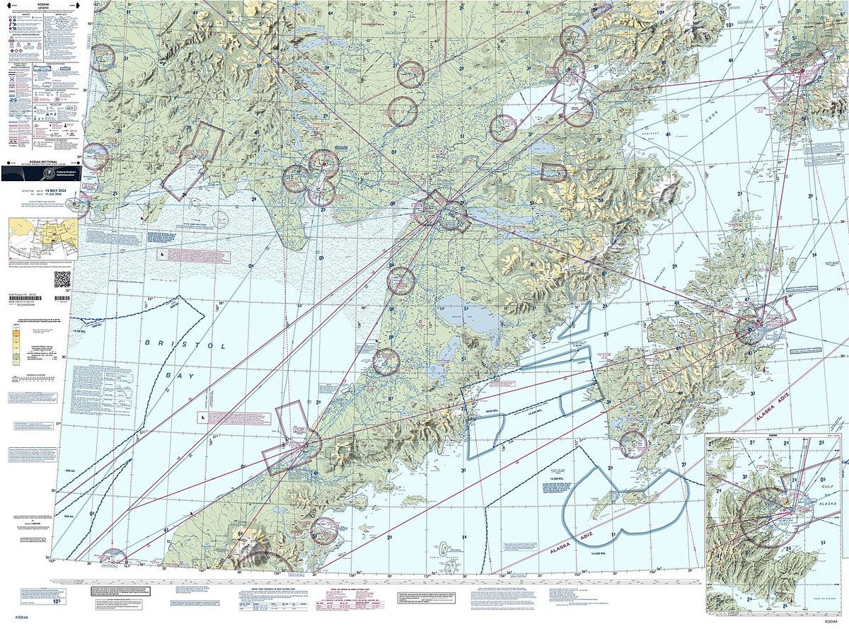
On sectional charts prohibited, restricted and warning areas are outlined in blue hatching, MOAs and alert areas in magenta. The chart's special use airspace table gives each area's altitudes, times and controlling agency; "TO 5000" means up to and including 5,000 ft MSL. For an IFR flight on a route through a joint-use restricted area, ATC lets the aircraft through without a specific clearance if the area has been released to the FAA, and otherwise routes it around unless the pilot has obtained permission to enter.
Military operations areas and routes
A military operations area (MOA) separates military training such as air combat tactics, intercepts, aerobatics, formation training and low-altitude tactics from IFR traffic. While it is active, ATC clears non-participating IFR traffic through only if it can provide IFR separation, and otherwise reroutes or restricts it. VFR flight through an active MOA is legal, but the AIM urges extreme caution. Military pilots there are exempt from the 91.303 aerobatic limits on surface areas and federal airways, and are authorised to exceed 250 kt below 10,000 ft. Before entering, VFR pilots should check the status with a flight service station within 100 miles and contact the controlling agency for traffic advisories.
ATC assigned airspace (ATCAA) is airspace of defined limits assigned by ATC to segregate specified activities from other IFR traffic. Its locations and scheduled activation are on the FAA's special use airspace website, and no NOTAM is issued.
Military training routes (MTR) carry low-altitude, high-speed training, generally below 10,000 ft MSL at more than 250 kt. IR routes are flown under IFR whatever the weather; VR routes under VFR, with at least 5 miles flight visibility and no ceiling below 3,000 ft AGL. A four-digit number, such as VR1207, means no segment is above 1,500 ft AGL; a three-digit number, such as IR206, means at least one segment is. Sectionals show only the centreline and direction, so the width, which can extend several miles either side, and the altitudes come from a flight service station within 100 NM. Non-participating aircraft may cross an MTR, with extreme vigilance.
Security airspace: ADIZ, FRZ, SFRA
Security airspace serves national defence and the protection of sensitive sites rather than the containment of hazardous activity. An air defense identification zone (ADIZ) is airspace over land or water in which the ready identification, location and control of all aircraft, except Department of Defense and law enforcement aircraft, is required in the interest of national security (14 CFR Part 99). The United States has one along its coasts and others around Alaska, Hawaii and Guam. An aircraft flying into, within or out of the country through one must file an IFR or defense VFR (DVFR) flight plan, carry a working two-way radio and transponder, and report its position; a DVFR pilot must notify an aeronautical facility before deviating from the flight plan, and an aircraft that cannot be identified may be intercepted (see interception and visual signals).
A special flight rules area (SFRA) is airspace of defined dimensions, above land areas or territorial waters, in which flight is subject to the special air traffic rules of 14 CFR Part 93 unless ATC authorises otherwise. The best known is the Washington, DC, SFRA, a permanent national defence area reaching about 30 NM from the DCA VOR/DME. Flight in it needs a flight plan, a discrete transponder code and two-way radio contact, and any pilot flying VFR within 60 NM of the DCA VOR/DME must first complete the FAA's special awareness training under 91.161. At its centre the flight restricted zone (FRZ), about 15 NM around the same point, is closed to most general aviation and requires specific authorisation and vetting. Violations lead to interception and certificate action.
Temporary flight restrictions
A temporary flight restriction (TFR) is issued by NOTAM, often at short notice, under one of several rules:
| Rule | Purpose |
|---|---|
| 14 CFR 91.137(a)(1) | Protect people and property from a hazard such as a toxic spill, volcanic eruption or nuclear accident |
| 91.137(a)(2) | Provide a safe environment for disaster relief aircraft, such as firefighting aircraft |
| 91.137(a)(3) | Prevent an unsafe congestion of sightseeing aircraft over an incident or event |
| 91.138 | National disasters in Hawaii |
| 91.141 | Protect the President, Vice President or other public figures |
| 91.143 | Space operations |
| 91.145 | Aerial demonstrations and major sporting events |
A 91.137 area is normally limited to within 3 NM and 2,000 ft above the surface. Entry into a 91.137(a)(2) area is limited to aircraft taking part in the relief, law enforcement flights, flights on an ATC-approved IFR flight plan, accredited news media above the relief altitudes with a flight plan filed, and flights to or from an airport inside the area after notifying the named facility, and never for the purpose of watching the incident. Presidential TFRs typically have a 10 NM inner ring and a 30 NM outer ring. A standing NOTAM under 99.7 closes the airspace within 3 NM and up to 3,000 ft AGL of any stadium seating 30,000 or more during major league baseball, NFL, NCAA Division I football and major motor racing events, from an hour before to an hour after; sectionals mark such stadiums with a solid diamond. Checking TFRs is part of the pre-flight action required by 91.103. In Europe the same needs are met by temporary restricted and danger areas notified by NOTAM.
Parachute jump areas
Parachutists are small, hard to see, and descend through the levels where light aircraft cruise. In Europe drop zones are marked on VFR charts with a magenta parachute symbol and a reference number, and the French AIP abbreviates parachute jumping exercise as PJE. A drop zone activated for a single day is notified by NOTAM, so it appears in the pre-flight information bulletin. Under the rules of the air, parachute descents other than in an emergency take place only under conditions set by the competent authority (see rules of the air).
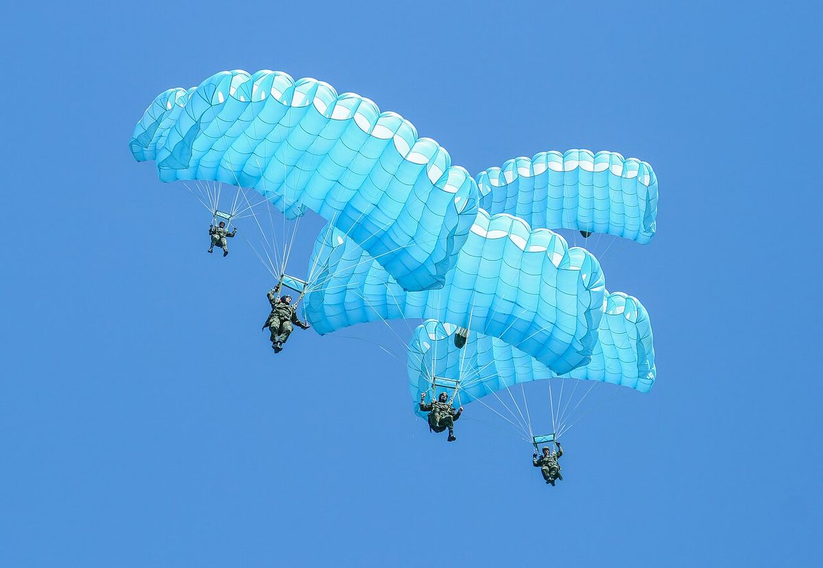
In the United States parachute operations are governed by 14 CFR Part 105. Parachute jump areas are tabulated in the Chart Supplement and marked on sectionals with a parachute symbol, sometimes beside the frequency to monitor. Jump pilots report altitudes above mean sea level or as flight levels so that ATC can give useful traffic information, and at an airport without an operating tower they broadcast on the common traffic advisory frequency before the jump, giving the aircraft's altitude and position and the expected times of the jumps.
Checking activation status
Much special use airspace is active only part of the time, so its status is part of pre-flight planning:
- Permanent areas are published in the ENR part of the AIP, which covers prohibited, restricted and danger areas, and on charts with their limits and hours (see aeronautical information services).
- Temporary areas and activations come by NOTAM and are gathered in the pre-flight information bulletin.
- In the United States the chart's special use airspace table gives the times of use and the controlling agency, whose frequency is printed in the chart margin. An airspace NOTAM is issued when an area needs one for activation, so pilots check the ARTCC NOTAMs, and the FAA's special use airspace website carries the scheduling data.
- In flight the controlling agency, ATC or a flight information unit can confirm the current status: in the United States, a flight service station within 100 miles of a MOA or within 100 NM of an MTR.
An inactive area becomes ordinary airspace, but a chart alone cannot say whether an area is active; that answer comes from the NOTAMs or the controlling agency.
Frequently asked questions
What is the difference between a prohibited, a restricted and a danger area?
In a prohibited area, above a State's land or territorial waters, flight is not allowed at all. In a restricted area flight is restricted in accordance with specified conditions, often entry only with permission while it is active. A danger area only warns that activities dangerous to flight may exist at specified times; entering it is not forbidden but may be very unwise. Unlike the other two, a danger area can lie over the high seas.
Can a VFR pilot fly through an active military operations area?
Yes. A military operations area separates military training such as air combat tactics from IFR traffic, and ATC routes IFR flights around an active MOA unless it can separate them. VFR flight through it is legal, but the AIM urges extreme caution, a call to a flight service station within 100 miles for its status, and contact with the controlling agency for traffic advisories. Military aircraft there may exceed 250 kt below 10,000 ft.
What is a temporary flight restriction (TFR)?
A TFR restricts flight in a defined area for a limited time and is issued by NOTAM under rules such as 14 CFR 91.137 to 91.145 or 99.7. Reasons include hazards and disaster relief, protection of the President and other public figures, space operations, air shows and major sporting events. A disaster TFR normally extends 3 NM and 2,000 ft above the surface, and a stadium TFR 3 NM and 3,000 ft AGL.
What is an ADIZ?
An air defense identification zone is airspace over land or water in which the ready identification, location and control of aircraft is required in the interest of national security, under 14 CFR Part 99. The United States has one along its coasts and others around Alaska, Hawaii and Guam. An aircraft flying into, within or out of the country through one files an IFR or defense VFR (DVFR) flight plan, carries a working two-way radio and transponder, and reports its position.
How do I find out whether a restricted or danger area is active?
Permanent areas are published in the ENR part of the AIP and on charts with their limits, hours and controlling authority, while temporary areas and activations come by NOTAM and appear in the pre-flight information bulletin. In the United States the sectional's special use airspace table gives times and the controlling agency, whose frequency is in the chart margin. In flight, ATC or the controlling agency can confirm the current status.
Test yourself on Special Use Airspace
The v1prep banks cover this topic in Air Law (010), with a worked explanation for every answer. EASA ATPL, PPL, IR and CPL, the FAA written tests and A320/B737 type ratings.
Start practising →Sources and further reading
- ICAO Annex 11, Air Traffic Services (consolidated text)
- AIP France, ENR 1.1, General rules (low-level military flights)
- AIP France, GEN 2.2, Abbreviations (TRA, TSA, CBA, RTBA, PJE)
- FAA Aeronautical Information Manual, Chapter 3 Section 4, Special Use Airspace
- FAA Aeronautical Information Manual, Chapter 3 Section 5, Other Airspace Areas (MTR, TFR, parachute jump operations, SFRA)
- 14 CFR Part 99, Security Control of Air Traffic
- 14 CFR 91.137, Temporary flight restrictions in the vicinity of disaster/hazard areas
- FAA Pilot's Handbook of Aeronautical Knowledge (FAA-H-8083-25), Chapter 15, Airspace
Library articles are written for study and exam preparation. They do not replace your aircraft's approved documentation, your operator's procedures or the regulations themselves.