Airspace Structure
Airspace structure is the way a State divides its airspace into named volumes for air traffic services: flight information regions for information and alerting, controlled airspace such as control areas, control zones and terminal areas for air traffic control, and advisory and uncontrolled airspace where less or no control is provided.
Airspace structure is the set of named volumes into which a State divides its airspace so that air traffic services can be planned and provided. It answers a different question from airspace classification. The class, A to G, says which rules and services apply in a volume; the structure says what the volume is for and who is responsible for it: a flight information region, a control zone around an aerodrome, a terminal area where routes converge, an airway, or advisory or uncontrolled airspace.
The building blocks are defined by ICAO in Annex 11 and applied in Europe through SERA. Each State publishes its own structure in the ENR part of its AIP and on its charts, so the same names describe very different shapes from one country to the next.
Flight information regions
The flight information region (FIR) is the basic unit. Every part of a State's airspace lies in one or more FIRs, and within them two services are available to all known flights: flight information service, advice and information useful for the safe and efficient conduct of flights, and alerting service, which notifies the search and rescue organisations (see flight information and broadcast services). Search and rescue regions are drawn to coincide with FIRs wherever practicable.
An FIR says nothing about control by itself. Controlled airspace is built inside it, and what is left over is uncontrolled. France is a typical example: its FIRs run from the surface to FL195 and are Class G except where control zones, control areas and other volumes are established, and flight information is given by flight information centres and by smaller flight information sectors (SIV).
Over the oceans the same pattern continues, with the controlled parts known as oceanic control areas (OCA). The North Atlantic high level airspace, for example, lies within six OCAs: Bodø, Gander, New York East, Reykjavik, Santa Maria and Shanwick (see oceanic and North Atlantic operations). In the United States, flight information is the job of flight service stations, and the air route traffic control centers provide area control.
Upper information regions
Where a State divides its airspace vertically, the upper part is an upper flight information region (UIR), and upper ATS routes carry the prefix U, as in UB3. Each State chooses the level: European exam material usually gives FL195, which France uses, while the United Kingdom divides its FIRs and UIRs at FL245. The idea behind the split is that upper airspace carries mostly transit traffic, while lower airspace carries traffic climbing, descending or flying locally.
In France the UIR is Class C from FL195 to FL660, where it forms the upper control area, and Class G above FL660. In the UK, too, all airspace above FL195 is Class C, the classification that Regulation (EC) No 730/2006 first required of EU States. SERA allows VFR above FL195 only in reserved airspace or with an authorisation, so the upper airspace is in practice IFR airspace (see VFR, IFR and meteorological conditions). In the United States, Class A airspace covers 18,000 ft MSL up to FL600, with Class E above it.
Control areas and upper control areas
Controlled airspace is airspace of defined dimensions in which air traffic control service is provided in accordance with the airspace classification, which means Classes A to E. It comes in two basic forms. A control area (CTA) is controlled airspace extending upwards from a specified limit above the earth. Its lower limit must be at least 200 m (700 ft) above the ground or water, and where it lies above 900 m (3,000 ft) MSL it should coincide with a VFR cruising level. Area control centres provide air traffic control to controlled flights in control areas and en route.
Control areas are usually set up around major aerodromes and where routes meet. Airways and terminal control areas are both forms of control area. An upper control area (UTA) is a control area in the upper airspace; in France the whole UIR between FL195 and FL660 is one. Below it France has a lower control area (LTA) from the higher of FL115 and 3,000 ft above the surface up to FL195, generally Class D but Class E over mountainous regions, and excluding the TMAs, airways and other volumes established within it.
Control zones
A control zone (CTR) is controlled airspace extending upwards from the surface of the earth to a specified upper limit. It protects instrument arrivals and departures at an aerodrome, so its lateral limits extend at least 5 NM from the aerodrome in the directions from which approaches may be made. A CTR lying under a control area extends at least up to the lower limit of that area. ICAO states that Class E is not to be used for control zones, so a CTR is normally Class A, B, C or D; Lyon Saint-Exupéry's CTR, for example, is Class D from the surface to 2,500 ft. Approach control usually provides the service in the CTR, and the tower handles aerodrome traffic.
Two rules apply to the VFR pilot inside a CTR. A VFR flight may not take off or land, or enter the aerodrome traffic zone or circuit, with a ceiling below 450 m (1,500 ft) or a ground visibility below 5 km unless ATC clears it, and below VMC only a special VFR clearance allows flight. An aerodrome traffic zone (ATZ) is a smaller volume around an aerodrome established to protect aerodrome traffic; at an aerodrome with an aerodrome flight information service (AFIS), it is where that service is given (see aerodrome traffic and circuits).
The FAA's nearest equivalents are the surface areas of Class B, C, D and E airspace. A Class E surface area around an airport without an operating tower is in effect a Class E control zone, a departure from ICAO practice.
Terminal control areas
A terminal control area (TMA), often called a terminal manoeuvring area, is a control area normally established where ATS routes converge in the vicinity of one or more major aerodromes. It is built above the control zones as a stack of layers, each with its own floor and class, the floors stepping up away from the aerodromes so that arriving and departing traffic stays inside while other traffic can pass beneath.
The layers are published with their limits and class, and they matter to VFR pilots. On French charts, parts 3, 4 and 5 of the Paris TMA are Class A from 2,500 ft to FL065, so a VFR flight beneath them must stay below 2,500 ft. Layers 2 to 4 of the Nantes TMA are Class D, where a VFR flight needs a clearance. One Toulouse TMA layer is Class E with a floor at the higher of 3,000 ft and 1,500 ft above the surface, so that VFR flights may enter without a clearance. France also sets a transition altitude for each TMA.
ATS routes
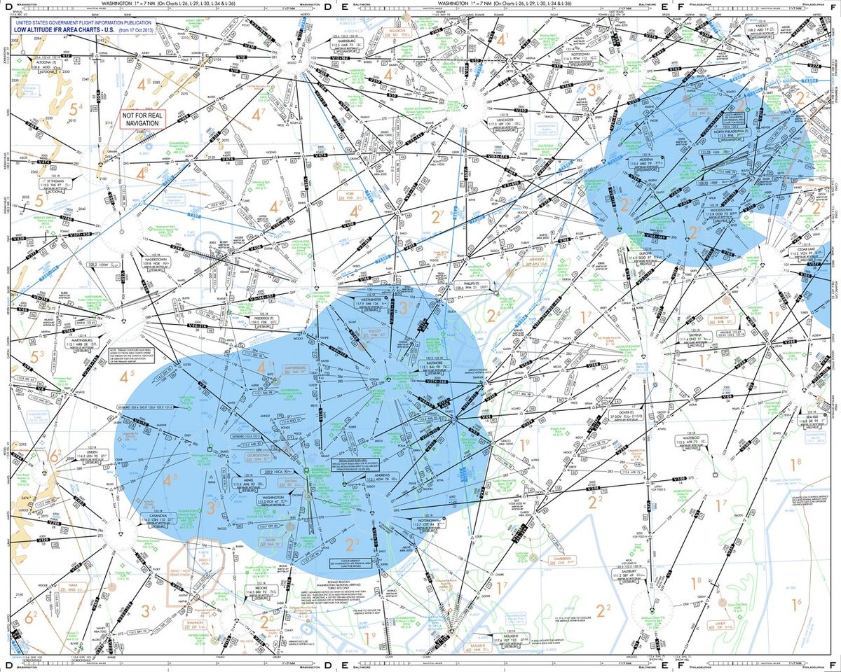
An ATS route is a specified route designed to channel the flow of traffic as necessary for the provision of air traffic services. ICAO notes that the term covers airways, advisory routes, controlled or uncontrolled routes and arrival or departure routes. An airway is a control area, or part of one, established in the form of a corridor; UK airways are typically 10 NM wide, and US federal airways extend 4 NM either side of the centreline. Designators show the type: U for upper routes, K for helicopter low-level routes and S for supersonic routes, while the suffixes F and G mark advisory and flight information routes (see airways and ATS routes).
In the upper airspace fixed routes are giving way to free route airspace, where flights plan direct segments between published points. France, for example, requires overflights of its free route cells to be planned from a published entry point to an exit point with direct (DCT) segments, sets no distance limit on those segments, and allows level changes only at significant points.
Advisory airspace and routes
Advisory airspace is airspace of defined dimensions, or a designated route called an advisory route, in which air traffic advisory service is available: ICAO Class F. The service lies between flight information and control. Participating IFR flights file a flight plan and receive an acknowledgement, not a clearance, and are kept apart by advice as far as practical; changes to their flight plan are not subject to clearance. SERA requires a flight plan for any IFR flight in advisory airspace, and IFR flights crossing an advisory route do so at right angles to it, at a level appropriate to the semicircular rule.
ICAO regards Class F as an interim arrangement until an air traffic control service can replace it, and some States have withdrawn it. The UK has reclassified its former advisory routes, and France's airspace classification table contains no Class F.
Uncontrolled airspace
Uncontrolled airspace is everything outside controlled airspace: Classes F and G. In Class G nobody is separated; flight information service is given on request, alerting service is provided to flights known to air traffic services, and collision avoidance rests on see and avoid. National rules can add requirements: France requires an IFR flight in Class G to keep a listening watch on the flight information frequency, and an IFR flight outside controlled airspace to fly no lower than the higher of 3,000 ft AMSL and 1,000 ft above the surface.
Equipment can be required without changing the class. A radio mandatory zone (RMZ) or transponder mandatory zone (TMZ), often combined, requires radio contact or a transponder, typically in Class E, F or G airspace, and France publishes the class of each such zone as that of the airspace in which it lies. Controlled airspace also has a ceiling: in France it ends at FL660, above which the airspace is Class G. Special use airspace is superimposed on this whole structure (see special use airspace), and each volume is served by a particular unit (see air traffic control units).
Frequently asked questions
What is the difference between a control zone and a control area?
A control zone (CTR) is controlled airspace extending upwards from the surface to a specified upper limit, set up around an aerodrome to protect instrument arrivals and departures. A control area (CTA) is controlled airspace extending upwards from a specified limit above the surface, at least 200 m (700 ft) above the ground or water. Terminal control areas and airways are forms of control area, usually built above and between the control zones.
What is a flight information region?
A flight information region (FIR) is airspace of defined dimensions within which flight information service and alerting service are provided. All of a State's airspace lies in one or more FIRs, which makes the FIR the basic unit of airspace. Controlled, advisory and uncontrolled airspace all sit inside FIRs, and search and rescue regions are drawn to match FIR boundaries wherever practicable.
Where does the upper information region begin in Europe?
Each State sets the level. European exam material usually gives FL195, and France uses it. Its FIRs run from the surface to FL195, and the upper flight information region (UIR) above is Class C controlled airspace, the upper control area, from FL195 to FL660, with Class G above. The United Kingdom divides its FIRs and UIRs at FL245. Upper air routes carry the prefix U, as in UB3.
What is a terminal control area (TMA)?
A TMA is a control area normally established where ATS routes converge near one or more major aerodromes. It sits above the control zones, often as a stack of layers with floors rising away from the airport, so that arriving and departing traffic stays in controlled airspace. Each layer has its own class; parts of the Paris TMA are Class A and closed to VFR, while other TMAs are Class C, D or E.
What is advisory airspace?
Advisory airspace, ICAO Class F, is airspace of defined dimensions, or a designated route, where air traffic advisory service is available. Participating IFR flights file a flight plan and receive advice and separation as far as practical, but no clearances. IFR flights crossing an advisory route do so at right angles and at a semicircular level. ICAO sees Class F as temporary, and the UK has reclassified its former advisory routes.
Test yourself on Airspace Structure
The v1prep banks cover this topic in Air Law (010), with a worked explanation for every answer. EASA ATPL, PPL, IR and CPL, the FAA written tests and A320/B737 type ratings.
Start practising →Sources and further reading
- ICAO Annex 11, Air Traffic Services (consolidated text)
- EASA Easy Access Rules for Standardised European Rules of the Air (SERA)
- AIP France, ENR 1.4, ATS airspace classification (FIR, UIR, LTA and UTA)
- AIP France, ENR 1.3, Instrument Flight Rules (1.3.4, free route airspace)
- UK CAA, Policy for the Classification of UK Airspace
- FAA Aeronautical Information Manual, Chapter 3 Section 2, Controlled Airspace
Library articles are written for study and exam preparation. They do not replace your aircraft's approved documentation, your operator's procedures or the regulations themselves.