Radar Services and Vectoring
Radar services are the air traffic services a controller provides from a surveillance display: identifying aircraft, separating them, giving headings to fly, passing traffic information and warnings, and guiding approaches. They all depend on radar identification and supplement, but do not replace, the pilot's own navigation and lookout.
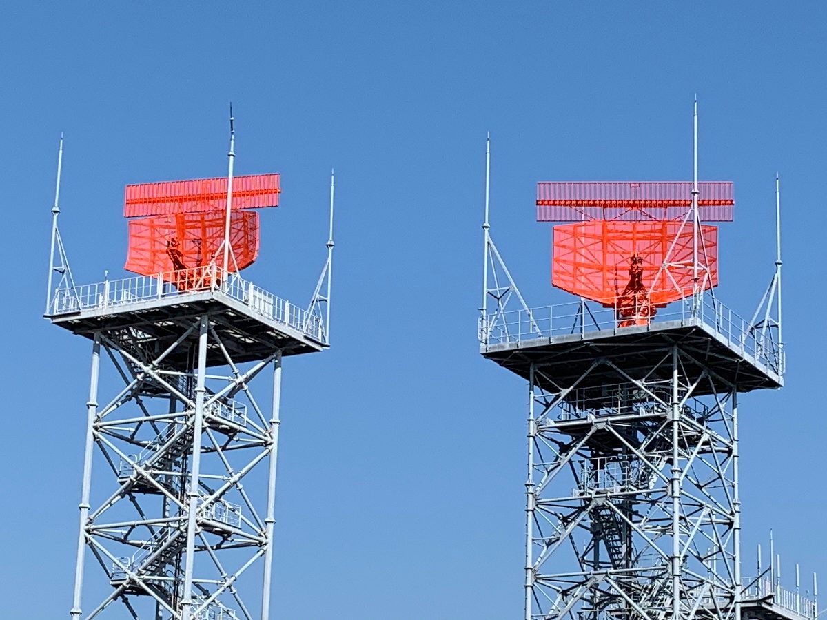
When a controller can see an aircraft on a surveillance display, the service changes character. Instead of relying on position reports and estimates, the controller can identify the aircraft, separate it from others by distance, give it headings to fly, warn it of traffic and terrain and, at some aerodromes, talk it down to the runway. ICAO Doc 4444 calls these ATS surveillance services, because the picture may come from primary radar, secondary radar, ADS-B or multilateration, but pilots and controllers still say "radar".
All of them rest on identification: the controller must know which return is which aircraft. And none of them relieves the pilot of navigation, terrain awareness or lookout unless the controller has explicitly taken on a task, as when vectoring an IFR flight.
ATS surveillance services
An ATS surveillance service is an air traffic service provided directly by means of a surveillance system. Doc 4444 defines the term; EU rules do not, a difference France lists in its AIP. The services include:
- surveillance separation, with a basic minimum of 5 NM that the authority may reduce to 3 NM, described in separation standards;
- radar vectoring and navigation assistance;
- traffic information and, where a collision risk is seen, avoiding action;
- monitoring of aircraft flying their own navigation, and position information;
- radar approaches.
What a flight actually receives depends on the airspace class, the flight rules and the unit's workload. In the United States every terminal radar facility gives VFR aircraft a basic radar service: safety alerts, traffic advisories, limited vectoring as workload permits, and sequencing where a local procedure exists; Class C and Class B services add separation.
Radar identification and radar contact
Radar identification is the process by which a controller associates a particular position on the display with a particular aircraft. Until it is complete, the controller cannot provide a surveillance service to the aircraft, such as vectoring or surveillance separation. The usual methods are:
- SSR methods: recognising the Mode S aircraft identification or a verified discrete code in the radar label, the block of data shown beside the return; seeing the return change to a newly assigned code; or observing a squawk ident.
- Primary radar methods: matching a return to a position report over a fix, or on a radial and distance; or an identification turn, in which the pilot changes heading by 30° or more and then returns to course, so the controller sees which return moves.
- Transfer of identification from another controller at a handover.
The controller then tells the pilot: in ICAO phraseology "IDENTIFIED", usually with a position, or "NOT IDENTIFIED" with the reason and, if necessary, "RESUME OWN NAVIGATION". The FAA says radar contact, for example "radar contact, two miles west of (fix)". Either way the pilot checks the position given and says so if it disagrees. The FAA does not repeat "radar contact" after a handover, though the new controller may confirm the identity with an ident, squawk standby or code change.
Identification changes the reporting routine. When told "radar contact", FAA pilots stop reporting over compulsory reporting points until "radar contact lost" or "radar service terminated"; ICAO controllers say "OMIT POSITION REPORTS" and "RESUME POSITION REPORTING". Neither phrase is a clearance: radar contact does not authorise entry into US Class B airspace, nor relieve a crew of obstacle clearance on a departure procedure.
The service can end in several ways, each with its own phrase: "WILL SHORTLY LOSE IDENTIFICATION" as the aircraft nears the edge of cover, "IDENTIFICATION LOST", "RADAR SERVICE TERMINATED" followed by instructions, or "RADAR CONTROL TERMINATED" with a reason.
Radar vectoring and orbits
Radar vectoring is navigational guidance in the form of specific headings. A vector is a heading, not a track: the pilot flies the heading given and the controller allows for the wind, the reverse of a SID, where the pilot corrects for drift to make good the published track. Headings are always given as three digits with the direction of turn, as in "TURN LEFT HEADING ZERO NINE FIVE", usually with the reason: DUE TRAFFIC, FOR SPACING, FOR DELAY, or FOR DOWNWIND, BASE or FINAL. Heading instructions must be read back.
While an IFR flight is vectored, the controller is responsible for its terrain clearance. Vectors are given at or above a minimum vectoring altitude; in Europe approach vectoring takes place inside a radar vectoring area with published minimum altitudes, and aircraft are not vectored closer to its edge than half the applicable surveillance separation minimum or 2.5 NM, whichever is greater. Being radar vectored is one of the conditions for descending below the minimum sector altitude. The pilot still queries a heading or altitude that looks wrong, and in the United States a VFR aircraft vectored without an assigned altitude keeps responsibility for its terrain clearance (see minimum safe altitudes).
Vectors to an instrument approach end with an intercept. ICAO controllers normally give a closing heading of no more than 45° to the localiser, or 30° for parallel runway operations, and ask the pilot to "REPORT ESTABLISHED". In the United States the approach clearance normally includes the intercept heading and "maintain (altitude) until established"; without it, a pilot on vectors does not turn onto the localiser, and queries ATC if about to fly through it.
An orbit is a 360° turn used to absorb time or create spacing. "ONE ORBIT LEFT" asks for a single complete turn, after which the aircraft resumes its previous heading; "ORBIT LEFT" with no number means keep orbiting until further advised.
Resuming own navigation
"RESUME OWN NAVIGATION" ends vectoring. The controller normally gives the aircraft's position and any instructions needed, and the pilot navigates again, though the surveillance service may continue. The phrase also accompanies a loss of radar contact, as in the FAA example "radar contact lost, resume own navigation, report (fix)", after which position reporting resumes.
Vectoring also changes the radio failure procedure. Under ICAO procedures a pilot who loses communications while vectored rejoins the current flight plan route no later than the next significant point, respecting the minimum altitude; under 14 CFR 91.185 the pilot flies direct from the point of failure to the fix, route or airway specified in the vector clearance.
Flight following
Flight following, or radar flight following, is the FAA's term for radar observation of an identified aircraft that is navigating for itself, and in everyday use for the traffic advisory service that VFR pilots request, which the AIM calls VFR radar advisory service. The pilot asks on initial contact, giving position, altitude, call sign, aircraft type, transponder code and destination. It is provided as workload permits, and the controller may decline or stop it without giving a reason.
The pilot then monitors the frequency at all times, tells the controller before changing frequency or VFR cruising altitude and, on leaving the service, returns to code 1200. Traffic advisories do not include vectors away from traffic unless the pilot asks. The service usually ends with "radar service terminated, squawk VFR, frequency change approved"; for an arriving VFR aircraft it ends automatically on landing at a tower-controlled airport or, at other airports, when the pilot is told to change to the tower or advisory frequency. Elsewhere the term has no formal standing, and each AIP describes what VFR flights can get.
Traffic information and the clock code
Traffic information warns a pilot of another aircraft close enough to deserve attention. For an identified aircraft it gives:
- the relative bearing by the clock code, 12 o'clock being straight ahead along the aircraft's track;
- the distance in nautical miles;
- the direction of flight, in terms such as opposite direction, same direction, crossing left to right or overtaking;
- the type and level of the other aircraft, if known.
The clock is based on the track the radar sees, not on the heading, so with drift the traffic appears elsewhere: in the AIM's examples, traffic called at 12 o'clock is seen at 2 o'clock or at 10 o'clock. In the United States a level taken from an unverified Mode C readout is prefixed "altitude indicates". Traffic information is not a readback item. The pilot acknowledges it with "traffic in sight", "negative contact" or "looking out", and may ask for a vector to avoid the traffic.
Avoiding action and TCAS reports
Seeing a risk of collision, the controller issues avoiding action: a turn, and if needed a climb or descent, to be flown immediately, with the reason and the traffic, for example "TURN LEFT IMMEDIATELY HEADING TWO SEVEN ZERO TO AVOID UNIDENTIFIED TRAFFIC, TWO O'CLOCK, FIVE MILES". The pilot acts first and acknowledges afterwards.
The FAA's equivalent is the safety alert, of two kinds: a terrain or obstruction alert, "LOW ALTITUDE ALERT, CHECK YOUR ALTITUDE IMMEDIATELY", usually followed by the minimum altitude for the area; and an aircraft conflict alert, "TRAFFIC ALERT", with a suggested heading or altitude. Once the alert is given, the choice of action is the pilot's.
A crew following an ACAS resolution advisory reports "TCAS RA" as soon as it can. The controller is then no longer responsible for separation from aircraft affected by the manoeuvre and must not try to change the flight path; a contrary instruction is answered "UNABLE, TCAS RA". Afterwards the crew reports "CLEAR OF CONFLICT, RETURNING TO (assigned clearance)" and, once back, "CLEAR OF CONFLICT, (assigned clearance) RESUMED"; the original clearance was never cancelled (see ACAS and TCAS).
Safety nets: STCA and MSAW
Ground-based safety nets are automatic functions of the controller's system that alert the controller, not the pilot, to a developing hazard.
- Short term conflict alert (STCA) alerts the controller to a potential or actual infringement of separation minima between two aircraft. The controller then passes traffic information or avoiding action. The 25 ft altitude reports of Mode S make it more accurate.
- Minimum safe altitude warning (MSAW) alerts the controller when an aircraft reporting pressure altitude is, or is predicted to be, below a set minimum safe altitude. In the United States it covers every tracked Mode C aircraft on an IFR flight plan, and VFR aircraft whose pilots ask for it. A classic trigger is a wrong altimeter setting: the Mode C readout ignores the subscale, so an aircraft flown too low because of the error shows its actual, lower altitude.
MSAW can be inhibited, as the approach radar's had been at Guam in 1997 when a Korean Air 747 descended below the step-down altitudes of its approach. Both complement, and never replace, the aircraft's own ACAS and TAWS.
Radar approaches: SRA, PAR and no-gyro
A radar approach is flown under the direction of a radar controller. The aircraft needs only a working radio, which makes it valuable when navigation equipment has failed.
| Surveillance radar approach (SRA) | Precision approach radar (PAR) | |
|---|---|---|
| FAA name | Surveillance approach (ASR) | Precision approach (PAR) |
| Guidance | Azimuth only, with advisory ranges and heights | Azimuth and elevation |
| Type | Non-precision, to an MDA/H | Precision, to a DA/H |
| Introduction | THIS WILL BE A SURVEILLANCE RADAR APPROACH | THIS WILL BE A PRECISION RADAR APPROACH RUNWAY (number) |
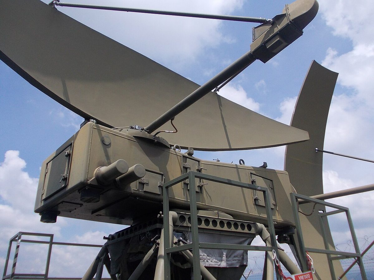
On a surveillance radar approach (SRA) the controller gives headings to line the aircraft up with the runway, says when to descend to the minimum descent altitude and passes the range each mile; the FAA adds recommended altitudes each mile on request. The approach terminates at a stated distance from touchdown, and EU air operations rules set system minimum heights of 250 ft for an SRA ending at 0.5 NM, 300 ft at 1 NM and 350 ft at 2 NM. Guidance stops there, so the pilot must know the obstacle clearance height and the missed approach.
On a precision approach radar (PAR) approach the controller gives a continuous talk-down: headings, the position relative to the glide path as "slightly" or "well" above or below, and trends such as "coming down rapidly". The FAA announces glide path interception 10 to 30 seconds ahead and gives the range at least once each mile. Because the talk-down is continuous, the pilot is told "DO NOT ACKNOWLEDGE FURTHER TRANSMISSIONS". The PAR controller obtains the landing clearance from the tower, normally by 4 NM from the threshold and at the latest by 2 NM; a pilot with no clearance at 2 NM goes around, as does one who loses radar contact for any significant time in the last 2 NM, or strays outside the safety limits without the runway in sight.
A no-gyro approach helps a pilot whose heading indicator has failed. Instead of headings the controller says "TURN LEFT", "TURN RIGHT" and "STOP TURN", and the pilot turns at standard rate, 3° per second, starting as soon as each instruction is heard; once on final approach, turns are made at half standard rate.
Exam tip: PAR landing clearance normally by 4 NM, missed approach if none by 2 NM. SRA system minima: 250 ft at 0.5 NM, 300 ft at 1 NM, 350 ft at 2 NM.
Frequently asked questions
What does resume own navigation mean?
RESUME OWN NAVIGATION ends radar vectoring. From then on the pilot is responsible for navigating the aircraft again, normally back to the cleared route, and the controller usually gives the aircraft's position and any instructions needed to rejoin it. It does not necessarily end the radar service, which may continue with the aircraft still identified. Controllers also use it when identification or radar contact is lost.
How does the clock code work for traffic information?
The controller gives the other aircraft's relative bearing as a position on a 12-hour clock, with 12 o'clock straight ahead, then its distance in nautical miles, its direction of flight and, if known, its type and level. The clock is based on the aircraft's track as seen on radar, not its heading, so an aircraft crabbing into a strong crosswind may see the traffic an hour or two off the position called.
What is the difference between an SRA and a PAR approach?
On a surveillance radar approach the controller gives azimuth guidance only, from surveillance radar, with advisory ranges and heights; it is a non-precision approach flown to a minimum descent height and ends at a stated distance, such as 2 NM. A precision approach radar measures elevation as well as azimuth, so the controller gives a continuous talk-down on both centreline and glide path to a decision height. Both need only a working radio.
What is MSAW in air traffic control?
Minimum safe altitude warning is a ground-based safety net that alerts the controller when an aircraft reporting pressure altitude is, or is predicted to be, below a set minimum safe altitude. The controller then warns the pilot, in the United States with the words low altitude alert, check your altitude immediately. It relies on the transponder's altitude reporting and complements, but does not replace, the aircraft's own terrain awareness and warning system.
What is a no-gyro approach?
A no-gyro approach, or no-gyro vectoring, is radar guidance for a pilot whose heading indicator has failed. Instead of giving headings, the controller says turn left, turn right and stop turn. The pilot turns at standard rate, 3 degrees per second, starting as soon as each instruction is heard. On a surveillance or precision radar approach the pilot is told, once on final, to make turns at half standard rate.
Test yourself on Radar Services and Vectoring
The v1prep banks cover this topic in Communications (090), with a worked explanation for every answer. EASA ATPL, PPL, IR and CPL, the FAA written tests and A320/B737 type ratings.
Start practising →Sources and further reading
- ICAO Doc 4444, Procedures for Air Navigation Services, Air Traffic Management (PANS-ATM), 16th edition, as published by Airservices Australia
- FAA Aeronautical Information Manual, Chapter 4 Section 1 (4-1-15 to 4-1-18, radar traffic information, safety alert and radar services for VFR aircraft)
- FAA Aeronautical Information Manual, Chapter 5 Section 3 (5-3-2, position reporting and radar contact)
- FAA Aeronautical Information Manual, Chapter 5 Section 4 (5-4-11, radar approaches)
- FAA Aeronautical Information Manual, Chapter 5 Section 5 (pilot and controller roles, vectors and safety alerts)
- EASA Easy Access Rules for Air Operations (Regulation (EU) No 965/2012), CAT.OP.MPA.110 aerodrome operating minima
- FAA Pilot/Controller Glossary, R (radar contact, radar flight following, resume own navigation)
Library articles are written for study and exam preparation. They do not replace your aircraft's approved documentation, your operator's procedures or the regulations themselves.