Airframe Icing
Airframe icing, also called structural icing, is the build-up of ice on an aircraft's external surfaces, mainly from supercooled water that freezes on impact and also from frost deposited directly from water vapour. It degrades lift, adds drag and weight, and can block sensors and intakes.
Airframe icing, or structural icing, is ice that forms on an aircraft's external surfaces: wings, tailplane, propellers, windscreen, antennas and probes. The term separates it from induction icing, such as carburettor ice, inside the engine air path. Most airframe ice comes from supercooled droplets that freeze when they strike the aircraft; frost is the main exception.
Ice changes the shape and roughness of an aerofoil. Maximum lift and the stalling angle of attack fall, drag and weight rise, and the stall can arrive before the stall warning, which is set for a clean wing. FAA AC 20-117 notes that ice, frost or snow with the roughness of medium or coarse sandpaper on a wing's leading edge and upper surface can cut lift by as much as 30 % and raise drag by 40 %.
- Supercooled water and the freezing level
- Conditions for airframe icing
- Icing types: rime, clear and mixed
- Factors affecting ice accretion
- Freezing rain and freezing drizzle
- Supercooled large droplets
- Hoar frost and frost
- High-altitude ice crystal icing
- Icing intensity and reporting
- Icing forecasts: CIP and FIP
- Frequently asked questions
Supercooled water and the freezing level
Supercooled water is liquid water below 0 °C. A cloud droplet needs an ice nucleus to freeze, and freezing nuclei are far rarer than the condensation nuclei on which droplets form. Supercooled water droplets are therefore common in cloud down to about −20 °C, and small droplets survive to about −40 °C, below which they freeze spontaneously. Disturbed by impact with an aircraft, a supercooled droplet freezes wholly or partly at once.
Below 0 °C the saturation vapour pressure over ice is lower than over water, so ice crystals grow at the expense of droplets. Colder clouds hold fewer and smaller droplets, and very cold cloud is mostly ice crystals, which usually bounce off a cold airframe.
The freezing level is the altitude at which the air temperature is 0 °C; in cloud above it, icing is possible. An inversion can create two or more freezing levels, the typical freezing-rain set-up. A descent below the freezing level sheds ice, and a climb above the tops leaves the water behind.
Conditions for airframe icing
EASA teaching lists three conditions that must hold together: liquid water present, air temperature below 0 °C and airframe surface temperature at or below 0 °C. The FAA puts it as visible moisture, such as cloud, rain or drizzle, with a surface temperature at or below 0 °C. Hoar frost is the exception, needing no liquid water. Airbus and Boeing treat visible moisture with an outside air temperature on the ground, or total air temperature in flight, of +10 °C or below as icing conditions, allowing for cooling in intakes and over the wing.
Kinetic heating raises the skin temperature; the ATPL rule of thumb is a rise of (TAS/100)² °C, about 9 °C at 300 kt and 25 °C at 500 kt. That may keep a fast jet ice-free in air just below freezing, but when it only partly closes the gap to 0 °C, droplets freeze more slowly and run back, making the ice worse.
Cumulus, cumulonimbus and deep nimbostratus usually give moderate to severe icing; thin layer cloud gives less; cirriform cloud, made of ice crystals, gives little or none.
Icing types: rime, clear and mixed
The three icing types are rime, clear and mixed.
- Rime ice forms when small droplets freeze almost instantly on impact, trapping air. It is white, opaque, rough, light and brittle, builds forward from the leading edge and is fairly easy to remove. It is typical of layer cloud, where droplets are small throughout, and of the colder parts of cumuliform cloud.
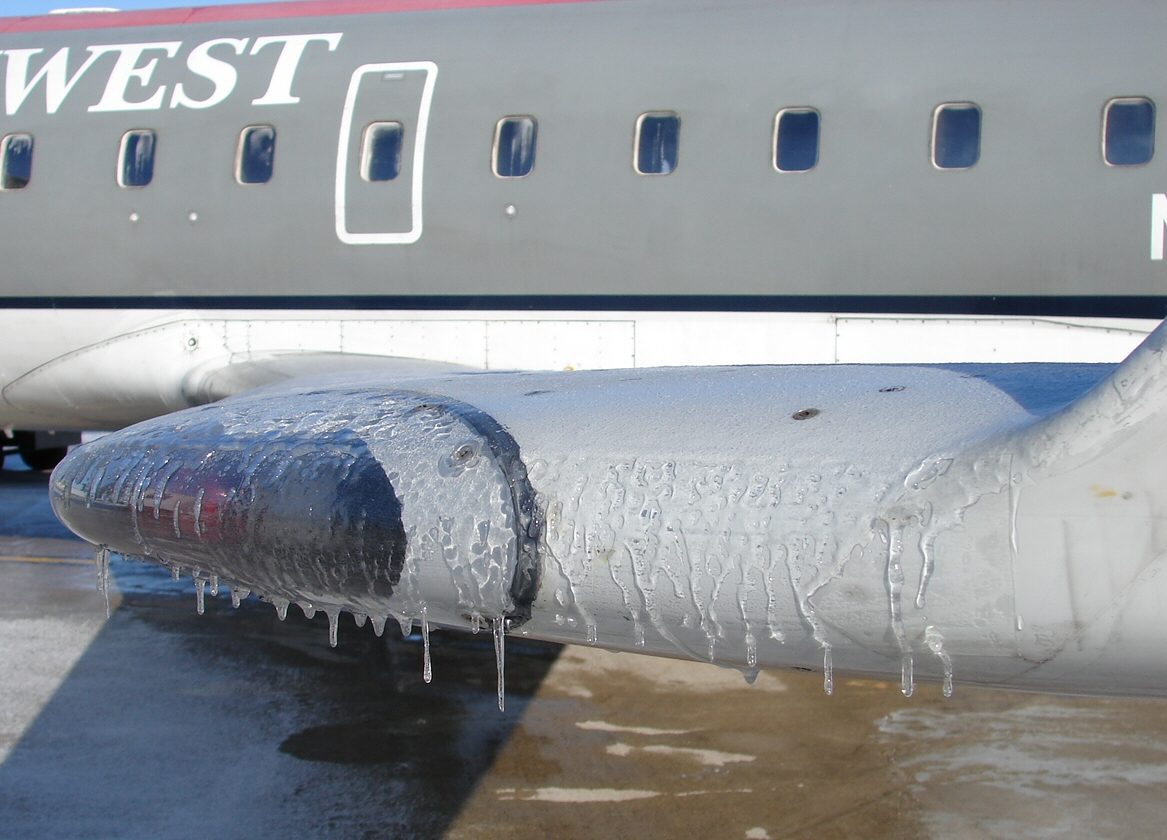
- Clear ice, or glaze, forms from large droplets. Only part of each freezes at once; the latent heat released keeps the rest liquid, and it flows back before freezing. The result is transparent, hard, dense and strongly bonded, often with horns or ridges, and can spread aft of the protected area. It builds fastest of all and is typical of cumuliform cloud and freezing rain in the warmer part of the sub-zero range.
- Mixed ice forms when large and small droplets, or snow and supercooled water, occur together. It is rough, heavy and can extend aft.
In EASA training material, large droplets and therefore clear or mixed ice are associated with 0 °C to about −20 °C, and only small droplets, giving rime, with −20 °C to −40 °C.
Pack snow is snow mixed with supercooled droplets. It sticks where dry snow would blow off and packs into intakes, filters and pressure heads; blockage, not aerodynamics, is the hazard.

Factors affecting ice accretion
The rate of build-up depends on:
- Liquid water content (LWC): the mass of liquid water per cubic metre of air, in g/m³. It is highest in cumuliform cloud with strong updraughts and in the warmer sub-zero part of any cloud, falling as the cloud gets colder and glaciates.
- Droplet size: large droplets have more inertia, so more of them hit and they strike farther aft.
- Catch rate efficiency: also called collection efficiency, the share of droplets in the swept volume that actually strike a component. It rises with droplet size and airspeed and falls as the component's radius increases, so thin tailplanes, struts, aerials and probes ice faster than a thick wing. Ice seen on the wing implies more on the tail.
- Airspeed and exposure time: more speed sweeps more water, until kinetic heating takes over. Layer cloud gives long exposures, cumuliform cloud shorter but more intense ones, which certification's Appendix C reflects as continuous maximum and intermittent maximum conditions.
Freezing rain and freezing drizzle
Freezing precipitation is supercooled liquid precipitation that freezes on contact. Freezing rain (FZRA) has drops larger than 0.5 mm; freezing drizzle (FZDZ) has drops between 0.05 and 0.5 mm. Together, freezing rain / freezing drizzle make up the supercooled large droplet conditions described below.
Freezing rain usually needs a warm layer aloft. Ahead of a warm front or a warm occlusion in winter, warm air overrides cold air near the surface (see fronts). Snow melts in the warm layer, and the rain falls into sub-zero air below, becomes supercooled and freezes on impact. The drops are large, so the ice is clear, spreads far aft and builds very quickly. The usual escape is a turn onto the reciprocal heading, normally the fastest way out, or a climb into the warm layer if its height is known. Ice pellets (PL) indicate freezing rain higher up.
Freezing drizzle often forms without any warm layer, by collision and coalescence of droplets in shallow stratiform cloud, and is harder to forecast.
Supercooled large droplets
Supercooled large droplets (SLD) are supercooled drops larger than 0.05 mm (50 µm), in other words freezing drizzle and freezing rain, inside or below cloud. Traditional certification covers only the cloud-droplet envelope of CS-25 and 14 CFR Part 25 Appendix C, with mean effective diameters up to 50 µm. SLD strike farther aft than cloud droplets and can form a ridge of ice behind de-icing boots or heated leading edges, where nothing can remove it.
That mechanism caused the loss of American Eagle flight 4184, an ATR 72, near Roselawn, Indiana, in October 1994. Holding in SLD, it accreted a ridge of ice aft of the boots that reversed the aileron hinge moments, and the resulting uncommanded roll killed all 68 on board. The FAA added an SLD envelope, Appendix O, to Part 25 in 2014, and EASA added it to CS-25 at Amendment 16 in 2015; manufacturers may certify for none, part or all of it.
Cues include ice on the side windows, ice aft of the protected areas or farther aft than usual on unheated spinners, and water splashing and streaming on the windscreen at sub-zero temperatures. The response is to leave the conditions at once, report them and follow the AFM on autopilot use, because the autopilot can mask trim changes until it disconnects in an upset (see upset prevention and recovery).
Hoar frost and frost
Frost is ice deposited directly from water vapour on a surface below 0 °C and below the frost point of the air next to it. Hoar frost (also written hoarfrost) is its feathery, crystalline form. On the ground it forms on clear, calm nights as surfaces cool by radiation, and over wing tanks holding cold-soaked fuel even when the air is above freezing. In flight it forms when an aircraft cold-soaked at altitude descends into warm, moist air, or climbs through an inversion. It is rarely severe, although it can obscure the windscreen, and clears as the skin warms in warmer air or at higher speed.
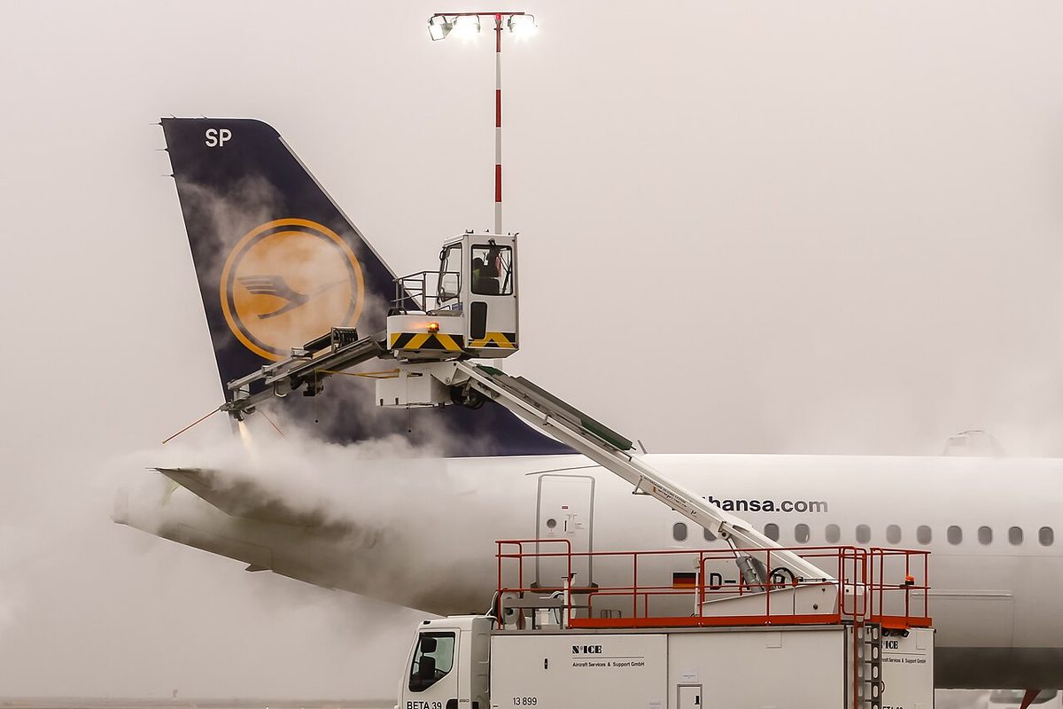
On the ground frost is dangerous because it roughens the upper wing, and both systems apply a clean aircraft concept. FAA rules such as 14 CFR 121.629 and 91.527 prohibit take-off with frost, ice or snow adhering to critical surfaces; EU rules such as CAT.OP.MPA.250 allow take-off only if the aircraft is clear of any deposit that might adversely affect performance or controllability, except as the flight manual permits. The recognised exception is thin hoarfrost, a uniform white deposit thin enough for paint lines, markings or lettering to show through, which is acceptable on the upper fuselage provided all vents and ports are clear. De-icing and anti-icing fluids and holdover times are covered in anti-ice and de-ice systems.
High-altitude ice crystal icing
High-altitude ice crystal icing (HAIC) occurs near deep convection, often in the tropics. Storms lift large amounts of water that freezes into dense concentrations of small ice crystals, found around the cores, downwind and in anvils (see thunderstorms), far above and colder than the conventional icing envelope. The crystals bounce off the cold airframe, leaving little visible ice, but inside an engine they partly melt on warm compressor surfaces, build up and then shed. Well over a hundred engine power-loss and damage events, including surge, rollback and flameout, have been attributed to them. Crystals can also block heated probes: in the Air France 447 accident in 2009, the BEA found that ice crystals obstructed the pitot probes, and the airspeed indications became unreliable.
Manufacturer guidance lists the cues: apparent rain on the windscreen at temperatures too cold for liquid water, a total air temperature indication stuck near 0 °C, light to moderate turbulence in cloud, and weak radar returns at cruise level above heavy precipitation lower down. Avoidance means keeping clear of the air above and downwind of strong cells, using radar tilt to look below. EASA defines the certification envelope in CS-25 Appendix P, and the FAA in Appendix D to 14 CFR Part 33.
Icing intensity and reporting
Icing intensity is reported by its effect on the aircraft. The AIM's icing intensity scale is:
| Intensity | FAA AIM meaning | Reference rate, unprotected outer wing |
|---|---|---|
| Trace | Ice becomes noticeable; accretion only slightly exceeds sublimation | Under 6 mm per hour |
| Light | Can become a problem if flight in it is prolonged; occasional use of ice protection removes it | 6 to 25 mm per hour |
| Moderate | Even short encounters become potentially hazardous; ice protection or diversion is necessary | 25 to 75 mm per hour |
| Severe | Ice protection cannot remove the ice, or ice forms where it normally does not, such as aft of protected surfaces; immediate exit is necessary | Over 75 mm per hour |
Older AIM editions described trace ice as not hazardous unless met for more than an hour. In ICAO wording, moderate icing makes a change of heading or altitude desirable, and severe icing makes an immediate change essential. Severe icing depends on the aircraft: the same cloud can be moderate for one type and severe for another.
Severe icing warrants a special air-report (AIREP) under ICAO rules and an urgent PIREP (UUA) in the United States. Pilot reports give the intensity, type and levels, for example "MOD RIME 060-090". For warnings, SIGMETs cover severe icing (SEV ICE) and severe icing due to freezing rain (SEV ICE (FZRA)), while AIRMETs cover moderate icing for low-level flights.
Icing forecasts: CIP and FIP
Under ICAO and EASA, the regulated icing forecasts are significant weather charts, SIGMETs, AIRMETs and, in Europe, GAMET area forecasts; FZRA and FZDZ in TAFs and METARs flag freezing precipitation. In the United States, G-AIRMET Zulu covers moderate icing and freezing levels, and the Aviation Weather Center adds two automated products developed with NCAR, the Current Icing Product (CIP) and the Forecast Icing Product (FIP).
CIP is an hourly three-dimensional analysis combining model output with satellite, radar, surface observations and pilot reports. FIP applies similar logic to model data alone and forecasts hourly out to 18 hours. Both show icing probability, severity and SLD potential, never reaching 100 % probability, and neither replaces a SIGMET or AIRMET.
Planning then asks where the freezing levels and tops are, where warmer or clear air offers an escape, and whether the aircraft is approved for icing. EU rules such as CAT.OP.MPA.255 allow flight into expected or actual icing only in an aircraft certified and equipped for it; FAA rules frame the same idea as flight into "known icing".
Frequently asked questions
What is the difference between rime ice and clear ice?
Rime ice forms when small supercooled droplets freeze instantly on impact, trapping air, so it is white, opaque, rough and brittle and builds forward from the leading edge. Clear ice forms from large droplets that freeze only partly on impact; the rest flows back before freezing, giving a transparent, hard, heavy layer that sticks strongly, spreads aft and builds fastest.
At what temperatures does airframe icing occur?
Icing needs liquid water at sub-zero temperatures. Supercooled droplets are common in cloud from 0 °C down to about −20 °C, where the most severe icing is usually found, and small droplets can survive to about −40 °C. Below that, cloud is almost entirely ice crystals. Manufacturers treat visible moisture at +10 °C or below as icing conditions to allow for local cooling.
Why is freezing rain so dangerous for aircraft?
Freezing rain drops are far larger than cloud droplets and carry much more water. They freeze slowly on impact and flow back beyond the protected leading edges, forming clear ice that builds very quickly on wings, tail and controls. It usually means a warm layer above a sub-zero layer, so the pilot should leave at once, often by turning back or climbing into the warmer air.
Can an aircraft take off with frost on the wings?
Generally no. FAA and EASA operating rules require critical surfaces to be free of frost, ice and snow, because even a thin, rough frost layer can cut maximum lift and raise stall speed. The main exceptions are thin hoarfrost on the upper fuselage, provided all vents and ports are clear, and limited cold-soaked fuel frost where the manufacturer's procedures allow it.
What are the CIP and FIP icing products?
The Current Icing Product and Forecast Icing Product are US Aviation Weather Center tools. CIP is an hourly three-dimensional analysis of icing that combines model output with satellite, radar, surface and pilot reports. FIP uses the model alone to forecast hourly out to 18 hours. Both show icing probability, severity and the potential for supercooled large drops, and supplement rather than replace SIGMETs and AIRMETs.
Test yourself on Airframe Icing
The v1prep banks cover this topic in Meteorology (050), with a worked explanation for every answer. EASA ATPL, PPL, IR and CPL, the FAA written tests and A320/B737 type ratings.
Start practising →Sources and further reading
- FAA Advisory Circular AC 91-74B, Pilot Guide - Flight in Icing Conditions
- FAA Aeronautical Information Manual, Chapter 7, Section 1 (inflight icing terms and icing PIREPs)
- FAA Advisory Circular AC 20-117, Hazards Following Ground Deicing and Ground Operations in Conditions Conducive to Aircraft Icing
- EASA, CS-25 Amendment 16 change information (Appendices O and P)
- FAA Lessons Learned, ATR 72-212 N401AM, Roselawn, Indiana, 1994
- NCAR Research Applications Laboratory, Icing Products (CIP/FIP)
- Boeing AERO Q1 2010, Avoiding Convective Weather Linked to Ice-Crystal Icing Engine Events
- ICAO Doc 9640, Manual of Aircraft Ground De-icing/Anti-icing Operations
Library articles are written for study and exam preparation. They do not replace your aircraft's approved documentation, your operator's procedures or the regulations themselves.