Polar and Grid Navigation
Grid navigation is a method of navigating in polar regions in which every direction is measured from grid north, a fixed datum parallel to a chosen meridian printed on a polar chart, instead of from true north or magnetic north, which change too quickly or become unusable near the poles.
Near the poles the two references on which everyday navigation rests stop working. The meridians crowd together, so the true direction of a straight route changes from one minute to the next, and the Earth's magnetic field plunges almost vertically into the ground, leaving a compass with little to align itself with. Polar navigation solves both problems by replacing true and magnetic north with an artificial datum, grid north, printed as a set of parallel lines on a polar chart.
Grid navigation is examined in the EASA ATPL General Navigation and Instrumentation subjects through convergence, grivation and gyro wander. On polar routes, inertial systems, true heading displays and HF radio take over the work of the compass, the VOR and VHF.
Navigating in polar regions
Two problems grow together with latitude.
Converging meridians. The angle between two meridians, the convergency, is found closely enough by multiplying the change of longitude by the sine of the mean latitude. It is zero at the equator, where meridians are parallel, and equal to the full change of longitude at the pole, where they meet. A great circle crosses each meridian at a different angle, and its initial and final true tracks differ by the convergency. Across 20° of longitude at 60°N it is already about 17°; near the pole a short leg cuts successive meridians at wildly different angles, so no single true track describes it (see the Earth, coordinates and great circles).
A weak and unstable magnetic field. A direct-reading compass is aligned by H, the horizontal component of the Earth's field. H is greatest near the magnetic equator and falls to zero at the magnetic poles, where the field is vertical. Beyond about 70° magnetic latitude the dip is too steep and H too weak for a compass to be trusted. Variation also changes rapidly with position, and a magnetic storm, which can last up to three days, can shift variation in polar regions by more than 5° for an hour or more and reduce H below what a compass needs (see terrestrial magnetism).
An inertial reference system computes true heading and derives magnetic heading from a stored table of variation. On the Boeing 737 that table covers 82°N to 82°S. With all its inertial units using the same variation table, the Airbus A320 gives no valid magnetic heading or magnetic track north of 73°N between 90°W and 120°W, north of 82°N or south of 60°S, and flight beyond those limits is prohibited. The FAA's AIM adds that performance-based navigation systems, apart from VOR/DME RNAV equipment, navigate by reference to true north and display magnetic courses only for the pilot's reference.
The polar grid and grid north
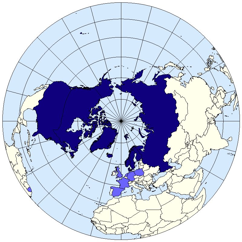
Polar charts use the polar stereographic projection, a plane touching the Earth at the pole (see chart projections). Its meridians are straight lines radiating from the pole at their true angular spacing, so its convergence factor n is 1 and the chart convergence between two meridians equals their change of longitude. The projection is conformal, and near the pole a great circle is almost a straight line.
Polar grid navigation overprints the chart with parallel grid lines aligned with one chosen datum meridian. On the standard north polar grid the datum is the Greenwich meridian. Grid north is the direction of the grid lines, and every track, heading and bearing is measured clockwise from it. A straight line on the chart, practically a great circle, keeps the same grid direction from end to end, so one grid track describes a leg whose true track would need revising every few minutes.
The angle between grid north and true north at a point is the convergence. On a polar stereographic chart with a Greenwich datum it equals the longitude with its name reversed: at 45°W true north lies 45° east of grid north. The northern-hemisphere rule follows the pattern of variation, "convergence east, true least".
| Aircraft position (northern hemisphere, Greenwich datum) | Convergence | Conversion |
|---|---|---|
| West longitude | East, equal to the longitude | Grid = true + longitude |
| East longitude | West, equal to the longitude | Grid = true − longitude |
| On the Greenwich meridian | Nil | Grid = true |
Exam tip: at 78°N 040°W, a true track of 350° is a grid track of 350 + 40 = 390, that is 030°(G). Convergence is 40°E, so the true figure is the lesser one: true = grid − 40°.
Grivation
A magnetic compass, or a heading system slaved to one, measures from magnetic north. To steer a grid heading with it, the navigator needs grivation (grid variation), the angle between grid north and magnetic north at a place. It combines variation (true to magnetic) and convergence (grid to true) into one correction, so a magnetic indication can be turned straight into a grid direction. Grivation is named east or west, like variation, according to the side of grid north on which magnetic north lies, and it is applied the same way: grid heading = magnetic heading + easterly grivation, or minus westerly grivation. Counting easterly values as positive, grivation is the sum of variation and convergence.
A worked example: at 78°N 040°W the convergence is 40°E. If the variation there were 30°W, the grivation would be 40 − 30 = 10°E, and a magnetic heading of 020° would be a grid heading of 030°. The long way round gives the same answer: 020°(M) with 30°W variation is 350°(T), and adding 40° of convergence gives 030°(G).
Lines joining places of equal grivation are isogrivs, the grid chart's equivalent of isogonals. Grivation changes along a route with both longitude and the magnetic field, so it is read afresh from the chart as the flight progresses. It cannot rescue a compass close to the magnetic pole: there the difficulty is not the correction but the lack of directive force.
Gyro steering and apparent wander
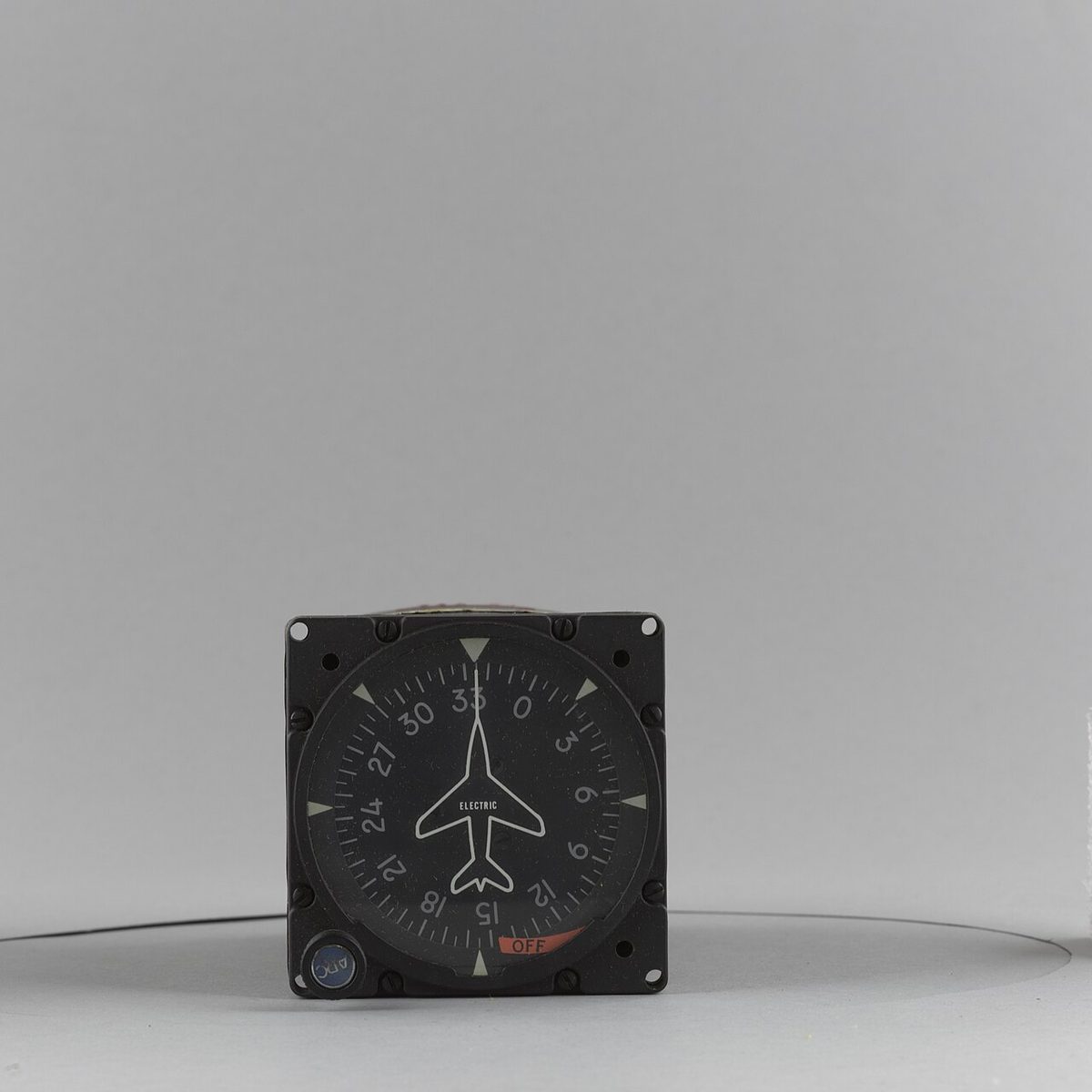
Where the compass fails, direction is held by a gyro. A directional gyro has no magnetic element and is not north-seeking: rigidity keeps its axis fixed, and the navigator sets it to a known heading and steers by it. For grid navigation it is set to grid heading from a reliable reference, for example the compass corrected by grivation where it still works, or an inertial system. Any departure of the gyro's axis from its reference is wander, called drift in the horizontal plane and topple in the vertical.
Apparent wander is not a movement of the gyro at all. Its axis stays fixed in space while the observer's frame of reference turns, and it has two sources:
- Earth rate. The Earth turns 15.04° per hour relative to space, and a gyro sees the local meridian rotate at 15.04° × sin(latitude) per hour: nil at the equator, about 13° per hour at 60°, the full 15° per hour at the poles. In the northern hemisphere an uncorrected gyro's readings decrease with time; in the southern hemisphere they increase.
- Transport wander. Flying east or west at any latitude other than the equator carries the gyro across meridians that are not parallel. Measured against true north, its reading changes by the change of longitude × sin(mean latitude); as a rate, by the east-west component of groundspeed ÷ 60 × tan(latitude) degrees per hour.
The total drift of a directional gyro is the sum of real wander, Earth rate, the latitude nut correction and transport wander.
Transport wander also explains why gyro steering suits grid navigation. A gyro corrected for Earth rate but not for transport wander, flown at a constant reading with drift allowed for, takes the aircraft along a great circle; the change it shows against true north is simply the convergency of the meridians crossed. Near the pole a great circle is a straight line of constant grid track on the polar stereographic chart, whose convergence (the change of longitude) almost equals the Earth's (the change of longitude × sin latitude, with sin latitude close to 1). Once set to grid, therefore, the gyro holds grid heading, and only Earth rate and real wander need correcting. Inertial systems apply Earth rate and transport wander corrections continuously in their computers.
Real wander and the latitude nut
Real wander, or random wander, is a genuine movement of the gyro axis in space, caused by bearing and gimbal friction and rotor imbalance. It cannot be computed away, only reduced by better engineering. ATPL texts quote about 1.6° per hour for an air-driven gyro spinning at 10,000 rpm, a few degrees per hour for an electric one and less than 0.01° per hour for an inertial-grade gyro. That is why a directional indicator is normally realigned with the compass every 10 to 15 minutes in steady, unaccelerated flight, and why long polar legs rely on high-grade gyros and inertial systems.
The latitude nut (latitude rider nut) cancels Earth rate in a directional gyro. It is an adjustable nut on a threaded stud fixed to the inner gimbal. Moved away from its balanced position, it applies a small constant torque, and the resulting precession produces a real drift equal and opposite to the apparent drift at one chosen latitude. It is a workshop adjustment, exact only at that latitude:
- flying towards the nearer pole from the corrected latitude, Earth rate grows, the gyro is under-corrected and, in the northern hemisphere, its readings decrease;
- flying towards the equator, Earth rate falls, the gyro is over-corrected and its readings increase;
- the residual drift grows with the distance from the corrected latitude.
Because the rate of precession for a given torque depends on rotor speed, an air-driven gyro whose rotor slows, for instance at altitude or with a blocked filter, over-corrects, and one that overspeeds under-corrects.
Exam tip: a gyro corrected for 60°N is flown at 70°N. Earth rate is 15.04 × sin 70° ≈ 14.1° per hour there, against the 13.0° per hour the nut removes, so the gyro drifts about 1.1° per hour, its readings decreasing.
The grid ring compass
The grid ring compass is an older design of direct-reading magnetic compass, not a polar instrument. The pilot turns a ring carrying parallel grid wires until the required course lies against the lubber mark, then turns the aircraft until the compass needle lies parallel to the wires, north end to north mark. Damping wires moving through the liquid help make it dead-beat. The "grid" refers to those wires, not to the polar grid: at high latitudes it suffers from weak H like any magnetic compass, and the course set on its ring is a compass course, so a grid heading must first be converted with grivation and deviation (see magnetic compass).
Polar routes and operational requirements
ATPL texts describe polar tracks as north-south routes taking aircraft above about 65° of latitude, through areas with few ground aids and variation changing too quickly for magnetic navigation. The Polar Track Structure (PTS) of older North Atlantic material no longer exists, and questions that refer to it are out of date. In the North Atlantic, voice position reports north of 70°N are made at intervals of 20° of longitude instead of 10° (see oceanic and North Atlantic operations).
Polar operations add requirements in every area:
| Area | What changes at high latitude |
|---|---|
| Heading reference | Crews select true heading. On the Boeing 737 the standby instrument has no magnetic heading in polar regions, later versions switching to true automatically, and the navigation display's PLN mode is always true-north up. |
| Inertial alignment | Gyrocompassing depends on the horizontal component of Earth rate, 15° × cos(latitude) per hour, which becomes too small near the poles. The 737's ADIRUs must not be aligned above 78°15'. |
| Ground aids | Few and far apart; in Canada's Northern Control Area, VORs are aligned with true north rather than magnetic. |
| Communications | HF is the main voice link. Geostationary satellites cannot be seen above about 80° of latitude; ACARS closed this gap in 2001 by adding HF data link. |
| Fuel | Long cold soaks bring fuel towards its limit, −47°C for Jet A-1 and −40°C for Jet A; if it gets close, crews descend to warmer air or increase Mach. |
| Diversions | Alternates are few and far apart, so the point of no return and point of equal time need careful planning (see point of equal time and point of no return). |
| Space weather | Magnetic storms can shift variation and weaken H for hours; crews rely on inertial, GNSS or other non-magnetic heading references. |
GNSS and inertial systems have made manual grid navigation rare in airline flying, but the principle stands: near the poles the aircraft is flown by true or grid reference, and the magnetic compass is at best a cross-check.
Warning: switching between magnetic and true reference changes every heading, track and wind direction on the displays. On descent from a polar route into airspace where ATC uses magnetic headings, confirm that the reference is back to magnetic before the approach. The 737 prompts the crew: with true heading displayed, a descent of more than 2,000 ft at more than 800 ft/min draws an amber box around TRU.
Frequently asked questions
What is grid navigation?
Grid navigation measures all directions from grid north, the direction of a set of parallel lines printed on a polar chart and aligned with one datum meridian, usually Greenwich. Near the poles the meridians converge so fast that a straight route changes its true track continuously and the magnetic compass is unreliable. A straight line on a polar stereographic chart is almost a great circle and keeps one grid track from end to end.
What is grivation?
Grivation is the angle between grid north and magnetic north at a place. It combines variation, the angle between true and magnetic north, with convergence, the angle between grid and true north, into one correction that turns a magnetic heading directly into a grid heading. It is named east or west like variation, and lines joining places of equal grivation on grid charts are called isogrivs.
How do you convert a true track to a grid track?
On a northern polar stereographic chart with the grid aligned to the Greenwich meridian, convergence equals the longitude with its name reversed. West of Greenwich add the longitude to the true direction; east of Greenwich subtract it. At 78N 040W a true track of 350 degrees becomes 350 plus 40, a grid track of 030 degrees. The mnemonic is convergence east, true least.
Why is the magnetic compass unreliable near the poles?
A compass aligns itself with the horizontal part of the Earth's magnetic field, which shrinks towards the magnetic poles as the field dips ever more steeply into the ground. Beyond about 70 degrees of magnetic latitude the directive force is too weak for reliable readings. Variation also changes quickly with position there, and magnetic storms can shift it by more than 5 degrees in polar regions.
What does the latitude nut on a directional gyro do?
The latitude nut is an adjustable weight on the inner gimbal of a directional gyro. Its torque makes the gyro precess at a rate equal and opposite to the apparent drift caused by the Earth's rotation, 15.04 degrees per hour times the sine of the latitude, at one chosen latitude. It is set in the workshop and is exact only at that latitude; flying away from it leaves a growing residual drift.
Test yourself on Polar and Grid Navigation
The v1prep banks cover this topic in General and Radio Navigation (061/062), with a worked explanation for every answer. EASA ATPL, PPL, IR and CPL, the FAA written tests and A320/B737 type ratings.
Start practising →Sources and further reading
- EASA, Explanatory Note to ED Decision 2018/001/R, Part-FCL theoretical knowledge learning objectives (061 General Navigation, 022 Instrumentation)
- FAA Aeronautical Information Manual, Chapter 1 Section 1 (1-1-17, impact of magnetic variation on PBN systems)
- NOAA National Centers for Environmental Information, World Magnetic Model
- NOAA Space Weather Prediction Center, Geomagnetic Storms
- FAA Pilot's Handbook of Aeronautical Knowledge (FAA-H-8083-25), Chapter 8, Flight Instruments (heading indicator and magnetic compass)
Library articles are written for study and exam preparation. They do not replace your aircraft's approved documentation, your operator's procedures or the regulations themselves.