Oceanic and North Atlantic Operations
Oceanic operations are flights through oceanic control areas, where controllers separate traffic largely from reported or data-linked positions instead of ground-based radar; on the North Atlantic they are flown in the NAT high level airspace under special approval, navigation, communication and contingency procedures.
Oceanic operations are flights through oceanic airspace, where ground-based radar and VHF radio do not reach. Controllers there have traditionally separated aircraft procedurally, from position reports and estimates, with large margins. Satellite surveillance and data link have shrunk those margins, but the system still rests on crews flying exactly the route, level and Mach number they were cleared for, and on procedures for the moment something goes wrong far from land.
The North Atlantic (NAT), with its daily track system, is the model for most exam questions. Its procedures are gathered in ICAO NAT Doc 007, the North Atlantic Operations and Airspace Manual, alongside the regional supplementary procedures of ICAO Doc 7030. Details change often, so crews use the current edition and each State's AIP rather than memorised figures.
- Oceanic control areas and centres
- NAT high level airspace and navigation systems
- The North Atlantic organised track system
- Track messages and TMI
- Connecting routes: NAR and Blue Spruce
- Oceanic clearances and the Mach number technique
- Oceanic lateral separation
- Master document and plotting procedures
- Gross navigation errors and loop errors
- Strategic lateral offsets and weather deviation
- Frequently asked questions
Oceanic control areas and centres
Oceanic airspace is divided into oceanic control areas (OCAs), each controlled by an oceanic area control centre (OACC). The NAT OCAs include Shanwick, controlled from Prestwick in Scotland, Gander, Reykjavik, Santa Maria and New York. Shanwick and Gander share their boundary at 30°W, the meridian at which the track system's validity times are defined. Flights in the NAT high level airspace are IFR, and it is classified as Class A airspace.
At the eastern edge, the Shannon Oceanic Transition Area (SOTA) and the Brest Oceanic Transition Area (BOTA) have the same vertical extent as the Shanwick OCA, and the NAT high-level requirements apply in them. Air traffic services there are provided by Shannon Control and Brest Control.
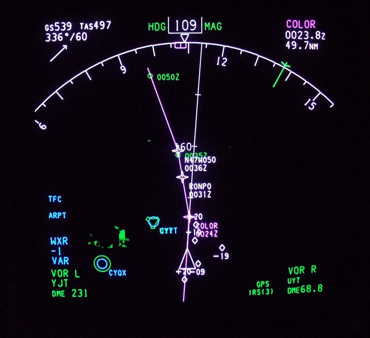
Communication beyond VHF range is by HF single sideband voice through aeradio stations, which relay messages to the OACCs, by satellite voice, and increasingly by data link. Crews carry out a SELCAL check before entering an HF area, so that they need not listen continuously, and use higher HF frequencies by day and lower ones at night. Every NAT aircraft monitors 121.5 MHz and the air-to-air frequency 123.450 MHz. In a non-radar oceanic environment, the AIM requires a report over each point used to define the route, even if charted as "on request", unless the aircraft reports automatically through an ADS-C logon. On east-west routes the points lie at every 10° of longitude. A revised estimate is due when it changes by 3 minutes or more. Under current NAT Doc 007 procedures, the transponder is set to code 2000 ten minutes after passing the oceanic entry point, except in the Reykjavik control area and within Bermuda radar coverage.
NAT high level airspace and navigation systems
The North Atlantic High Level Airspace (NAT HLA) extends from FL285 to FL420 inclusive. It was formerly called minimum navigation performance specification airspace (MNPSA), and older flight plans marked the approval with the letter X in Item 10. Operators and aircraft need State approval for it, as well as RVSM approval: two independent altimeters agreeing within 200 ft, an altitude alerting system, an autopilot with height hold and an altitude-reporting transponder. The altimeters are cross-checked before entering the OCA, and a difference of more than 200 ft is reported. On the NAT, the data link mandate requires FANS 1/A CPDLC and ADS-C, or equivalent, between FL290 and FL410 inclusive throughout the region, with limited exceptions (see ADS-B).
Navigation relies on two independent long-range navigation systems (LRNS): GNSS, INS or IRS, each giving continuous position, track and speed, so that the failure of one leaves a usable system. Reduced separations add performance-based approvals: RNP 10 requires 10 NM accuracy for 95% of the flight time and, for IRS-only aircraft, is typically limited to about 6.2 hours after the last position update; RNP 4 requires 4 NM and GNSS.
Dispatch depends on the equipment behind the approval. The operator's minimum equipment list is based on the manufacturer's Master Minimum Equipment List (MMEL) and may be more restrictive but never less, and before an oceanic departure the crew check that no deferred item removes equipment the HLA approval depends on. Missing secondary parts such as fairings are handled by the Configuration Deviation List (CDL) in the flight manual, whose performance penalties, often extra fuel burn, must be added to an already long flight plan. If navigation capability degrades after entry, the crew assess the situation, propose a course of action, consult the OACC and obtain a re-clearance before deviating.
The North Atlantic organised track system
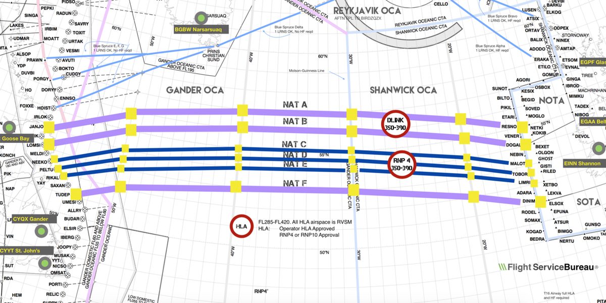
NAT traffic runs in two main daily flows, which the track times reflect: westbound during the European day and eastbound overnight. To fit these flows around the jet stream, the OACCs publish an organised track system (OTS) twice a day, drawn from the forecast winds so that eastbound traffic can use the jet and westbound traffic can avoid its core (see jet streams).
| System | Direction | Published by | Valid at 30°W | Lettering |
|---|---|---|---|---|
| Daytime | Westbound | Shanwick | 1130 to 1900 UTC | A is the most northerly, then southwards |
| Night-time | Eastbound | Gander | 0100 to 0800 UTC | Z is the most southerly, then Y northwards |
Each track is one-way, and both semicircular sets of levels can be allocated to its direction. Waypoints lie at whole degrees of latitude on each 10° of longitude; in the track message a group such as 59/10 means 59°N 010°W. Flights may also plan random routes outside the OTS.
Track messages and TMI
The NAT track message lists each track by letter, with its points, the levels available and the connections to the domestic route networks at each end. It carries a track message identifier (TMI), the Julian date of the day it applies to, such as 059 for 28 February. An amended message is reissued in full with a letter suffix, such as 059A, so crews and dispatchers check that the TMI in the flight plan matches the current message.
Connecting routes: NAR and Blue Spruce
At the western end, North American Routes (NARs) link the OTS with the North American domestic network; they are republished on a 56-day cycle. Blue Spruce routes are special routes designated for aircraft with only one serviceable LRNS; State approval for operations in the airspace is still required.
Oceanic clearances and the Mach number technique
An oceanic clearance contains the three elements on which separation rests: the route (a track letter or a random route), the Mach number and the flight level, which give lateral, longitudinal and vertical separation. How and when it is requested varies between OACCs and changes over time, so crews follow the current NAT Doc 007 and AIP instructions. After a complete communications failure, the crew maintain the last received and acknowledged oceanic clearance, including level and speed, to the last specified oceanic point.
The Mach number technique (MNT) keeps longitudinal spacing on long routes. Each turbojet flies the true Mach number ATC has approved and asks before changing it; if a temporary change is essential, for example in turbulence, ATC is told as soon as possible. The assigned Mach is kept during step climbs, and ATC may assign 0.01 more or 0.02 less than requested. Two aircraft at the same Mach on the same track need 10 minutes between them, less when the leader is faster (see separation standards).
Oceanic lateral separation
Oceanic lateral separation depends on the navigation, communication and surveillance approved. RNP 10 allowed 50 NM between tracks instead of 100 NM. RNP 4 with ADS-C and CPDLC supports 30 NM, and ICAO allows 23 NM for aircraft approved for RNP 4 or RNP 2 with the required data link performance. Composite separation, combining reduced vertical and lateral minima, was historically used on the OTS. Since 2019 space-based ADS-B has let Shanwick and Gander reduce in-trail spacing from 40 NM to as little as 14 NM.
Master document and plotting procedures
The master document is the copy of the flight plan used for navigation on the flight deck. Wrongly loaded coordinates are a classic source of gross errors, so the key defence is the waypoint cross-check: both pilots independently verify the coordinates loaded in the FMS against the master document and the clearance, and do so again after every re-clearance. In flight, crews confirm at each waypoint that the next one is correct, record the time and fuel on the master document, and many operators require the aircraft's position to be plotted on a chart shortly after each waypoint as an independent check.
Gross navigation errors and loop errors
A gross navigation error (GNE) is a large lateral deviation from the cleared track, beyond a threshold set by the NAT authorities. Typical causes are flight-planned coordinates left in the FMS when the cleared track differs, and mistyped waypoints, which the waypoint cross-check is designed to catch. An ATC system loop error is any error caused by a misunderstanding between pilot and controller about the assigned level, Mach number or route, such as a clearance heard, read back or entered wrongly. Readback discipline and comparing every clearance with the loaded route break the loop.
Strategic lateral offsets and weather deviation
Precise navigation means that an aircraft that deviates in level meets others exactly on the centreline. The strategic lateral offset procedure (SLOP) spreads traffic across three positions: the centreline, 1 NM right or 2 NM right, chosen at random. Left offsets are not allowed. Flown with the FMS offset function, SLOP also relieves wake turbulence; if neither available offset takes the aircraft upwind of the aircraft ahead, the crew can agree a different offset with the other aircraft on 123.450 MHz.
A weather deviation is requested from ATC first, by voice or by CPDLC. If a revised clearance cannot be obtained in time, the crew apply the regional contingency procedure: leave the track by a turn, keep other traffic informed on 121.5 MHz, watch for conflicting traffic and offset the level as NAT Doc 007 prescribes. A pressurisation failure calls for a rapid descent to a safe level, with the aircraft's level broadcast on 121.5 MHz (see decompression).
Frequently asked questions
What is the NAT HLA?
The North Atlantic High Level Airspace (NAT HLA) is the airspace between FL285 and FL420 inclusive in the North Atlantic oceanic control areas, formerly called MNPS airspace. Operators and aircraft need State approval, two independent long-range navigation systems, RVSM approval and, between FL290 and FL410, FANS 1/A data link. Crews follow the procedures of ICAO NAT Doc 007, the North Atlantic Operations and Airspace Manual.
When is the North Atlantic organised track system valid?
Two track systems are published each day. The daytime system is westbound, published by Shanwick and valid from 1130 to 1900 UTC at 30°W. The night-time system is eastbound, published by Gander and valid from 0100 to 0800 UTC at 30°W. Westbound tracks are lettered from A for the most northerly; eastbound tracks from Z for the most southerly.
What is SLOP in aviation?
The strategic lateral offset procedure (SLOP) lets crews fly on the centreline or 1 NM or 2 NM to the right of it in oceanic airspace, chosen at random. Because modern navigation places aircraft exactly on the centreline, spreading them across three positions reduces the collision risk if one aircraft deviates in level, and helps avoid wake turbulence. Left offsets are not allowed. The offset is flown with the FMS offset function.
What is the track message identifier (TMI)?
The TMI identifies each North Atlantic track message by the Julian date of the day it applies to, such as 059 for 28 February. If the message is amended after publication, the whole message is reissued with a letter suffix, as in 059A. Crews and dispatchers check that the TMI on the flight plan and in the oceanic clearance matches the current message.
What are Blue Spruce routes?
Blue Spruce routes are special routes through the North Atlantic high level airspace designated for aircraft equipped with only one serviceable long-range navigation system. Normal operations in the airspace need two independent systems, so these routes give such an aircraft a way to cross. The operator still needs State approval for operations in the airspace, and the crew still follow the NAT procedures.
Test yourself on Oceanic and North Atlantic Operations
The v1prep banks cover this topic in General and Radio Navigation (061/062), with a worked explanation for every answer. EASA ATPL, PPL, IR and CPL, the FAA written tests and A320/B737 type ratings.
Start practising →Sources and further reading
- ICAO NAT Doc 007, North Atlantic Operations and Airspace Manual (2026 edition)
- ICAO Doc 4444, Procedures for Air Navigation Services, Air Traffic Management (PANS-ATM), 16th edition, as published by Airservices Australia
- FAA International Notice, North Atlantic Data Link Mandate
- FAA Aeronautical Information Manual, Chapter 5 Section 3 (5-3-2 and 5-3-3, oceanic position reports and NAT estimates)
- EASA, Easy Access Rules for Air Operations (Regulation (EU) No 965/2012)
Library articles are written for study and exam preparation. They do not replace your aircraft's approved documentation, your operator's procedures or the regulations themselves.