Triangle of Velocities
The triangle of velocities, or wind triangle, is the vector relationship in which the air vector (heading and true airspeed) plus the wind velocity gives the ground vector (track and groundspeed). Knowing two of the three vectors, a navigator can find the third, and with it the drift and the heading to steer.
An aeroplane flies through a mass of air, and the air itself moves over the ground. The triangle of velocities, called the wind triangle in FAA material, puts the two motions together: the aircraft's motion through the air (heading and true airspeed) plus the motion of the air (the wind velocity) equals its motion over the ground (track and groundspeed). Each is a vector, with a direction and a size, and together they form a closed triangle.
Almost every dead-reckoning problem is this triangle solved for a different unknown: the heading to steer and the groundspeed to expect on a planned leg, the wind found in flight from two fixes, or the position reached after flying a known heading for a known time. It is examined in EASA subject 061 General Navigation and in the FAA knowledge tests, and the same arithmetic runs continuously inside every flight management system.
- Heading, track and drift
- Air, ground and wind vectors
- Solving for heading and groundspeed
- Wind correction angle and maximum drift
- Headwind, tailwind and crosswind components
- Air nautical miles and ground nautical miles
- Relative velocity and closing speed
- Using the CRP-5 or E6B computer
- Frequently asked questions
Heading, track and drift
The heading (HDG) is the direction in which the aircraft's longitudinal axis points, measured clockwise from north. It is what the pilot steers, referenced to true, magnetic or compass north (see true, magnetic and compass direction).
The track (TR or TRK) is the direction of the aircraft's path over the ground. Planning uses the required track, measured on the chart; in flight, the direction actually achieved is the track made good (TMG). The FAA's equivalent of the planned track is the course, and the true course (TC) is the course measured from true north.
Drift is the angle between heading and track, measured from the heading to the track and named left (port) or right (starboard). Steering 100° with 8° of right drift, the track is 108°. Drift is not track error, the angle between the required track and the track made good: an aircraft can have a large drift and no track error if the heading has been corrected for it.
A GNSS receiver derives track and groundspeed from successive positions and knows nothing about where the nose points; the compass shows heading. In a crosswind the two readings differ by exactly the drift.
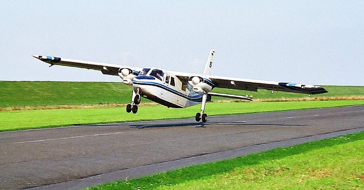
Air, ground and wind vectors
| Vector | Direction | Magnitude | Written |
|---|---|---|---|
| Air vector | Heading | True airspeed (TAS) | HDG/TAS |
| Wind vector | Direction the wind blows from | Wind speed | W/V |
| Ground vector | Track | Groundspeed (GS) | TR/GS |
The wind velocity (W/V) is quoted as the direction the wind blows from, in degrees, and its speed in knots: 270/25 is a westerly of 25 kt. On the triangle its arrow points downwind, because it is the air's movement that is added to the aircraft's. The air vector uses TAS, the aircraft's actual speed relative to the air mass. Groundspeed (GS), also written ground speed, is the speed over the surface, and it decides flight time and fuel.
The triangle holds six quantities, two per vector. When four are known the other two can be found:
| Known | Found | Typical use |
|---|---|---|
| Required track, TAS, W/V | Heading and GS | Planning a leg |
| HDG/TAS and TR/GS | W/V | Finding the wind in flight |
| HDG/TAS and W/V | TR/GS | Dead-reckoning position |
All directions in one triangle must share one reference. Forecast upper winds and METAR and TAF winds are in degrees true, while the surface wind passed by ATIS or the tower is magnetic (see surface wind). Solving a true track with a magnetic wind puts the answer out by the local variation.

Solving for heading and groundspeed
Take a required track of 270°T, a TAS of 300 kt and a forecast W/V of 210°T/60 kt.
- Wind angle. The wind blows from 60° left of the track, ahead of the beam.
- Components. The crosswind is 60 × sin 60°, about 52 kt from the left; the headwind is 60 × cos 60°, 30 kt.
- Drift. The heading must be turned into wind until the aircraft's own sideways speed cancels the crosswind: sin (correction) = 52 ÷ 300, giving 10°. The aircraft steers 260°T and carries 10° of right drift.
- Groundspeed. Pointing 10° off the track leaves 300 × cos 10° ≈ 295 kt along it, and the headwind removes 30 kt more: GS about 265 kt.
The mental check agrees: 60 × 52 ÷ 300 gives 10.4°. The true heading then goes through variation and deviation to become the compass heading.
The in-flight problem runs the other way. Steering 090°T at a TAS of 140 kt, a pilot finds from two fixes a track made good of 097°T and a groundspeed of 150 kt. The drift is 7° right, so the wind comes from the left; the groundspeed above TAS shows a tailwind component, so the wind is behind the beam. Subtracting the air vector from the ground vector gives a W/V of about 334°/20 kt. Quoting 154°, the direction the wind blows towards, is the classic slip.
Flight management systems solve the same triangle continuously: the difference between the ground vector and the air vector is the wind shown on the navigation display.
Wind correction angle and maximum drift
The FAA calls the angle between the course and the heading needed to hold it the wind correction angle (WCA). EASA texts lay the heading off from the required track by the expected drift, always into wind: with right drift the heading is the track minus the drift, with left drift the track plus the drift. While the track is held, WCA and drift are the same angle: the correction applied and the effect it cancels.
The largest drift a given wind can produce at a given TAS is the maximum drift. It occurs when the wind blows across the aircraft's path, strictly at right angles to the track, where sin (maximum drift) = wind speed ÷ TAS and the groundspeed is TAS × cos (drift). A wind at right angles to the heading gives almost the same drift, and exam questions usually phrase it that way. A wind straight along the heading gives no drift at all.
For small angles the 1-in-60 rule makes this mental arithmetic:
- maximum drift in degrees ≈ 60 × wind speed ÷ TAS;
- drift for any wind ≈ 60 × crosswind component ÷ TAS.
At 90 kt a 15 kt wind across the track produces about 10° of drift. On a true course of 180° at a TAS of 110 kt, with a 20 kt wind from 270°, the wind comes from the right and the rule gives about 11° of left drift, so the heading is turned about 11° to the right, near 191°; the exact solution is 10.5° and a groundspeed of 108 kt. The same wind drifts a slow aeroplane far more than a fast one.
Exam tip: a pure crosswind still reduces the groundspeed. With the wind at right angles to the track, GS = TAS × cos (drift): at a TAS of 120 kt, a 30 kt wind across the track needs a heading 14° into wind and leaves a groundspeed of about 116 kt.
Headwind, tailwind and crosswind components
If θ is the angle between the wind direction and the track or runway direction, the crosswind component is wind speed × sin θ and the headwind or tailwind component is wind speed × cos θ.
| Angle off | Crosswind share (sin θ) | Head or tailwind share (cos θ) |
|---|---|---|
| 30° | 0.50 | 0.87 |
| 45° | 0.71 | 0.71 |
| 60° | 0.87 | 0.50 |
| 90° | 1.00 | 0 |
A tower wind of 240°/20 kt on runway 27 is 30° off: 10 kt of crosswind and about 17 kt of headwind. Runway designators and the tower wind are both magnetic, so they compare directly; a METAR wind in degrees true does not, until the variation is applied.
Many pilots use the clock code: 15° off gives a quarter of the wind as crosswind, 30° half, 45° three quarters, 60° or more all of it. From 45° upwards it slightly overstates the crosswind, the safe side; it suits limit checks, not navigation. A tower wind of 200°/25 kt for runway 27 is 70° off: about 23 kt of crosswind, beyond a 17 kt maximum demonstrated crosswind, and only about 9 kt of headwind.
In flight planning the wind component (WC) along the track carries a sign: plus for a tailwind, minus for a headwind, as in −20 kt. For small drift angles GS ≈ TAS + WC, so a TAS of 200 kt with a 30 kt headwind gives 170 kt. A 15 kt headwind on a TAS of 105 kt makes a 45 NM leg take 30 minutes, not the 26 that ignoring the wind suggests.
Air nautical miles and ground nautical miles
Nautical air miles (NAM), or air nautical miles, measure the distance flown through the air mass; nautical ground miles (NGM), or ground nautical miles, the distance covered over the surface and measured on a chart. In still air they are equal. With a headwind the aircraft flies more air miles than ground miles; with a tailwind, fewer. Both are flown in the same time, so:
NAM ÷ NGM = TAS ÷ GS
Flying 63 NAM at a TAS of 142 kt against a 20 kt headwind (GS 122 kt) covers 63 × 122 ÷ 142 ≈ 54 NGM. In a climb or descent, where TAS keeps changing, the time is used instead: NGM = NAM + WC × time in minutes ÷ 60. A climb of 11.5 minutes covering 23.5 NAM against a 30 kt headwind covers 23.5 − 5.75, about 18 NGM.
Jet cruise tables give specific range in air miles per unit of fuel, and the navigator converts with the wind. At a TAS of 150 kt and 60 litres per hour an aeroplane flies 2.5 NM through the air per litre, but against a 30 kt headwind only 2.0 NM over the ground. The same groundspeeds drive the point of equal time and point of no return.
Relative velocity and closing speed
The relative velocity of two aircraft is the velocity of one as seen from the other, found by subtracting one velocity vector from the other. Its size is the closing speed, or opening speed if they are separating.
| Geometry | Closing speed | Example |
|---|---|---|
| Head-on, same track | Sum of groundspeeds | 400 kt and 480 kt close at 880 kt |
| Same direction, overtaking | Difference of groundspeeds | 480 kt behind 420 kt closes at 60 kt |
| Tracks at right angles | √(GS1² + GS2²) | 300 kt and 400 kt give 500 kt |
| Equal groundspeeds, tracks θ apart | 2 × GS × sin (θ/2) | 360 kt, 60° apart, give 360 kt |
At 880 kt, two aircraft 100 NM apart meet in under 7 minutes; the overtaking aircraft 30 NM behind needs 30 minutes to catch up. Two aircraft on the same track at the same groundspeed have zero relative velocity, so their longitudinal separation stays constant. Reciprocal aircraft on parallel tracks 5 NM apart pass at the sum of their speeds but never meet.
When both aircraft are in the same wind, it adds the same vector to each and cancels out of the difference, so interception geometry can be worked with headings and TAS alone.
Using the CRP-5 or E6B computer
The navigation computer, or flight computer, solves the triangle graphically and handles navigation arithmetic. The CRP-5 is common in European training and the E6B in FAA training. Both have two faces:
- The calculator side is a circular slide rule for time, speed and distance, fuel and unit conversions, and for TAS and density altitude from pressure altitude and temperature. It cannot solve wind problems.
- The wind side carries a rotating compass rose with a transparent plotting disc, a true index at the top against which directions are set, a drift scale either side of it, and a sliding grid printed with speed arcs and drift lines.
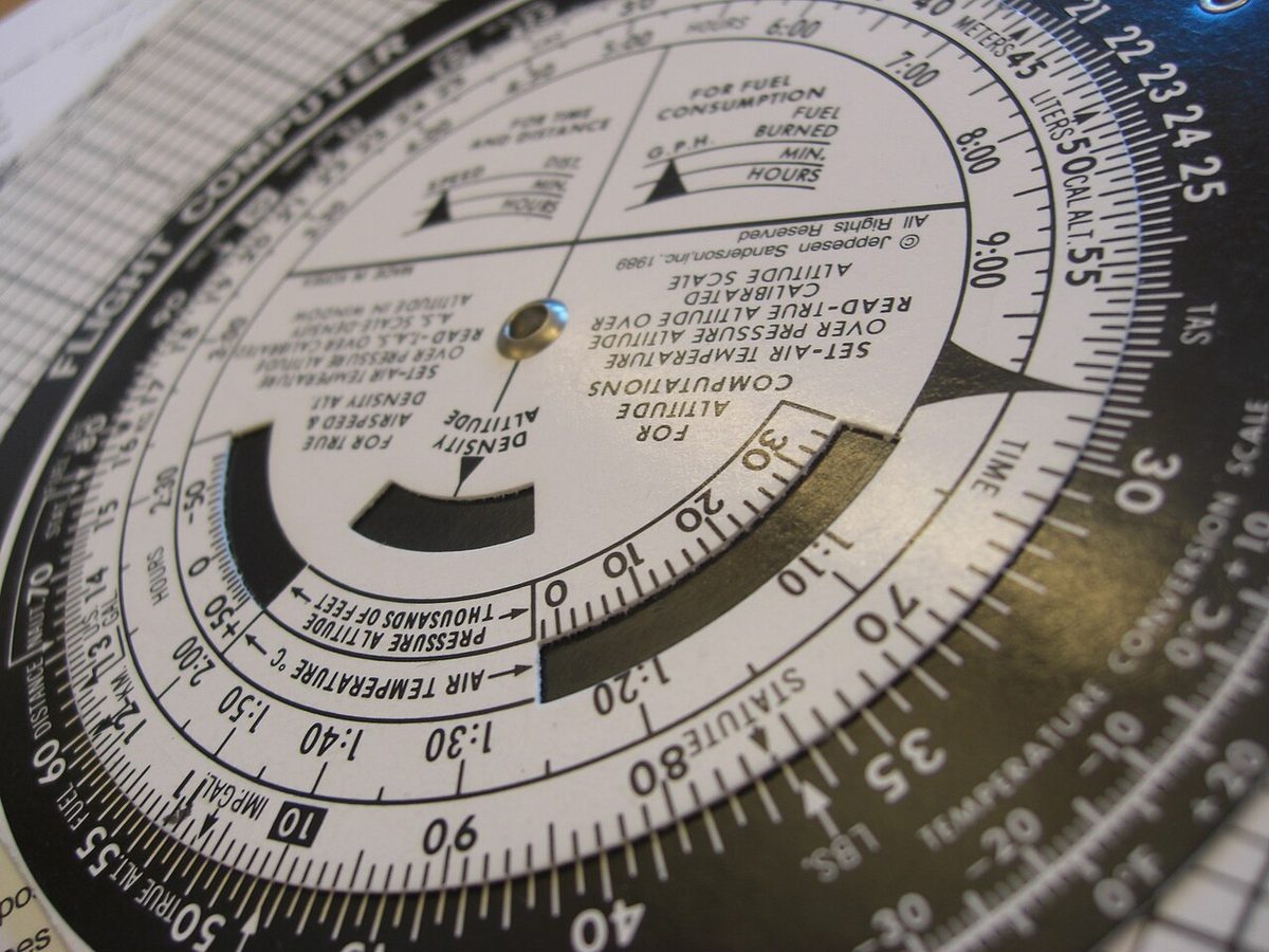
In the wind down method usual with the CRP-5, the wind direction is set under the index and the wind speed marked downwards from the centre dot. With the TAS arc under the centre and the heading under the index, the wind mark lies on the groundspeed arc and on the drift line. For a required track, the track is set first and the drift read; the heading is then adjusted until the drift read at the wind mark equals the difference between heading and track.
In the wind dot method usual in FAA material for the E6B, the wind direction is also set under the index, but the wind speed is marked upwards from the centre grommet. The true course goes under the index, the grid slides until the wind dot lies on the TAS arc, and the wind correction angle is read at the dot and the groundspeed under the grommet.
Either way the computer only reproduces the geometry, and all directions fed in must be true or all magnetic. A 1-in-60 estimate catches the usual errors: plotting the wind in the direction it blows towards, or applying the drift the wrong way.
Frequently asked questions
What is the difference between heading and track?
Heading is the direction in which the aircraft's nose points, measured clockwise from north. Track is the direction of its actual path over the ground. In still air they are the same. In a crosswind the aircraft is carried sideways, so the track differs from the heading by the drift angle, and to follow a required track the heading must be turned into wind by that angle. A GNSS receiver shows track; the compass shows heading.
How do you calculate drift or wind correction angle quickly?
Use the 1-in-60 rule. Maximum drift in degrees is about 60 times the wind speed divided by the true airspeed, and the drift for a particular wind is about 60 times the crosswind component divided by the TAS. A 15 kt wind across the track at a TAS of 90 kt gives about 10 degrees. It is an approximation, best for small angles, but it is an excellent gross-error check on a flight computer or FMS answer.
How do you work out crosswind and headwind components?
Find the angle between the wind direction and the runway or track. The crosswind component is the wind speed times the sine of that angle, and the headwind or tailwind component is the wind speed times its cosine. A 20 kt wind 30 degrees off the runway gives 10 kt of crosswind and about 17 kt of headwind. Compare the magnetic tower wind with the magnetic runway direction, not a METAR wind in degrees true.
What is the difference between nautical air miles and nautical ground miles?
Nautical air miles measure the distance flown through the air mass, and nautical ground miles the distance covered over the ground. Both are flown in the same time, so their ratio equals the ratio of true airspeed to groundspeed. With a headwind the aircraft flies more air miles than ground miles; with a tailwind, fewer; in still air they are equal. Performance tables work in air distance, and the wind converts it into ground distance.
What does the wind side of an E6B or CRP-5 do?
It solves the triangle of velocities graphically. A rotating compass rose with a transparent plotting disc, and a sliding grid printed with speed arcs and drift lines, let the pilot plot the wind and read off the heading to steer and the groundspeed for a required track and true airspeed, or find the wind from a known heading, track and speeds. The other side is a circular slide rule for time, speed, distance, fuel and TAS.
Test yourself on Triangle of Velocities
The v1prep banks cover this topic in General and Radio Navigation (061/062), with a worked explanation for every answer. EASA ATPL, PPL, IR and CPL, the FAA written tests and A320/B737 type ratings.
Start practising →Sources and further reading
- FAA Pilot's Handbook of Aeronautical Knowledge (FAA-H-8083-25), Chapter 16, Navigation
- FAA Airplane Flying Handbook (FAA-H-8083-3C), crosswind approach and landing
- EASA, Explanatory Note to ED Decision 2018/001/R, Part-FCL theoretical knowledge learning objectives (061 General Navigation)
- ICAO Annex 3, Meteorological Service for International Air Navigation (wind direction reporting)
Library articles are written for study and exam preparation. They do not replace your aircraft's approved documentation, your operator's procedures or the regulations themselves.